Wednesday, June 22, 2016

Brine and Bridges: The Yunlong Legacy


                                                     by Jim Goodman

'wind and rain bridge' opposite Chanfxin
      The attractions of Yunlong, the westernmost county in Dali Autonomous Bai Prefecture, include a pleasant, uncongested city surrounded by hills and temples, an ancient salt mining village and several classic ’wind and rain bridges.’ But until the  recent, sudden popularity of nearby Nuodeng, the old Bai salt village, it suffered from undeserved neglect.
       The usual way to Yunlong starts from Xiaguan, 165 km east.  The route crosses rolling hills with pleasant but unexciting scenery until just before it reaches Yunlong city.  Then the road runs between two towering cliffs called Stone Gate, after which the city got its original name (Shimen).  A more interesting route starts from Lanping, 100 km north, and follows the west bank of the Bi River south to the city. The road passes a few of the old covered bridges on the way, especially around the town of Changxin, several Bai villages, with forested hills above them, and finally crosses to the east bank.  A few kilometers later it rounds a hill and suddenly, just one kilometer away, the buildings of Yunlong city come into view.  Drab, modern structures of concrete and glass dominate this part of the city, but the center has some nice buildings and several parks, and the residential quarters in the southeast comprise two-story, mud-brick houses with tiled roofs.
Yunlong city, seen from Tiger Head Mountain
       Yunlong means Cloud Dragon in English and an iron sculpture of the city mascot stands in the central square.  The office and commercial buildings around it feature Bai-style narrow, tiled awnings over the windows of each floor.  Smaller buildings in the parks and market area exhibit the traditional Bai architectural style and would fit in harmoniously in any Dali Old Town neighborhood.
       A long concrete channel runs through the city, carrying the water of a stream from the hills down to its confluence with the Bijiang at the lower end of town.  All along one side awnings covered with blossoming bougainvillea shade the sidewalk. Running into the city and passing the central square, it empties into the Bi River near an unused Qing Dynasty temple, set on a large stone base, a classic structure still in good condition, but with its interior stripped of furnishings,
arched bridge over the channel
Cloud Dragon sculpture
       A suspension bridge crosses the stream here to a high and steep hill, its summit crowned with a relatively new, multi-tiered pagoda (Wenbita).  Partway up the slope is a small temple honoring an eight-armed Guan Yin.  One of the city’s garden parks lies beside the Bijiang here, with a full view of the hill.  A red sandstone railing along the river features bas-relief sculptures of various animals, not of all of which, like the giraffe and the hippopotamus, live in China.  Yet another park with long roofed pavilions, Bai-style wall sections, potted shrubs and flowers, lies between the main square and the old former temple.
abandoned temple in the heart of the city
       Signboards along the river, erected every thirty meters or so, between the bridge and the former temple, as well as along the last stretch of the concrete channel before the central square, advertise the county’s attractions.  These include pictures of scenic beauties like Tianshi Lake, 10 km west of the city and 2500 meters high; various temples; rope-bridges over the Lancang River in the west; rattan suspension bridges over the creeks and gullies; classical covered bridges in the north; a long suspension bridge at Baofeng, 15 km south, its two sections joined at a tower standing in the middle of the Bi River; and cultural shows like Bai opera and a strange dance called erzige, in which performers dress in what looks like costumes made of palm fiber.
Nuodeng village
       Signposts also depict scenes from the old salt trade that made Yunlong, in dynastic days, an economically important city in Yunnan.  Until recent times salt production, a government monopoly, was confined to a handful of places in the province and Yunlong was one of them.  The wells were located about 7 km away, in the ancient Bai village of Nuodeng.  For most visitors to the county, Nuodeng is the prime attraction and sometimes the only one they come to see.
       To get there the traveler goes north of Yunlong city to the suspension bridge crossing to the west bank of the Bijiang at Guolang, and then south a few km to a loop in the river, enclosing a parcel of hilly land shaped like a Taiqi symbol.  Nuodeng lies on this peninsula, though its evocative shape is not apparent without ascending one of the nearby mountains to get a view down.
entrance gate to Nuodeng village
       After crossing the river on a suspension bridge a trail leads to the village entrance gate, a fine old edifice from the Qing Dynasty.  Inside the gate a stone staircase leads up to the village.  The houses of Nuodeng, some 200 or more, sprawl along the slopes of a hill with a relatively flat summit.   All buildings are still in the traditional Bai style--mud-brick and timber on stone bases, with wide fronts and roofs of gray tiles.  Some have whitewashed side walls.  Most are in compounds with fancy entrance gates.  Narrow footpaths with stone staircases or steps chiseled out of the mud connect the neighborhoods.  At some places on the slopes the gradient is so steep the houses seem to be built on top of each other.
       The brine wells lie a short walk from the bottom of the village.  Supposedly, production of salt began here in the Later Han Dynasty.  By the middle of the 9th century, during the Tang Dynasty, the village that grew up beside the wells became known as Nuodeng, the same name it has today (though it was often referred to as Nuodeng Well).  Every household participated in salt production.  In those centuries before the introduction of refrigeration, salt was the primary preservative for food like meat and fish.  So this trade was destined to make Nuodeng rich.
stone stairway to a Nuoeng neighborhood
compound gate in Nuodeng
       To produce salt is not particularly laborious, but it does require paying attention to the application of heat and the evaporation process.  Workers begin by boiling the brine in a large cauldron over a wood fire.  As the water evaporates it leaves behind a residue of salt crystals.  These are heaped into wooden baskets to dry in the sun.  When all the crystals have been released and dried, workers stuff them into a two-piece bamboo mold to press them into cylinders.  The final step is to place the cylinders on an iron tray and heat it to harden them.  The entire process takes a full day.
Yi woman in Yunlong
       Ponies and mules fully laden with salt cylinders joined the caravans transporting the salt to distant places.  A portion of it went east to Dali and beyond, but most of it was consigned to caravans on the Tea and Horses Road to Tibet and the Southwest Silk Route to Burma and India.  The salt trade grew increasingly lucrative in the Ming and Qing Dynasties and Nuodeng won the sobriquet ‘the richest village in China.’
       Enjoying their prosperity the villagers built themselves fine homes, embellished their compounds with carved entry gates and constructed temples to Buddhist and Taoist deities.  They also installed a Confucius temple at the top of the hill and used it to educate their children.  In the Qing Dynasty over a hundred Nuodeng villagers won government commendations for their performance on the national examinations.  Six of them were chosen to be government officials.
       With the collapse of the Qing Dynasty the salt trade, and every other kind of caravan business, became vulnerable to banditry on the main routes.  After 1949, peace returned to this remote area, but the availability of cheap sea salt, plus the spread of refrigeration, doomed Nuodeng’s salt business.  Today most of the wells have been abandoned and only a few families still engage in salt production.  And that’s not to market the salt, but to use it for salted ham, a famous local dish that was, in the heyday of the caravans, exported along with the salt cylinders.
       Villagers prepare this by first draining the pig carcass of its blood and removing excess skin and fat.  Then they cure it with corn liquor and rub salt all over it.  Throughout all the steps they must remain vigilant against flies.  Finally, they hang up the salted carcass to dry for 12-24 months.  Because the villagers feed the pigs corn, yellow beans and green vegetables, and the salt has a high potassium content, the ham has a delicious and unique taste.
temple on top ofTiger Head Mountain
       A popular TV show, “Bite of China,” ran a feature on Nuodeng ham a couple years ago, prompting skyrocketing demand for it from all over the country.  Villagers could sell it for at least 100 yuan per kg, so they stopped eating it themselves.  The media exposure also brought a new influx of tourists, for Nuodengi s a rare example of a large village without t a single modern building marring the unanimity of traditional Ming and Qing Dynasty houses.  Around 40 of them have now turned their quarters into home-stay venues, offering travelers basic accommodations, meals with the family and a traditional Bai social and cultural environment.
Anlan suspension bridge at Changxin
       Nuodeng is also popular as a day trip out of nearby Yunlong.  Chinese from Yunnan usually opt to stay in the city’s hotels.  They may even skip the Bai village altogether, for their main purpose here is to make the climb up Tiger Head Mountain at the southeast edge of the city to the temples perched on its summit.  The path up begins gradually but soon becomes a zigzag trail up steeper cliffs, passing small shrines, both Buddhist and Taoist, pagodas and pavilions etched into the crevices along the way.
       A Buddhist temple sits at the top.  A small waterfall emerges from the mouth of a stone tiger head next to it.  Narrow paths lead to other pavilions on the adjacent ridge.  And of course, from anywhere up this high the view down to Yunlong city is spectacular.  There are several ways down, too, ending up at different points in the city.  The paths are especially crowded on Buddhist holy days like full moon and new moon.
       Otherwise, Yunlong is rather sedate except on its Sunday market day.  Then umbrellas go up over small stands hawking sundry types of merchandise all over the commercial area.  Villagers from all around bring in their farm produce to sell and the hustle and bustle lasts until late afternoon.  Unlike other market day venues in the prefecture, though, the Bai do not dress in the ethnic style.  
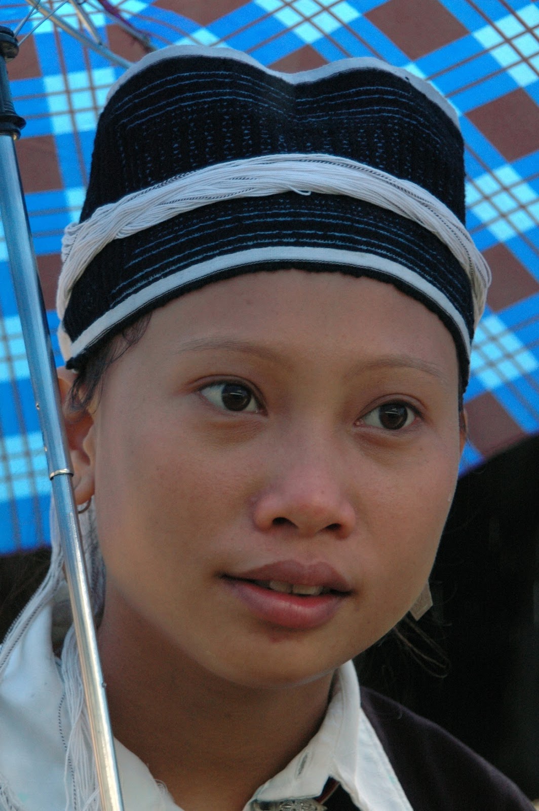
Some Yi minority folks from the eastern mountains may turn up, however, and the older women are likely to be wearing their traditional black turbans and a long coat with embroidered flowers.
Dadaqiao wind and rain bridge
       Sunday is also market day in Changxin, 36 km north, on the west bank of the Bi River.  The town lies on the other side of the Anlan suspension bridge, built in the 18th century, its wooden planks just wide enough for pedestrians and pack animals.  The market scene is much the same as in Yunlong, with perhaps more livestock on hand, and no evidence of ethnic clothing.
       However, Changxin is worth a visit anyway for the old covered bridges in its vicinity.  Called ‘Wind and Rain Bridges” (fengyuqiao), They have a protective roof and sometimes walls on each side and were designed as refuges from sudden storms.  Such bridges exist elsewhere in Yunnan, but usually in villages far off the beaten track, never in major towns.  In Yunlong County four of them are on the main north-south road.
Tongjing Bridge at Baoluo
       The oldest, Caifengqiao, constructed in the late Ming Dynasty, slightly arched and with wooden walls on each side, spans the Bijiang at Shendang village, between Baishe and the Lanping County border.  Opposite Changxin a straight bridge without walls on the sides, and built much later in the Qing Dynasty, crosses a stream coming down from the mountains.  A little further south, over a smaller stream, stands Dadaqiao, a more beautiful Wind and Rain Bridge, made of brick, wood and tiles, arched in the center with wooden walls each side, its towers on either end partially whitewashed.
       At Baoluo , 2 km north, stands the other covered bridge in the area.  This one, Tongjingqiao, built in the late 18th century, is longer than those opposite Changxin, for it spans the Bi River.  Also slightly arched, the bridge is mostly wooden, with brick towers at the two ends.  A large Bai village lies on the other side and this particular covered bridge sees far more traffic, of man and beast, than the others.
       The Wind and Rain Bridges, like the preserved traditional Bai village of Nuodeng, even the old temples, used and unused, are like living relics of pre-modern China.  This is becoming known to a greater number of discerning travelers, for there are few places like Yunlong County so evocative of a bygone era.

Tongjingqiao wind and rain bridge

                                                                      * * *   

Wednesday, June 15, 2016

Puzhehei—A Second Sani Homeland


                                                          by Jim Goodman

Yi village and Pearl Lake
       Landscapes in Wenshan Autonomous Zhuang and Miao Prefecture, southeastern Yunnan, jutting into Guangxi province on its eastern side and bordering Vietnam to the south, differ greatly from the rest of the province.  High mountains characteristic of most of the province don’t exist here.  Instead, small limestone hills of less than a thousand meters height speckle broad plains.  In some places they appear in scenic clusters and Puzhehei, in Qiubei County, where lakes, streams and ethnic minority villages flank the hills, is the most beautiful example.
       About 13 km north of Qiubei city a road bends west to a flat plain studded with small hills and scattered Miao, Han and Zhuang settlements.  It’s another two or three kilometers to the resort  at the edge of the lake, while villages in the immediate area here are Yi.  Puzhehei’s natural attractions made its development as a tourist resort inevitable, but on my first visit in 1999 the business hadn’t really taken off yet.  There were a few hotels and restaurants and a stadium where local Yi put on shows for the occasional tourist group.
farmland beside Pearl Lake
       Next to the resort a few dozen boats lay moored in the water, for the prime activity for most visitors is to take a boat ride on the watercourse that begins with Pearl Lake, at 530 hectares the largest of the district’s 70-odd lakes and ponds, most of them connected by streams to form a 20-km boat journey.  The ride includes stops at a few of the 80 large caves within some of the 300 hills in the area.  
       Having already been to the best of Yunnan’s caves, I passed up the boat ride option and spent my time on foot exploring the area, climbing the small hills to get better photo angles and wandering along the lakes and streams.  The hills come in a variety of shapes.  Some are like round skull caps, others look like thimbles, some like straight or leaning triangles, others long and low, one side higher than the other, resembling crouching animals.
Sani village, Puzhehei
     
 Puzhehei is a Chinese transcription of a Yi language word that means ’pond teeming with fish and shrimps.’   Gathering those fish and shrimps is part of the local Yi lifestyle.  A few families use cormorants to catch fish.  Most villagers take their canoes out onto the lake to cast nets, but also lay long, tubular, netted traps, held together by poles every meter or so, just under the surface along the shoreline for catching shrimps, small fish and a few crayfish.  After pulling in their catch, the people lay them out on the walkways to dry.
       The Yi in Puzhehei are the Sani sub-group, most of whom live in Shilin and Mile counties further north.  They migrated to Puzhehei several generations ago, though I did not get the story of how and why.  Their dialect is the same as that spoken around the Stone Forest and they dress in similar apparel. 
Sani buffalo cart
tourist boats at the resort
       While I did wander briefly through a couple of villages on my hike that time, on the second visit eight years later, I spent more time in the nearest Yi village than I did looking for angles to photograph the scenery.  While the resort area was only modestly built up in the interval, the biggest change, other than increased boat ride prices, was the apparent effort to turn the Yi village adjacent to the resort into a showcase of Sani culture.
laying out the netted traps
       Crossing the stream at the end of the resort area, a path leads through the trees, passes a life-sized recumbent stone tiger and comes to a stone statue of what looks like a sitting tiger cub behind a row of carved wooden figures beside the village entrance gate.  A couple of nice, big traditional buildings just inside the gate serve as restaurants.  A right turn on the path behind them leads to an area looking like the village ritual grounds.
       A tall stone pillar stands in the foreground, its surface carved with clumps of twisting vines topped by little demonic faces.  The area behind the pillar is studded with stone statues of the heads of rather fierce-looking creatures, with big eyes and wide, fanged mouths, obviously demons of some kind.  A few heads lie on the ground, others sit on small brick pedestals and some stick out of the ground two meters high.
submerged trap
       Behind this field of grotesquery a path leads to a stone staircase up the hill beside the village.  From the summit one has a broad view of the whole area, a vantage point to revel in the various configurations of water, hill and plain that change with every direction you point your eyes.  In addition, you can see rice fields of rich red soil flanking the ponds and streams.  Dikes by the shores enclose the lake water in small ponds for shrimp farms.
      The lakeside Yi village below this hill and opposite the field of sculptures mainly consists of traditional mud-brick, two-story houses with tiled roofs, in the same style as those in Sani villages around the Stone Forest.  A few whitewashed, three- or four-story concrete houses had been erected since my previous visit.  A few of these and the older houses offer home-stay services for visitors.  For this, at a quite moderate price, the boarders get a clean room with a comfortable bed and meals, which always include, whether ordered or not, a plate of deep-fried little shrimps.
enchanting landscape of Puzhehei
       The main village square is just a couple blocks from the entrance gate.  At one end of the square a stone tiger (or cub), similar to the one by the entrance gate but bigger, with a wide open snarling mouth, sits on a pedestal, the surface of which has an inscription in the Yi script.  Several houses in the vicinity have Yi mythological figures, generally demons with big eyes and fangs, painted on the exterior walls.  Other houses have carved wooden masks hanging on the outside wall.  Most consist of a single ferocious visage, but a few include a smaller demonic face or two on the head of the larger one.
       Such wooden masks are part of Yi culture elsewhere in the province.  The Yi Museum in Chuxiong has a display of some that are exactly the same style as those in Puzhehei.  The same masks are used by the Yi in Weining, Guizhou province, in a dance depicting the creation of the world.  They are also used by various Yi sub-groups to ward off evil, represent mythological creatures or in rites to propitiate spirits. 
stone Yi demon head
grotesque village sculptures
       In Puzhehei I didn’t learn to what use they were employed.  Many houses also mounted a small clay tiger image on their roofs, obviously a protective device and a custom shared by other ethnic groups in the province.  But besides the wooden masks, others, round, of clay or papier-maché, and not at all fierce-looking, adorned the walls of other houses.  Yi-style ‘moon guitars’ and the long-handled, bucket-shaped three-stringed instruments also were on display.  So perhaps the masks, like the other items, (except the rooftop tigers) were there simply to proclaim Sani ethnicity.   
       The main square, surrounded by shops and a few snack stands, is also the terminus for the various conveyances coming into the village.  Oxen and buffaloes pull one or two passengers in cabs or haul trailers loaded with bamboo or products of the fields or forests.  Pony-drawn coaches carry up to four passengers, residents and visitors, from the resort to the village and back.
Yi wooden mask
      Other than the paved way from the entrance gate to the square, all the other lanes in the village are unpaved.  Unless it’s raining, these are rather active on any normal day.  Village women tend to do a lot of their agricultural chores outside their houses:  sorting chilies, binding bundles of spices, stacking firewood, shelling maize and laying out their freshly harvested grain for drying.    
       In the traditional Sani division of labor, men do the heavy agricultural work like plowing and threshing.  They are also responsible for the fishing and take their boats out onto the lake from early to mid-morning and maybe again around an hour before sunset.  Usually they go out solo, but sometimes the wife comes along to pole the boat along the shoreline while the husband lays the traps.
       Women more or less do all the rest of the work, both in the fields and at home.  Deeply immersed in the behavioral codes and the work and social responsibilities of women in Yi society, they are more tradition-minded than the men.  They are more likely to be aware of what day in the lunar calendar or animal cycle it is, whether that is a propitious day or one to avoid certain kinds of activities.  They will worry about the influence of bad spirits that the men maybe don’t believe in anymore.  The men are more exposed to the outside world, its new ideas and very different concepts about everything.  The women adhere to the old ways.
working outside the house
       A consequence of this traditionalist mind-set is that Sani women prefer to dress in Sani garments, not just on special occasions but every day.  Over plain black trousers they wear a side-fastened, long-sleeved jacket, usually light blue, occasionally red.  A rectangular piece patched on vertically below the lapel and the sections of the sleeves from the biceps to the cuffs are in contrasting colors, usually black, sometimes embellished with embroidered flowers.  Around the waist they tie an apron, usually white, blue or black. 
       To top off the outfit women wear a round headdress, heavily embroidered on the sides with rows of embroidered flowers, the color red dominating.  Some of these headdresses have flaps protruding from the front sides.  Some women wear headscarves instead, while those donning the traditional headgear while working during the day may keep it protected by wrapping it in clear plastic.
       Unfortunately, I had already checked into a hotel in the resort area before discovering the possibility of staying in the village.  I did take my meals there, though, and learned that my visit coincided with that of provincial Party officials and the family running the restaurant invited me to observe the performances that night that the village would stage for the guests.
Sani village with its view
      The venue was the grounds opposite the village, around the tall, carved, stone pillar.  Three different troupes performed:  young women, young men and older women.   The young women wore trousers that matched the blue of their jackets, which were fancier than usual, with spangled trimmings.  The young men wore wide-legged trousers, plain black or blue with two bands of contrasting color above the cuffs, and were shirtless with open vests.
       Usually in ethnic minority clothing tradition the younger women wear the flashier, brighter, more eye-catching outfits and the older women dress in darker, duller colors with little or no embellishment.  Not this night.  The jacket of the older women was longer and over it they wore a covering bib-apron in many panels of color, with long thin tails hanging down from the waist in front.  The headdress was more elaborate, with embroidered, butterfly-shaped flaps added to the front.
       The program began with the young women dancing while embroidering cloth.  Then they did a number with the young men, playing moon guitars while the men played the long-necked, 3-string lute.  In another dance the boys didn’t play the instrument but instead waved it over their heads while they danced.  The choreography was quite vigorous and obviously well rehearsed.
the young men's troupe
       Even more impressive were the sets of the older women, who were just as energetic as the youth.  They included dances that mimed farming activities, with baskets or sickles as props.  They also danced playing moon guitars or the same Sani mouth-harp common in Shilin County.
       I can safely assume the audience of a couple dozen Party officials appreciated the show.  It was probably a normal experience for them, for entertaining important guests to make a good impression has long been a part of ethnic tradition in Yunnan.  I have experienced this myself in several remote parts of the province, when the ’important guest’ was defined as me, the first foreigner.
      My own appreciation was different.  I had just spent a day exploring the villagers’ environment, watching them work, eating their food and enjoying their company.  Now, unexpectedly, I had the bonus of observing how they entertained themselves with their traditional dances and music.  They did it for their guests this night, but in the same way they do it for themselves at festivals, weddings and other celebrations.  And they seemed to enjoy their performance even more than their audience.  
       Nine years later, following dramatic increases in tourism, the harmony and mutual appreciation that characterized the atmosphere then has reportedly been altered by the introduction of hassling and hustling.  But one first impression I had, reinforced with my return, will surely endure.  In deciding where to make their homes, whether among the pillars of Stone Forest County or the hills and lakes of Puzhehei, the Sani certainly choose enchanting landscapes.

older women's group playing the Sani mouth-harp
                                                                    * * *                


Monday, June 6, 2016

Rainy Day Markets in NW Hà Giang


                                                       by Jim Goodman

Hmông women in Vĩnh Yên
       We were headed for nw Hà Giang, a province famous for its rugged mountain scenery and preponderance of ethnic minorities.  We didn’t have time for the more scenic parts of Hà Giang north of the capital city, so on the advice of friends in Hanoi familiar with the border areas, we opted for Xín Mân, in the northwest corner, assured that if we timed our arrival for a Saturday night, we could enjoy the weekly market the following day, a scene dominated by colorful minorities.
       Xín Mân was to be the last stop before crossing into Yunnan, China on a journey that began in H Chí Minh City and had included stops in the Central Highlands, Hi An and Huế.  We’d had fairly good weather so far, but that ceased in heavily overcast Hanoi.  Then the day we were to take the night train to Lào Cai the city experienced its heaviest rainfall in many years.  Hoàn Kiếm Lake overflowed into the city streets, most of which were impassable by dark as we left for the train station.  After many detours, we had to walk the last few blocks in a downpour with water up to our knees.  Fortunately the train was delayed.  As it turned out, it was the last to depart before they had to close the train service for two days.
Giáy woman, Vĩnh Yên
       It wasn’t raining when we arrived in Lào Cai the next morning, but the driver we had arranged to meet us informed us that the short route to Xín Mân via Bc Hà was blocked by landslides.  We would have to take a long detour, first south, then up through western H Giang to reach Xín Mân.  It would probably take all day.  Since we didn’t have another choice, off we went.
       The drive south along the eastern side of the Red River was not particularly interesting until we made a turn to the northeast and came to Vĩnh Yên, a village 20 km from the Lào Cai-Hà Giang provincial border.  It was just another plains village of no particular attraction.  But we happened to arrive on the day the international aid organization Oxfam was delivering supplies to the local people.  So an unusually large number of ethnic minorities were there to receive the handouts; Hmông, Nùng, B Y and Giáy.
       The Hmông belonged to the Hmông Hoa (Flowery Hmông) sub-group, so named for the bright, colorful jackets and skirts worn by the women.   Hmông women cover practically the entire surface of their long-sleeved, side-fastened jackets and bulky, calf-length pleated skirts with thin bands of appliqué and panels of embroidery, with red the color most employed.  The outfit takes several months to stitch together and women spend most of their free time working on it. 
Nùng women,VĨnhYên
       Younger women were bare-headed or wore headscarves.  Older ones wore headscarves or broad, circular hats.  And all ages wore typical Hmông ornaments like silver neck rings and big round earrings loaded with little pendants.  The Hmông Hoa are the dominant Hmông sub-group in western Hà Giang, eastern Lào Cai and northern Lai Châu provinces and we would meet them again in Xín Mân.
       In stark contrast to the resplendent Hmông clothing, the outfits worn by Nùng women were almost somber.  They comprised a black turban with one end falling to the shoulders, a long black coat and black trousers.  Besides a blue sash belt and a couple of red tassels on the turban end, they display a heavy dose of multiple colors on their embroidered and fringed shoulder bags.
colorful Nùng shoulder bag
       Like the Tày and the Thái further west, the Nùng are part of the Tai-Kedai linguistic group.  Like them, they are also wet-rice cultivators living in the valleys.  They were the nearest residents to Vĩnh Yên and we passed several Nùng villages in the area, with their sturdy, stilted wooden houses with tiled or thatched roofs.
       The Tai-Kedai group also includes the Giáy and B Y minorities, generally living on the lower slopes of the hills.  Giáy women wear black or blue side-fastened, long-sleeved jackets over plain black trousers, headscarves and little or no jewelry.  They trim the jacket with bands of contrasting colors around the cuffs, the upper arms and lapel.  B Y women wore similar jackets but usually with the addition of a large black bib in front that hung to the hips, the edges trimmed in blue and a few flowers embroidered on the front.  They braided their hair, coiled it around the top of the head and wore a silver-studded band beneath.
Giãy people receiving the Oxfam handouts
       The sign Oxfam put up at Vĩnh Yên announced the event as flood and storm relief aid.  The items distributed, however, seemed out of synch with that theme.  Each recipient got a rubber-plastic basin, towels, soap, toothbrush and other toiletries, as if Oxfam wanted these uncouth minorities to clean up, wash their faces, brush their teeth and get civilized.
       I don’t know if any of the beneficiaries pondered the nature of the handouts.  They were probably just happy to get anything useful for free.  They were certainly in a good mood and quite friendly towards us.  Vĩnh Yên does not have a regular market day and is not near any tourist trekking route.  From the surprised, delighted, inquisitive expressions on their faces, we had the feeling we were the first foreigners they encountered in the flesh.  They posed proudly and happily, as if being photographed was a form of flattery—a mutually exciting encounter.
typical traditional house in western Hà Giang
       After an hour the activity began to dissolve and we departed with a farewell wave from a group of Giáy women and headed for Hà Giang.  After Vit Giang we turned north and drove along a high road flanking the valleys, passing settlements of the Red Dao, another very traditional minority group, virtually all of whom we saw dressed in traditional clothing. 
       In the late afternoon it began raining again.  By the time we reached Hoàng Su Phì it was already dark and we got stuck in the mud a few km west of the town and had to get a passing truck to pull us loose.  Another such patch of slippery mud confronted us just short of Xín Mân.  Fortunately, this time the driver negotiated the vehicle successfully through, thereby saving us from the 200.000 đng fee (about ten dollars) he said Xín Mân drivers charged to pull vehicles out of the muck.
Xín Mân market day in the rain
       We arrived in Xín Mân early evening.  The rain ceased for a while, but resumed late at night and was forecasted to continue, at varying levels of intensity, all day Sunday, Xín Mân’s market day.  Landslides in the hills had also blocked access to Xín Mân for many villages, so attendance would be reduced.
       Xín Mân is a mountain town lying along and above the Chy River, surrounded by coruscating hills and backed by two towering peaks.  We had a few breaks in the clouds Sunday that gave us an opportunity to appreciate the setting.  We could also see how steep the hills were and how easily a landslide could temporarily shut a village off from the outside world.  In this modest-sized town, Vietnamese run the commercial establishments and dominate its population.  Villages in the vicinity are home to Hmông, Dao (pronounced Zao) and two small Tai-Kedai minorities—La Chí and B Y, the former residing here a long time, the latter, part of China’s Bouyei nationality, settling here in the mid-19th century.
Bố Y woman, Xín Mân
Hmông Hoa in Xín Mân
   
Like the Nùng we met in Vĩnh Yên, La Chí women dressed in long black coats over black trousers, without the blue sash belt, but with colored trim on the cuffs and coat hems and a row of silver buttons down the front of the coat.  They bundled their hair into a black cap and most wrapped a colored scarf around it.  The B Y dressed in a similar fashion to what we saw among the few B Y at Vĩnh Yên, but without the embroidered bib over the jacket.
mountain stream after a heavy rain
       The Dao villages must have been the ones cut off by landslides, for no one from that community turned up that day.  The majority of the folks who braved the slippery trails were Hmông Hoa, mostly dressed like we’d seen in Vnh Yên, with perhaps the addition of a long rectangular apron in front.  But apparently a branch of this sub-group also lives around here, for some of the Hmông women wore the same style jackets and bulky pleated skirts, but with light blue the dominant color rather than red, plus plain hoop earrings without the filigreed pendants.         
       Considering the continuous rain, it was remarkable how crowded and active the market scene was.  Some of the sellers huddled under roofs or awnings of shops along the main street.  Others set up small stalls with canvas coverings overhead.  Still others, especially the Hmông, operated under umbrellas, wearing raincoats and laying out their goods on the sidewalk, just a few cm above the street, which was flush with running water.  Buyers had to stand in ankle-deep water to inspect the vegetables on offer.  Next to them might be a B Y or La Chí woman standing with one hand holding an umbrella and the other hand a silver necklace.
       Xín Mân is a popular stop for motorcycling tourists, so the market crowd was used to the presence of foreigners.  People were friendly and polite, but without the looks of astonishment we witnessed in Vĩnh Yên.  Ordinarily, travelers on market day would spend time examining the products for sale, walking out to scenic viewpoints or trying to strike up conversations with the locals.  But with water running down the street, plastic coverings obscuring the goods and clouds covering the hills most of the time, the first two options were out.  And the pattering of heavy raindrops against rooftops, tent flaps and umbrellas made ordinary conversation difficult, too.
La Chí and Hmông in Hoàng Su Phì
       Fearing worsening road conditions, we left Xín Mân just before noon, when the market was at its most active.  We headed back to Hoàng Su Phì, 30 km away, this time in the daylight, with views of the muddy swollen streams that tumbled down the hillsides and flooded the road.  We got through them safely as well as the two problematic spots of the night before, for they had mostly drained away.  When we arrived in Hoàng Su Phì it was the peak hours of its own market day.
       Hoàng Su Phì is a little larger than Xín Mân.  As in the latter, Vietnamese dominate the town’s population, while ethnic minorities reside in all the nearby villages.  The Hmông Hoa were again the largest contingent.  Besides hawking herbs and vegetables, they also ran stalls in the only indoor venue, selling Hmông clothing components, jewelry and accessories to other Hmông.
Hmông clothing market, Hoàng Su Phì
      Many more La Chí women turned up here than in Xin Mân, crouched over their herbs and vegetables under the awnings of shops.  Many Dao women were also wandering the streets, a branch of what Vietnamese identify as the Black Dao. Their rather plain black clothing was very different from the almost flamboyant, heavily embroidered apparel of the Red Dao we’d seen north of Vit Quang. 
       They wore a loose, side-fastened black jacket that hung to the hips, trimmed with a thin red band along the lapel and sides, and black trousers.  They tied their hair in a bun and covered the front part with a black cap tied with a braid of light blue woolen thread.  Despite their very dissimilar appearance, the Black Dao speak the same dialect, follow the same religion, customs and social organization and live in the same manner as the Red Dao or any other branch of the Dao.
       The same holds true for the Hmông sub-groups, where the outfits worn by Black Hmông around Sapa contrast so sharply with those of the Hmông Hoa in Lào Cai and Hà Giang.  It’s easy to understand how customs and traditions can remain intact after sub-groups split off and move elsewhere to live.  Living in the same conditions in the new location, they follow the ways that have served them in the past.
young Dao woman, Hoàng Su Phì
older Dao woman, Hoàng Su Phì
       But what accounts for the great diversity in apparel, not only within a single ethnic group, but also within sub-groups?  They live in similar environments and yet the cut, shape, color and types of embellishment, like embroidery, appliqué and ornaments, of their clothing components and accessories can differ enormously, even when the sub-groups live next to each other.  How did that come about?
       So the mystery of ethnic fashion remains unsolved.  Perhaps nw Hà Giang might be a good place to research this.  There’s plenty of ethnic variety, warm and friendly people, great mountain scenery and it would be an enjoyable type of research.  It would be worth going there again.  But next time I better do it in the dry season.

Hmông girl,  Xín Mân market
                                                                    * * *