Sunday, December 26, 2021

Opening Up Dulongjiang—Yunnan’s Last Frontier


                                                              by Jim Goodman

       From the foundation of New China the government in Yunnan set out to improve or establish transportation links throughout the province.   It was not an easy task in a mountainous land, with many remote areas accessible only by narrow trails.  By the end of the century roads suitable for motor traffic connecting major cities and towns had been completed everywhere except the extreme northwest county of Gongshan, in Nujiang Prefecture.  A road existed along the Nu River as far north as Bingzhongluo, site of the First Turn of the Nu River.  Beyond that was just a riverside caravan trail that went into eastern Tibet.  But the route was open all year.

       The western district of the county, Dulongjiang, hanging like a hump over northeast Myanmar, was still only accessible by caravan trail and only for five to six months a year.  The Dulong River, after which the district is named, flows north to south in between the Gaoligongshan Mountains to its east and the Dandanglika Mountains to its west.  The old caravan trail began at Shuanglawa village, near Gongshan, and followed the Pula River up to Gaoligongshan, climbed up over the pass and descended into the valley of Dulongjiang and its main town.  The journey took three days.

       Because the mountain range is over 4000 meters altitude the pass was covered with snow half the year.  Dulongjiang was then cut off from the rest of Yunnan.  Nobody could get in or out.  Once the snow melted and the passes were clear the caravans resumed, mainly bringing in food supplies.  The district was home to a great variety of animals and plants and sometimes the caravans included professional specialists researching its wildlife, botanical features and the native Dulong people, or Drung as sometimes called.  And if they intended to observe the only major Dulong festival, which occurs at the beginning of winter, they had to stay until spring. 

       In 2001 the government announced it would build a road from Gongshan over the mountains to Dulongjiang.  This inspired my friend Xiao Wang, who ran an eco-tour company in Kunming, to organize a clean-up project along the first half of the old caravan trail.  Caravans had always had rubbish to dispose of and they did it by simply throwing it along the trail.  By then I had spent nine years exploring parts of Yunnan but had not yet visited Nujiang.  So I joined the group. 

        Our night bus from Kunming arrived in Liuku, at the south end of Nujiang Canyon, before sunrise, so our ride north gave us wonderful daylight scenery all the way.  We stayed two nights in Gongshan to arrange the permits and assemble all the participants, most of whom were local residents.  The city, attractively sited on a slope above the river, had just opened to foreigners.  No tour companies yet, but there was a nice bar, run by Tibetan girls from Bingzhongluo, decorated with artifacts and textiles of the Nu, Tibetan and Dulong communities.

       We set out in the morning from Shuanglawa.  The trail along the Pula began between two high cliffs and was relatively level all the way to the last post house before the ascent to the pass.  Sometimes it ran several dozen meters above the river, where the caravans often dumped their rubbish down the steep slope.   We passed occasional Nu hamlets, marked by wide log cabins with roofs of slate.  We made several stops for rubbish collection, stashing it in periodic separate heaps for eventual disposal. 

       Rain fell for most of the day.  Dulongjiang is the third wettest place in East Asia.  Even the Dulong people, used to this weather throughout their history, get fed up with too much rain.  They carry out a shamanic ritual involving thrusting consecrated spears into the gray skies to poke holes in the clouds to allow sunlight to pass through.  Next morning Xiao Wang took half the crew uphill while half, and all the photographers including me, stayed behind to work in this vicinity.  Two days later they returned and we all trekked back to Gongshan the following day.  The group then dispersed, while I stayed in the county a few more days and proceeded to stop at other Nujiang locations further south.

       Nujiang impressed me so much I made it a book project over the next few years.  The promised road to Dulongjiang took longer to construct than expected and it wasn’t until summer of 2005 that I was finally able to make the journey.  From Gongshan the distance is around 100 km, but the ride took over six hours.  Passengers crammed into two jeeps and two small trucks carrying market goods joined us.

       Near Shuanglawa the road immediately ascended over a thousand meters into the high mountains above a densely vegetated valley with very steep cliffs featuring long, ribbon-like waterfalls and towering trees on the slopes.  Among the species were pine, larch, oak, dwarf bamboo, rhododendron and other types, deciduous and evergreen.  The forest floor was lush with innumerable plant species.  The road passed a trio of hamlets 14 km from Shuanglawa, then just stray cabins the next 20 km and after that, until the final descent to the river, only occasional tents for road workers dealing with landslips.

       While the views were magnificent, the ride was often rough.  The road wasn’t paved, only flattened, with some parts overlaid with gravel.  It was rainy season, so we splashed through lots of puddles. It rained intermittently during the day, too.  At many points stone blocks or stacks of logs buttressed the road on the downward side of steep slopes.  Around 50 km from our start we crossed the watershed of the Gaoligong Mountains.  From here on all streams flowed into the Dulong River.  As the area was uninhabited there was no possibility of a lunch break.  In fact, we didn’t see any people at all until we were several km from the town. 

       As we came nearer the descent we spotted small herds of goats, unattended, and several Dulong cattle wandering freely.  The latter is a breed of livestock in the hills, half-bison and half-cattle, raised for its meat, not used for traction.  In Yunnan they are only native to Dulongjiang, but are also found in the highlands of northern Myanmar and Northeast India, known by the name of mithan.  It is the sacrificial animal during the Dulong New Year festival, when it is ceremonially speared and its meat distributed to all the villagers.

       At km 85 the road began its descent to the river.  Once we were below 2500 meters the Dulong cattle vanished from the landscape.  They do not live in the valley and I didn’t see them again until back on the high road returning to Gongshan.  (I didn’t find out who they belonged to.)  On the final descent the road crossed a well-made cement and stone bridge over a blue-green stream beside a bluff with a Dulong hamlet on top.  The road followed this stream 2 km to its confluence with the gray-brown waters of the Dulong River and along the river another 4 km to the town.

       Dulongjiang town was not very impressive.  Aside from the cell phone tower, fancy new police station and an apartment building for government workers, all other buildings were one-story wooden structures with tin roofs.  It had one basic inn and a few restaurants offering limited fare.  It had the feel of a remote mining town without the mines.  Market goods were largely limited to necessities and the town had no regular market day. 

       While some Han, Naxi and Nu lived in the town, most inhabitants were Dulong.  With a population of barely 5000, they are the smallest minority nationality in Yunnan.  They speak a Tibeto-Burman language close to Nu, but have no written system.  In their origin myth two brothers came to the Nu River, but only one of them managed to cross before a sudden flood wiped out the rope-bridge.  He settled in the canyon and became the Nu ancestor, while his stranded brother hiked west over Gaoligongshan and became the Dulong ancestor.

       Nu mythology has a similar tale to explain the division of the people into two branches, with separate dialects.  Dulong material culture shares features of their Nu cousins, though it’s difficult to determine who influenced whom.  Perhaps the terrain was the chief factor, with its steep slopes converted to temporary farms by slash-and-burn agriculture.  They raised maize, buckwheat, barley, beans and yams and only rarely rice.  They supplemented their diet with hunting, gathering and fishing.  Like other Nujiang people—Nu and Lisu—they hunted with crossbows and fished using nets stretched across two curved bamboo poles.

       They also wove their own cloth on back-strap looms, usually tied to a house post, designed in a striped pattern like that of the Nu, but with darker colors.  Traditionally they did not know about fitted garments and wore the cloth, a meter wide and over two meters long, around the body and under one arm.  At night it served as a blanket—two of them when it got cold.  They also wore hemp cloth wrappers around the lower legs.  That was in the past, but nowadays abandoned.  Contemporary Dulong dress modern-style, though the weaving tradition was still evident on my visit, the cloth mainly used to cut into sleeveless vests, worn by both sexes.
       They lived in elevated rectangular houses of wood and sometimes plaited split bamboo walls, similar to the Nu, but as slate is unavailable in Dulongjiang, they used thatch for the roofs.  Because of the heavy rainfall the thatch grows much thicker here and the use of it prevents leaks.  A single extended family occupied the house and when sons and grandsons married they added sections to the original, which became a longhouse, with separate family rooms and hearths.  In recent decades sons have opted to set up their own houses and the longhouse tradition has lapsed everywhere.

       The traditional house style still dominated the areas beyond the town, except for Bapo, 4 km away, a resettlement village for Dulong from landslide-affected villages or places where daily life was becoming too harsh.  It held about twenty houses in rows on a gentle slope, stilted wooden and plaited bamboo buildings, but with tin roofs, probably a harbinger for the future.

        The other Dulong tradition that has all but disappeared is facial tattooing.  The custom allegedly originated to protect women from marauding abductors by making them unattractive.  Girls used to undergo this procedure as a puberty rite of passage.  Older women applied the tattoos using indigo and splinters of wood.   Designs consisted of circles, dots and lozenges arranged in patterns.  Only slight variations existed within a clan, but the overall design differed from one clan to another.  Thus people could identify a female’s clan by the specific tattoos on her face.

       The only example I ever encountered was an old Dulong woman wearing Lisu clothing in Lishadi, Fugong County.  Local Dulong told me they heard, but could not confirm, old tattooed women still lived in the far north of the district, over two days walk.  I confined my excursions to both directions along the river.  People I met wore modern clothes and the only young woman on the trail had dyed her hair, an example of how the youth had already been under modern influence just because of the caravan goods.

       They were enjoyable hikes anyway just for the river scenery, waterfalls, dense forests, bird songs and the possibility of a tiger or takin crossing the trail in front of me.  The villages were empty in the day time and no house was locked.  A persistent Dulong custom is to regard stealing as the most heinous crime, so egregious that it never happens.  People are not entitled to something which does not belong to them.  Even if they find an object in the jungle, like a machete or shoulder bag, they place it on a big boulder or in tree branches on the trail so that the owner can retrieve it later. 

       Dulong people always lived in a harsh, isolated environment.  Maintaining survival depended on social cohesion, mutual aid and sharing resources.  No matter what diversity, they could always rely on each other.  Therefore stealing never arose as a temptation. 

       The new road enabled goods, especially construction materials, to reach Dulongjiang faster and in greater bulk.  Yet it was still closed half the year, like the caravan trail, when snow covered the pass.  In 2014 the government completed a long, high-altitude tunnel under the pass and now the road is open all year.  Dulongjiang town has grown and Bapo is over twice as big.  Government projects have included more hydroelectric stations, schools and rice farming in terraces.  Surely the place will evolve more quickly and material life will improve.  Yet I expect that the core elements of Dulong tradition will weather the changes.  It always was a unified cooperative society.   No reason to change that.


                                                                    * * * 

Thursday, November 25, 2021

Memories of Luang Prabang


                                                                     by Jim Goodman


      Luang Prabang, the old royal capital of Laos, first entered my consciousness during the Vietnam War, reading articles about the Pathet Lao advance on the city and a little background on its history.  Afterwards, while living in Korea, I heard tales from a few travelers of what it was like before 1975.  When I eventually moved to northern Thailand in 1988 my interest returned.  Laos opened to tourists in 1989, but unrestricted, unsupervised travel was only possible in Vientiane Prefecture.  To visit Luang Prabang one had to suffer the constant companionship of a government minder and go by plane round-trip, all expenses for the minder paid by the tourist. 

       In 1994 the Friendship Bridge, connecting Nong Khai with a point in Laos a little south of Vientiane, officially opened.  At the same time Laos changed its tourism rules and now people could go anywhere on their own.  One could also take any means of transportation, by air, road or river.  For my first trip that summer I chose the river route from Huey Sai in northern Laos, across from Chiang Khong, Thailand.   Two types of boats were possible:  the slow, bigger one, with some room to move around, stand on deck and sleep overnight, and the small, cramped speedboat, which took only six hours either way.  I took the latter.

       With the exception of the riverside town of Pakbeng, about halfway, the scenery is unremittingly similar, full of forests on both sides, with an occasional Hmông village of stilted houses along the route.  About 25 km before Luang Prabang, however, the boat passes very tall cliffs at the confluence of the Nam Ou River to the left and the Pak Ou Caves with their Buddhist images on the right.  The latter is a popular excursion out of the city, while a ride on the Nam Ou leads to the lovely rustic retreat of Muang Ngoi Neua.

       Compared to Vientiane, Luang Prabang is a small and quiet city, nestled in a mountainous landscape, a first view dominated by Phousi Hill and its chedi overlooking the city.  It has two distinct parts.  The original town lies on a narrow peninsula formed by the turns of the Nam Khan River coming down from the hills and flowing into the Mekong.  This is the Xieng Thong founded by Fa Ngun in 1367 as the capital of the new kingdom Lanexang.  The name changed when the state acquired the Phrabang Buddha image from a Khmer king and thenceforth became Luang Prabang.  The image, however, stored in the royal palace, was looted by Thai armies in 1778, returned in 1792, captured again in 1828, and given back again in 1867.

          Long before Fa Ngum, the Khamu minority established the first settlement in Luang Prabang, though how long ago has not been determined.  When many centuries later the Lao set up their first state here they recognized the Khamu as the spiritual owners of the land and their kings often employed Khamu shamans to conduct ceremonies honoring the land spirits.  The Lao themselves trace their origin to the myth of Khun Boulom, sent to earth, along with his two wives and a few others, by the King of Heaven to bring order and purpose to the world. 

       Upon his arrival he found a great gourd vine reaching to the sky and soon blotting out the sunlight.  Khun Boulom ordered people to cut it down, but knowing whoever cut it would subsequently die, no one was willing.  Finally an elderly couple who had descended with Khun Boulom, Phou Ngeu and Gna Gneu, volunteered, provided they would afterwards receive offerings from the people and their spirits would be invoked at the beginning of meals.  Phou Gneu and Gna Gneu then hacked away at the liana roots until the whole thing came tumbling down, killing them in the process.  Subsequently the Lao people revered them as the Magical Great Ancestors and keep their red masks and hairy costumes in Wat Aram to bring out during the New Year festivities in April.

       Khun Boulom’s two wives bore him seven sons and Khun Lo, the eldest, became the progenitor of the Lao people, settling in Xieng Thong.  To his other sons Khun Boulom gave the lands of Xieng Khouang, Sipsongpanna in Yunnan, Sipsong Chau Tai in northwest Vietnam,  Lanna in northern Thailand, the central plains of Siam, and Pegu in the delta areas of the Salween and Irrawaddy in Burma.  Tai peoples moved into many of these areas perhaps as early as the 6th century, but lived under Khmer jurisdiction until the 13th century, when Tai states formed in Lanna and Siam and in Luang Prabang the following century. 

       Lanexang ruled over most of the Lao population, though King Sethithirat I moved the capital to Vientiane in 1560.  The state broke up into three kingdoms in 1707—Luang Prabang, Xieng Khouang and Champassak.  In the late 18th and early 19th centuries Luang Prabang suffered from Thai invasions and to pre-empt the Thai from taking all of Laos the French moved in during the 1860s to establish a protectorate over the whole country.  The resultant construction of colonial settlers’ homes and new government offices gave Luang Prabang new architectural features, a legacy that would enhance its charm when it became a modern tourist attraction.

       The city was still the royal capital of Laos and the object of siege and capture during the anti-colonial war.  Fortunately, it did not suffer much damage then and during the Vietnam War it was far enough away from the Ho Chi Minh Trail not to experience aerial bombardment.  No bomb craters to visit here, unlike the pockmarked hills and plains of Xieng Khouang.  And when the Pathet Lao did take over they did not launch an iconoclastic campaign against the temples.  The new government discouraged religion but it was impossible to ban it altogether.  When the government relaxed its attitude the temples became as active as ever. The state now views them as valuable tourist attractions and worthy of upkeep.   

       Luang Prabang suffered a brief yet destructive occupation by Chinese Black Flag pirates in 1887, who damaged or destroyed all but one temple.  Only Wat Xiengthong, at the northeast end of the peninsula, emerged unscathed and though all the others have been restored, this classic structure is the most attractive and harmonious in the city.  It’s also one of the most tranquil locations, close to the river junction.  The compound’s atmosphere and the array of different exterior wall murals, on the subsidiary buildings as well, inspire an extended visit.

       Some murals depict scenes from the Buddha’s life, others fanciful figures of mythology and vignettes of daily life.  Most are paintings, but some employ low-relief sculptures, like one of half-naked maidens in a lotus pond.  Paintings illustrating scenes of farming, caring for animals, bearing loads on the back, using boats, chatting, weaving and cooking provide insights into the rural life just a short distance outside the city, confirmed by a hike up the Nam Khan.  A vignette might be of the morning alms rounds of the monks, which one could witness live on the road from Phousi Hill on the southwest end of the peninsula to the Ashoka Stupa of Wat Visounarath.   

       I observed this the morning after my arrival, though in drizzling rain with the devotees crouched over their offerings under umbrellas.  The rain ceased afterwards and it was still early, so I was off to the nearby produce market.  It looked much the same as Thailand markets, save for the stall selling French bread.  The weather didn’t improve and after a few days I left, but with an overall positive impression, especially of its polite and friendly people, and a desire to return.

       The next year 1995 Luang Prabang achieved recognition as a UNESCO World Heritage Site and in sunny March, 1997 I returned for a longer stay.  Not much had changed yet, nor was it crowded, and backpackers outnumbered tour groups, who were mostly Thai.  The only difference was the addition of a Hmông handicrafts market next to the pier where the tour boats landed.  The street on the peninsula along the Nam Khan River side still featured the colonial era homes, many of them serving as shop houses catering to local residents with a variety of goods for daily use.  Fancier hotels and restaurants had gone up on the other side of Phousi Hill, but I preferred the open-air ones on the Mekong side of the peninsula and again indulged in my favorite meal of spiced fish steamed in banana leaves, served with cold Beer Lao while watching the sunset.

       I visited the old royal palace this time, which stands at the end of a road flanked by towering palm trees.  I walked through Wat Xiengthong compound again and more closely examined the black and gold pillars and gilded wall murals of Wat Mai.  Inside one of the temples on the road along the Mekong an artist on a scaffold was delicately restoring old classical mural paintings on the upper part of the wall. 

       Exploring beyond the city, I hiked three km southeast along the Nam Khan River to Wat Phan Pao, a two-story, octagonal, light ochre building topped by a golden chedi, unlike any of the temples in the city.  Another day I rode downriver to Kuangsi Falls, a popular attraction.  My visit coincided with a celebration of some kind in the village next to the falls.  Folks invited me for food and drink and to watch the dances.  I enjoyed that as much as the sight of the falls.

       I made a third journey six years later in May, flying in to get an aerial view of the city and its environment.  After arrival I also crossed the river to take photos of the city from a new angle.  I had a story assignment on paper production, both the sa paper in Luang Prabang and the type made from elephant dung in Hongsa, Xayaboury Province.  So I spent little time in the city itself, but did notice the greater number of tourists and the conversion of many shop houses into lodges, tourist agencies and restaurants advertising vegetarian meals and internet service.

       A final excursion in June, 2004 confirmed this trend.  All the shop houses were now tourist-oriented facilities.  At night the entire street turned into a handicrafts market, with mostly Lao vendors rather than Hmông.  At the morning alms round camera-flashing tourists outnumbered both the monks and the devotees together.  The best temples had ticket booths at the gates.    The highest priced entry was Wat Xiengthong, but I didn’t mind paying as I was keen to view the murals again.     

       I had clear skies for the most part and took advantage of this to photograph many of the temples, chedis and houses.  I spent most of one day at the enchanting Tat Sae waterfalls in a forest above the city.  Unlike the Kwangsi falls that tumble over a cliff, at Tat Sae branches of a stream slide over a series of stone terraces.  Children play in the pools beside the falls and Lao families picnic on the banks.  It seemed to be more popular with locals than with tourists, as none were around.

          My other adventure in the area was the boat ride from Luang Prabang to Muang Ngoi Neua.  The boat goes upriver past the Pak Ou Caves, then turns up the Nam Ou River at the steep high cliff next to its confluence with the Mekong.  Muang Ngoi Neua lies an hour’s ride further upriver, passing steep hills and karst landscapes.  A small village of stilted wooden houses with thatch roofs, and a few artillery shells from the war used as garden ornaments, this was an ideal rural retreat.  The main activity was watching passing boats and the fishing on the river.  Proposed dams threatened this environment, but at the time they hadn’t been constructed yet.

       But they had in China already, in several locations on their portion of the Mekong, and were beginning to go up in Laos.  The first was underway near Pakbeng, which would terminate those boat journeys from Huey Sai to Luang Prabang.  Another was scheduled just downstream from the World Heritage Site.  I had the feeling that this fourth trip would be the last chance to see Luang Prabang and vicinity in its original environment.  Afterwards my travels and research resumed focus on Yunnan and Vietnam, but I kept up with news of Luang Prabang developments.

          In response to ecologists’ opposition to the dams, the Lao government contended that as a resource-poor country its main possible export was the electricity generated by the dam projects.  Recent photographs of the city show that it now lies next to a large reservoir that floods the original landing pier and gives it a very different appearance from the view I had across the river back in 2004.  I can’t envision returning anymore.  But I still have my memories.


                                                                  * * *


Monday, October 25, 2021

Santai Yi Fashion Show


                                                by Jim Goodman


       The Yi are the largest minority nationality in Yunnan, comprising 11% of the province’s population, with settlements in every prefecture except Dehong in the southwest.  Wherever they constitute a majority of the population or inhabit over 50% of the territory of a district, county or prefecture, they are in charge of the local government.  Chuxiong, for example, lying between Kunming and Dali, is a Yi Autonomous Prefecture.  Han Chinese dominate the urban areas and some of the rural zones and make up around 80% of the population.  But the Yi sit on over half the land. 

       It’s a big prefecture and the Yi areas are not always contiguous over most of it.  They are divided into many sub-groups, all dressed differently but basically following the same lifestyle.  A good example of this diversity is Dayao County, in the northwest part of the prefecture, where I started exploring in the mid-90s.  It was a small, old-fashioned city, with a lot of traditional wooden shophouses, almost entirely Han-populated, just several minutes walk from the surrounding countryside. 

       Outside the city, on a small hill overlooking the farmland, stood the 18 meters high White Pagoda, also called the Bell Stick Pagoda after its shape.  Erected in the 8th century Nanzhao Era, it has withstood several earthquakes since then, suffering only a small crack on one side, hardly noticeable until you get close to it.  A village straddles one side of the hill and a walk around the hill, looking at farms along the way, and up to the pagoda to see the mountains on the horizons, is the most attractive excursion around the city. 

       Sunday is Dayao’s market day, when the city fills with Yi people coming down from the nearest of those mountains and Han people from the immediate rural area.  Most of the Yi the day I attended were from the southeast hills and not particularly colorful.  A few from north of Dayao wore the Yi goatskin vest over modern clothes.  But a couple girls were dressed in bright and colorful jackets, fully covered with multi-colored strips of appliqué and embroidery, aprons in front and, incongruously, an army cap on their heads. 

       I couldn’t find out where they were from.  But an acquaintance later suggested maybe Tanhua, a hill town north of the city, mostly inhabited by Yi.  On my next trip to the county I visited Tanhua, timing it for market day, where the crowd was 90% Yi.  The women dressed more colorfully with side-fastened blouses in bright reds, pinks, blues and greens, appliqué strips around the sleeves and cuffs and along the lapel and neck, with an embroidered bib and a black turban.  Not all of them dressed in the full outfit, but they all carried embroidered shoulder bags and most wore the goatskin vest.

       Made from the hides of two goats, it has black fur on one side and smooth leather on the other.  It can be worn either way, but when it rains they wear it with the fur on the outside.  It has no sleeves, does not fasten, and reaches to the knees.  I bought one on sale at a stall.  The vendor asked for 300 yuan and when I agreed she threw in dinner as a bonus—a hearty meal of grilled goat, soup and rice liquor.  Friends in Dayao afterwards assured me that was a fair price.A couple Yi dressed like the two who caught my attention in Dayao showed up in Tanhua and this time I learned they were from Santai, another town in the county west of Tanhua.  So on my next trip to Dayao that was my destination.  Santai district is famous for its walnuts and I timed my visit for October, the harvest time  Unfortunately, that year experienced a prolonged monsoon and it rained heavily most of my excursion.

       Leaving Dayao, the road goes northwest into the hills around Sanchahe and then north to Santai.  A landslide caused me to spend a night in Sanchahe but the next morning the road had been cleared and I arrived in Santai in a light drizzle.  
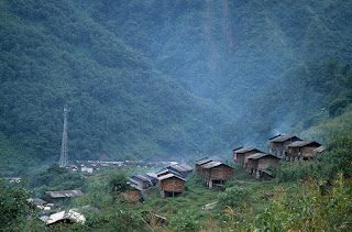
The town lies at the junction of two streams with hills rising all around it, higher in the north, marked by villages of mud-brick and wood houses and tiled roofs and patches of forest or walnut groves in between.  Terraced fields lie below the settlements, nearly all Yi-inhabited.  In the Ming Dynasty the district was a source of copper, silver and other minerals.  Platforms for blast furnaces were set up on three sites, giving the town its name.  San tai in Chinese means three platforms.

       It was market day but the landslides and rain reduced participation.  The women wore their splendid blouses and aprons, but these were barely visible under their raincoats.  Instead of a plastic raincoat I wore the goatskins I bought in Tanhua, which proved to be a social success, as most men were also wearing them, and got me invitations to drink and chat and come visit their village.  But the skies looked threatening and I declined.  They left and in fact a downpour commenced an hour later.  It was not enough to prevent my departure next morning and I left with a memory of friendly people and a desire to come back for their festival next year.  It would be dry season then and all the women will be incredibly photogenic.

       The festival, held the 28th day of the 3rd lunar month, is called Fuzhuangjie, which means Dressing Up Festival, but is commonly known as the Yi Fashion Show.  The Santai-style long-sleeved blouse, more heavily festooned with decorative strips than that of the Tanhua Yi, was the star of the event, worn by virtually every Yi woman, young and old.  For the festival they put on their newest ones and several aprons in front in contrasting colors, some garnished with sequins, each apron about five cm smaller on three sides than the one underneath, making bands of color alongside the front apron.  Their belts were tied at the back with the embroidered end tabs draped over the buttocks.  Some tied silk scarves around the waist, with the ends left dangling.

       The style was uniform, but with all the individual touches in choice of colors and appliqué strips no two outfits were precisely the same.  The plain black trousers and green army caps actually accentuated the brilliance of the garments on the upper body.  Some of the girls wrapped bright silk scarves around the cap.  Those wearing the army cap were all from the younger generation.  Perhaps it was the current fashion, like their preference for running shoes.  Older women wore black turbans lined with rows of small white buttons and cowry shells.  Some also attached small loops of colored wool tassels or an embroidered flat cap fringed on all sides with pairs of loops of woolen thread in alternating colors.  Except for earrings and silver pendants on a few of the turbans, jewelry wasn’t part of the ensemble.

       Everyone carried shoulder bags, even the men.  Aside from the goatskins, which many men wore in spite of the warm weather, and an occasional black turban, that was their only traditional clothing item.  The shoulder bags were like those in Tanhua, fully embroidered cross-stitch style—little x’s sewn into floral and geometric patterns—with long fringes at the bottom.  Some of the girls and older women carried white fringed deerskin bags.  None of the women wore goatskins that day, for that would cover up part of the blouse they were showing off. 

       The festival was originally called Fuzhuangsai—Dressing Up/Fashion Competition.  There were apparently judges who awarded winners.  The name had changed some years earlier and now there are no judges.  I guess that was because it was just too difficult to decide, among all the gloriously dressed females, exactly which one to recognize as being even slightly more splendid than any of the others.  Never mind.  The competition carries on as before, though with each other for esteem and admiration rather than aimed at a prize. 

       The festival fell on a Sunday, which was the regular market day, augmenting the event, since the actual festival program only began after dark.  Local people began setting up stalls in the morning around 9:00.  Most people wouldn’t arrive until a couple hours later, so I hiked on the trail along the stream heading to the hills, as this was a main entrance to the town for Yi  villages in that area.  I picked a spot where I could take nice photos of them as they approached.

       They came in separate small groups, the men leading the ponies, the women all dressed to the hilt.  A few men took a break to join me for a chat and a smoke and I learned a few Yi words and phrases I could use for the day.  Two girls stopped in their tracks when they spotted me and after some moments turned and walked away so as not to encounter the strange foreigner.  Santai hardly ever hosted foreigners in those days.  So as to not keep them in a state of fright that prevented them from coming to the market, I returned to the town.  It was getting crowded there already anyway, with lots more photo opportunities.

       The main square was jammed with people wandering around or checking out the stalls on the sides.  Men haggled over prices of horse trappings, ropes, straps and tools.  Women browsed the stalls hawking beads and ornaments, spangled silk pieces, aprons, scarves and other clothing accessories, traditional and modern.  Some stalls sold bedding and blankets, others shoes and sandals.  Besides grains, vegetables and fruits sold in the market area, cooked food was also available.  Rows of tables on the upper street offered bean gelatin and noodle dishes.  Restaurants prepared goat meat soup, a favorite with their mainly Yi customers.

       The market action began winding down after six p.m.  Stall owners packed up their merchandise to load on ponies or tractor-trailers and the crowd gradually dispersed.  Some headed for their villages, while a large number, including myself, walked up to the nearest Yi village, called Guola, on a hill slope above Santai, to observe the festival program.  The venue was the village basketball court, but people meandered around the square for a while, for the first part of the program was a basketball tournament.

 
      A loudspeaker blared Yi songs during the games, but was turned off when the basketball contest concluded around nine.  Then half a dozen Yi musicians on flutes and lutes entered the court.  The youth, mostly girls in their gorgeous outfits, lined up in groups along the sides, extending beyond its limits.   Spectators sat in bleachers behind the court.  The musicians, some in goatskins, circulated in the center of the rectangle, moving from one group to another.       The musicians played the same tune over and over as about 20-30 dancers responded each time.  Dancers moved to their right, but whenever the musicians got close to a group, the dancers added kicks to their steps.  I was the only one with a camera on the scene and whenever I took a flash photograph a collective “Ahh!” ensued from the dancers, yet they never missed a step.

       Festivals are usually occasions for the youth to meet and interact with the opposite sex.  I didn’t witness much of that, however.  Most of the boys stood behind the girls and just gawked.  The few that joined the dance were at the end of the line and never in between girls.  I didn’t notice any boy-girl conversations in the market, either, as they all wandered around in small groups of the same sex.  Perhaps they were shy in public or more conservative than other Yi I’d met.  The girls were reluctant to pose, but didn’t mind me taking candid shots.  This was before digital cameras were available, so I couldn’t show them instant results, which would undoubtedly have made the day much more engaging.

       The men were the opposite, greeting me as they passed by, exchanging remarks about the festival and inviting me to join them in the restaurants for goat soup, rice and cold beer.  With the women I could only look, exchange smiles or make but a single comment, like “beautiful” in Yi or Chinese.  Their reaction could be surprised, friendly or neutral, but never negative or hostile.  The crowd’s general attitude was yes, it’s a wonderful festival, glad you could see and enjoy it.  I certainly did, even though the late night dance was the only real action to watch.  Most festivals celebrate religious, agricultural, historical or mythical events.  The Santai Yi Fashion Show theme is different.  It celebrates the beauty of being a Santai Yi woman.


* * *

Monday, September 27, 2021

French Adventurers in Yunnan 1867-73


                                                                 by Jim Goodman 

       In the mid-19th century, bolstered by the new wealth generated by the Industrial Revolution, France began competing with Great Britain over establishing colonies in Southeast Asia.  The British had already taken lower and central Burma, Siam was strong enough to resist, so the French turned to Vietnam and forced a treaty in 1862 that gave them control over several provinces in Cochinchina, the Mekong Delta region of Vietnam.  The following year they signed a treaty with Cambodia that made that country a French protectorate, probably saving it from annexation by Siam.  Now that they possessed lands along the Mekong River the next question was how to take advantage of it.  Most importantly, was this the river road to China’s riches?         

       To find out how close to the Chinese border the river could be navigated a group of French explorers, military officers and their Vietnamese porters and servants formed the French Mekong River Expedition.  Led by Doudart de Lagrée and Francis Garnier, it departed Saigon 5 June 1866.   Before the year was over they had discovered the Khone Falls in southern Laos, an effective barrier to long-distance navigation.  Nevertheless, the party continued upriver, traversing ever-rougher country in ever-hotter weather until they reached Luang Prabang 29 April. There they took a four-week rest.

       Having jettisoned most of its baggage, sent its collections of jungle specimens on to Bangkok, and reduced loads to one bag per person, the party set out again 25 May soon after the onset of the rainy season.  The journey was further complicated by political troubles trying to pass through the petty states of northern Burma.  Eventually they got into Menglong for a first meal on Chinese soil.  They admired the White Pagoda there and began trekking north, passing exotic peoples like the Aini, with their unusual head-dresses.

       They reached Jinghong at the end of September. Local Dai officials were inclined to refuse the party permission to proceed, until Lagrée showed them a letter from Prince Gong, a brother of the recently deceased emperor.

       Departing Jinghong 2 October 1867, in two weeks they reached Simao (today’s Pu’er).  A fortified city 300 years old, lying in a plain surrounded by low mountains, Simao was their first genuinely Chinese city and they were overjoyed to be there, past the petty intrigues of the Dai and Burmese.  But they were aware they had walked into a province wracked by the Muslim Revolt and as they traveled further north they would come across evidence of the devastation wrought by the war.

       The Chinese mandarins in Simao extended their best hospitality, in spite of the explorers' decrepit appearance.  One of them, though, tried to remove Lagrée's hat to see the back of his head.  Rumor had it that Europeans were so powerful because they had a third eye in the back of the head, with which they sought out riches while appearing to be looking at something else.  The explorers thought this humorous, so it did not cause offence.  The mandarins were anyway cooperative, both here at Simao and at the next stops of Pu'er (now called Ning’er) and Mojiang.

       On 17 November they came to Yuanjiang, where they had their grandest reception, greeted by a party of mandarins with an escort for them of 200 soldiers and porters.  Posters bearing the guests' names were hoisted aloft, cannons boomed and music played.  The chief magistrate demonstrated that even in so remote a place as Yuanjiang he was not without his own small collection of modern gadgets.  These included a watch, a telescope and a stereoscopic viewer, which he used to look at erotic pictures.

       But of greater significance to the French was Yuanjiang's proximity to the Red River.  That this waterway, which empties into the sea below Haiphong in Vietnam, might be the river road to China, rather than the Mekong, ignited flames in Garnier's imagination.  He tried taking local boats as far as they would go, but soon came to dangerous rapids banked by high, perpendicular cliffs.  No amount of cajoling or threatening could induce the boatmen to take him any further.

       Still harboring hopes of navigation downstream somewhere, to be explored at some future date, Garnier made his way to Jianshui to join the rest of the party.  Arriving ahead of them through the magnificent Chaoyang Gate, he aroused the immediate and overbearing curiosity of the local residents.  When the crowd took to hurling stones at him to see how he would react, Garnier fired off a few quick shots with his revolver.  The crowd, amazed that a firearm could shoot successive rounds without having to reload, quickly scattered.

       The rest of the party arrived soon and the entire group was then insulated from the unruly populace by the mandarin Li Daren.  Under this powerful magistrate’s protection the explorers were safe from unwanted scrutiny.  They experienced similar conditions in Tonghai and were obliged to barricade themselves there.  (In Tonghai they also experienced a freak early snowstorm, which for the Vietnamese in the party was their first ever look at snow.)  But nothing untoward happened in Jiangchuan and from here on their reception was normal and civil.

       Leaving Jiangchuan and skirting Xingyun Lake the party came to its first grisly evidence of Yunnan's civil war.  There on a plain beside the lake stood hundreds of unburied coffins, containing victims of a cholera epidemic that followed recent fighting in the area.  Continuing towards Kunming they passed by many villages that had been burnt to the ground.  They spent a night on the southern shore of Dian Lake and arrived at Kunming 23 December for a two-week rest and a discussion of what to do next.  It was the biggest city they had soon so far and  was heavily fortified, as the war was always in mind.

       Since leaving Jinghong for Simao the Mekong Expedition had veered further and further away from the river they were supposed to be surveying.   Now Garnier, always eager to be the first Frenchman to discover anything, proposed to take part of the group west to Dali to once again explore the course of the Mekong.  Lagrée, by now extremely ill, acquiesced, his own interest being simply to stay put and try to recuperate.

       The Muslim Revolt was still raging, though Kunming had fully recovered from its brief occupation by the rebels several years earlier.  Du Wenxiu's forces were at the moment mostly quartered around Dali, but one never knew when they might move east on a foray.  As insurance for the road, as well as to serve as an introduction to the self-styled Sultan of Dali, Garnier secured a letter from the most respected mullah in Kunming.  This document requested all good Muslims to aid the explorers on their purely scientific mission.  Garnier hoped this would be sufficient to persuade the Sultan to allow the party to continue to the Mekong.

       However, keeping in mind that central Yunnan was the most frequent battleground in the war, the French decided to take a longer, but safer, route to Dali.  They proceeded north to Huizi, in Qujing Prefecture, where Lagrée stayed to convalesce.  Garnier's group then turned west into Sichuan to the Jinshajiang (River of Golden Sand--Upper Yangzi), becoming the first Westerners since Marco Polo to see the river this far into the interior of China.  They then re-entered Yunnan and swung southwest through present-day Dayao County en route to Binchuan. 

       From there the party continued towards Dali, seeing the Cangshan Mountains, Bai people and Erhai Lake for the first time 1 March.  But they never did get to meet Du Wenxiu, for he and his advisors would not believe they were French explorers on a scientific survey.  Rather, the court at Dali considered them English spies and made it clear the party would be killed if they tried to enter Dali.

       Garnier's group then had to retreat, over much the same route, to Huizi, which they reached 3 April and learned that Lagrée had died of amoebic dysentery 12 March.  The Expedition was over.  Garnier gathered the survivors and took them to Shanghai, where they embarked for Saigon.  Garnier himself and expedition member Louis de Carné published their findings, a wealth of information about Yunnan, hitherto a practically unknown province, to guide and excite all who would follow in their wake.  They had failed to find a viable trade route into China after all, along the Mekong anyway, but hinted that perhaps it would be the Red River instead.  It ran through northern Vietnam and the optimistic imperialists expected France to seize control of that territory soon.

       Within four years of this prediction Jean Dupuis, an adventurous French businessman, put it to the test.  He had heard of the Red River commercial possibility in Shanghai when the Mekong Expedition members were there at the end of their long journey, and thus began pursuing the connection almost at once.  For his first cargo he chose a commodity that was in great demand by the Chinese government--arms and ammunition.  In the spring of 1871 Dupuis obtained a commission from Kunming to bring a shipment into Yunnan.

       Brazenly passing the border town of Lao Cai, Dupuis entered Yunnan at Hekou (then called Songping) and sailed over another 100 km to Manhao.  Today Manhao is a small, riverside town on the Gejiu-Jinping route, near a picturesque view of this river.  There Dupuis unloaded his cargo and transferred it to a pony caravan to go north to Mengzi, where the government buyers waited.  Flushed with success, Dupuis claimed credit for both proving and discovering the commercial potential of the Red River, ignoring Garnier.       

       Next, instead of trying to secure permission from the Tonkin government in Hanoi, Dupuis went to France to talk up his project.  When he departed in spring, 1872, he had what he thought was semi-official backing.  This implied the French government hoped he would succeed, but couldn't openly support the attempt.  This gave this impetuous adventurer all the sanction he needed.  After the rains concluded that autumn, Dupuis loaded his arms in shallow-draft vessels and sailed into Yunnan, brandishing his commission from Kunming as his excuse to ignore Vietnamese objections.

       The following year (1873) Dupuis was ready for another run.  Only this time he chose salt for his cargo.  Salt was a government monopoly in Tonkin, exacerbating the attitude of the Vietnamese, already outraged by Dupuis' first shipment.  This time they blocked passage.  Dupuis promptly hoisted the French flag, as if to display official French government backing.  At this point both Dupuis and the Vietnamese contacted Admiral Dupré of the French mission in Saigon.  Dupré saw the situation as an opportunity to advance French interests in Tonkin.  He dispatched Garnier with a small force to help Dupuis.

      
Together Dupuis and Garnier had but 400 armed men with them, not all of them soldiers.  Some were Vietnamese supporters of the Le family and the Trinh Lords of the north, who had been displaced after the civil wars by the Nguyen of Hue.  But Garnier, convinced of Western superiority, styling himself "the Great Mandarin of France," demanded the Vietnamese give up the citadel in Hanoi, which they of course refused.  On 20 November Garnier's forces made a surprise attack and captured it.

       Next day the Vietnamese, allied with Chinese Black Flag bandits, counter-attacked.  After repulsing the first assault, Garnier decided to make a sortie.  But in pursuing the enemy he split up his small band and then ran into an ambush set by the Black Flag forces.  They captured and beheaded him.  Dupuis escaped.  Dupré disavowed Garnier's actions and the French had to sign a treaty with Tonkin that expressly prohibited commercial use of the Red River by foreigners.

       Yet in 1882 the French took over Tonkin anyway.  Theoretically the Red River route to China was open again.  But first the border had to be demarcated, which began in 1884.  The Black Flag bandits were still a force in the region and harassed the border commission constantly.  Based in Hekou, they sailed downriver to attack the French commission, killing a few.  But eventually the work was completed and commerce with Yunnan commenced.  Hopes were high for trade in tin and other minerals and a French Trade Mission was set up in Mengzi.  But the volume never amounted to much.  The river was just too shallow.

* * *