Thursday, June 24, 2021

Beyond Shangrila: the Mountains of Deqin


                              by Jim Goodman


       Mountains in Yunnan rise higher the further northwest you go in the province.  They top more than 4000 meters in Dali Prefecture and over 5500 meters near Lijiang.  There are other 4000+ peaks in Ninglang County and upper Nujiang, but the biggest of them all lie in Deqin Autonomous Tibetan Prefecture, for most of its territory is geographically the southeastern tip of the Tibetan Plateau.  Here the mountains stand over 6000 meters.

       The most accessible and popular part of the prefecture is Shangrila County.  It used to be called Zhongdian until 2001 when, to promote its tourist potential, the government claimed it was the site of the Shangrila of James Hilton’s famous novel Lost Horizon and so officially changed its name.  With its broad plain, traditional Tibetan houses, lovely monasteries at Songzhanlin and other places and friendly people, it certainly appeals as an idyllic escape from the commotion of wherever the tourists came from.

       The Shangrila hype notwithstanding, the village of the novel had a very different setting, in a valley with a triangular-peaked snow mountain towering over one end.  Shangrila lies at about 3100 meters and from various points in the county, especially in winter, one can see some snow around the mountains beyond the plain.  But they are not very high and to see anything resembling the mountain described in Lost Horizon one has to go further on to Deqin, the next county north.

       Not long after leaving Shangrila city, after passing Napahai Lake, the landscape abruptly changes.  From here on the topography is all mountainous, with no more broad expanse of relatively flat land.  The road runs along the higher parts of the mountain slopes that, in the early 90s during my visits, were largely denuded of trees, with stray hamlets clinging to the hillsides. Then it descends to cross the Jinshajiang, the River of Golden Sand that is the moniker for the Upper Yangzi, and soon pulls into Benzilan, the first major town in Deqin County.

       There were two Benzilans then.  In the lower one, the original Tibetan settlement, the houses lined a ridge overlooking a small plateau that served as farmland and pastures.  The upper one was the commercial center along the main road, full of shops, hotels and restaurants catering to travelers on the Shangrila-Deqin route, most of whom stop here for lunch.

       From Benzilan it’s up into the mountains again, where the slopes are high and barren again, although not necessarily due to deforestation.  Many gradients are so steep they never supported forests anyway. But streams run down them and there, on modest gradients, Tibetans built their settlements that are patches of green in the otherwise dusty brown landscape.   Around 15 km from Benzilan a turn-off takes one a short distance to a dramatic view of a bend in the Jinshajiang,  The river makes a loop 2/3 the way around a conical hill  protruding from the vertical cliffs on the eastern bank.

       Back to the road, the next stop north is the monastery of Dongzhulin, 103 km north   of Shangrila, at an altitude of 3000 meters.  The original monastery lay further away from the road and was built in 1667 during the reign of the Kang Xi Emperor, who himself was interested in Tibetan Buddhism.  In the 19th century Dongzhulin housed over 900 monks and 12 Living Buddhas (reincarnations of famous lamas).  It was here that the French missionary Père  Renou disguised himself as a trader and stayed to learn about Buddhism and to speak the local dialect in order to, after he left the monastery, proselytize Christianity among Deqin’s Tibetans.

       Dongzhulin became associated with the Tibetan Revolt in 1958, allegedly storing arms for the rebels, and in retaliation government forces leveled the monastery.  In 1985 it was rebuilt in its current location, a splendid traditional-style building, four stories high and supported by 82 thick wooden pillars.  The ground floor houses large images of various deities like Tsongkhapa, the founder of the Gulugpa (Yellow Hat) monastic order, Avalokitesvar, Manjusri and others.  Portraits of celestial beings, demons, benevolent and wrathful deities fill the walls.  The 3rd floor features huge images of the Maitreya Buddha, seven meters high, and Sakyamuni, ten meters high.  The other floors are for reciting sutras and performing private rituals. 

       In the early 90s Dongzhulin had about 300 monks and one Living Buddha.  There was also a Buddhist nunnery attached to it.  Nuns follow the same rules as monks, shave their heads, wear robes, recite sutras, etc, but have the option of staying in the nunnery or living at home.  Most stay in the nunnery across the road in Shusong. 

        From here it’s another 80 km or so to the county capital and halfway there the road runs through a forest and over a pass at 4000 meters.  The peak of Baimashan looms to the left of the road.  Though only 4292 meters high, it is perpetually covered in snow.  The pastures on the edge of the forest are prime yak grazing areas in the summer months.  The whole area is a protected nature preserve, home to foxes, deer, leopards and bears.  The poplar trees and parts of the pine groves turn yellow in autumn and local species of the maple tree turn red.

       From the pass the city is another 35 km through stony hills with thin patches of forest and scarcely any human habitation until just before the city.  Formerly called Atuntse, and known to local Tibetans as Jui, Deqin is about half the size of Shangrila and at around 3400 meters a slightly higher altitude.  It is sited on slopes that funnel precipitation down to a stream at the lower end of town that eventually empties into the Lancangjiang (Upper Mekong).  Most of the buildings then were modern concrete structures, with a quasi-Tibetan style in the upper end neighborhood and no style at all elsewhere.

       The only remaining wooden buildings were around the central market, which was about half the size of Shangrila’s but less ethnically diverse, for nearly all the city’s residents are Tibetan.  Several shops here and on the main street specialized in Tibetan clothing, crafts and jewelry.  City residents and villagers come here to sell off heirlooms, furs and herbs and purchase Tibetan belts, scarves, carpets, woolen cloaks, brocaded silk, fur hats and ornaments of coral, turquoise and silver.

       Most Deqin women, though, didn’t seem to be as fond of wearing traditional clothing as in Shangrila County and when they did the outfit resembled  more the style of Lhasa, with an ankle-length dress and a long striped apron in front, rather than the ensemble popular in Shangrila County.  On the whole, they were not as outgoing or engaging as their counterparts in Shangrila/Zhongdian, but invariably polite and cordial.

       Deqin has a mosque, not for Hui but for Tibetan Muslims who converted to Islam when part of Hui-run caravans in the past.  The population is overwhelmingly Buddhist, but the devout had to journey to villages beyond the city, as Deqin had no big monastery of its own anymore.  During the Qing Dynasty, especially in its last decades, lamas from high-ranking Tibetan families ruled Deqin as their private fief.  Around the end of the 19th century two new developments began to challenge their practical autonomy.  Under pressure from France, the Qing government allowed French missionaries to proselytize in Tibetan areas.  At the same time the government inaugurated a land reform policy in these same areas.

       Both of these threatened the lamas’ authority.  Land reform would target their own family holdings and conversion to Catholicism would undermine their religious leadership.  In 1904, the British colonial Government of India authorized the Younghusband Expedition, a military invasion of Tibet ostensibly designed to prevent the Russians from taking it.  London disapproved of the move and the following year Younghusband’s forces withdrew.

       Among the Tibetans the incident provoked outright rebellion against anything and anybody foreign.  In 1905 a widespread uprising began at Batang in southwest Sichuan, where the lamas instigated attacks on the foreign missionaries, all their converts and Chinese government officers.  Victims suffered grisly deaths, especially the priests, and the rebellion spread to Litang and Kangding in Sichuan and down into Yunnan in Atuntse/Deqin.  Massacres of priests and their followers took place in Deqin and Cikou, the French mission in the Lancangjiang valley south of Deqin.  Marauders mounted the severed heads of the priests on the Dechenling Monastery gate in Deqin.

       Chinese government forces halted the rebels’ advance on Xiaowieixi, the next Christian settlement south of Cikou.  They then marched on Deqin, isolated and surrounded the lamas in Dechenling and finally slaughtered everybody inside and burnt the building to the ground.  Chinese officials took charge of the administration, but eventually married local women and stayed on after their service was completed.  Surviving Christians rebuilt their demolished church in Cizhong, a little north of Cikou, this time in a French village style.

       The main reason travelers go to Deqin is not for the city’s few attractions, but for the view of the nearby snow mountains. On a clear day this is truly magnificent.  Leaving Deqin the road heads towards the Lancanjiang and after climbing out of the city’s valley and into the countryside, doming to Dong village and the modest Feilai Temple, surrounded by grain fields.  Inside the main hall is a large statue of the mountains’ guardian deity.  In the annex, when I visited, the carcasses of freshly killed goats hung from the rafters.  As the monks were presumably vegetarian it wasn’t their food.  Some Bon, pre-Buddhist sacrifice? I wondered, but never did find out.

      Lovely  Taizishan Snow Mountain, 6054 meters altitude, is visible from the approach to Dong.  A little further on, at a small break in the forest, is the most celebrated viewpoint.  Looking west one can clearly see Meili Snow Mountain, at 6740 meters altitude the highest in the province.  From its peak a long wide glacier runs down in front.  This is the most accessible glacier in Yunnan and in later years tour companies promoted one-day hikes to it and back or overnight camping at the glacier’s foot.  Adventurous travelers could also go on extended treks in the nature preserve around the mountain.

       On my visit the viewpoint also featured several chortens and strings of prayer flags, adding a religious aspect to the scene.  After a few years the government built a high wall between the road and the viewpoint with a ticket booth in front of its only door.  The entry fee was 150 yuan.  On my visit it was free.

       The road continues along the Lancangjiang Valley all the way to the Tibetan border, passing both forested and barren areas and through tunnels chiseled out of the cliffs.  It is a good example of Yunnan’s road engineering skills, though occasionally subject to landslides, which are always quickly restored.  Herder take their yaks along the same road and wherever fatal accidents have occurred, people have erected chortens on mounds of stone slabs inscribed with Tibetan prayers.

       About 30 km north of Deqin the road swerves away from the valley to cross the Adong River.  Upstream stands a major hydroelectric plant and a switch pulled here daily around midnight plunged Deqin and vicinity into darkness.  Further up, 64 km from Deqin, lies Foshan, a nondescript town from where the Lancang River is the provincial boundary between Yunnan and Tibet.  Just past Foshan is the rather prosperous village of Nagu, famous for the ancient stone coffins found nearby, but unfortunately they had been removed to a museum by the time of my visit.  Another 40 km is the Tibetan border, with an old Naxi settlement on the way, a relic of the early Qing Dynasty when Naxi troops from Lijiang guarded the border.

       While the mountains south of Taizishan are not as high or dramatic, the scenery all the way to Cizhong is quite impressive.  A road from the south end of Deqin winds along narrow gorges cut by the Lancangjiang’s tributary streams, offering sporadic glimpses of the snow peaks, passes through three tunnels and then makes eight distinct bends on the descent to the riverside town of Yunling.

       From Yunling the road runs along the Lancang River, with excellent views across to isolated villages, monasteries perched atop ravines, deep gorges cut by streams, splendid tall, thin waterfalls spillling over sheer cliffs, and occasional thick forests that burst into a variety of colors in autumn.  Around Yanmen, 30 km south of Yunling, Nagu-like stone coffins have also been found, including remnants of ancient pottery and bronze artifacts.

       A little downriver on the opposite bank lies the county’s last major attraction—the Catholic Church at Cizhong.  Tibetans comprise 3/4 of the population, with Naxi at 20% and Han 5%.  The altitude is sufficiently lower here so that Cizhong farms can grow rice instead of barley.  Viniculture, introduced by the French missionaries, is also prominent and Cizhong has a reputation for its wine.  Tibetan Christianity never revived in Deqin, but here in Cizhong, in spite of 1905, it survived.  Its congregation is mostly the older generation, but its very existence puts Cizhong on the list of what-to-see for any traveler seriously exploring Deqin County.


                                             * * *                                               

For more on Deqin and the Tibetans, see my r-book Living in Shangrila


Thursday, May 27, 2021

Anonymous Masters: Angkor Artisans


                                      ,by Jim Goodman


       Wandering through the ruins of Angkor Thom, Angkor Wat and subsidiary sites in the vicinity, one is constantly consumed by a sense of wonder.  After all, much of its original splendor still stands.  Thai armies from Ayutthaya attacked and ravaged it so badly nearly six centuries ago the government abandoned it for a new capital further east.  Not all the residents left, but their numbers and resources were insufficient to repair or maintain the monuments.

       They were also powerless to prevent private looting of valuable sculptures, which became especially acute under French colonial rule, when authorities permitted their removal.   Some of Angkor’s masterpieces were openly marketed to various museums, especially the Guimet Museum in Paris.  Others were surreptitiously sold to rich private collectors.  Cambodia’s long civil war in the 70s and 80s and its immediate aftermath resulted in further damage and theft.

       Eventually peace and security returned to the area.  Angkor won recognition as a World Heritage Site and destruction and theft have ceased.  Despite the damage and vandalism over the centuries much of Angkor’s heritage remains.  Thai soldiers removed many outstanding religious sculptures when they ransacked Angkor, which were in turn looted by Burmese soldiers attacking Ayutthaya at the end of the 16th century.  But the Ayutthaya forces did not level the city to its foundations.  The temples remained intact, though stripped of their gold embellishments, and so did much of the decorative art, which is so impressive today.

       Thanks to modern research we know a lot about the organization of Angkor, its social divisions, how the people lived, both upper and lower classes, what clothes they wore and what food they ate.  We know how they procured the materials to build the city and how artisans produced their work.  The one big mystery is just who these master craftsmen were.  We can determine when a particular item was created, but not the name of the artisan.  None ever ‘signed’ their work.  Perhaps it was all for the greater glory of the gods, or the state that employed them, but apparently not for the greater glory of their personal reputations.

       While we have the names of the kings who sponsored the construction, extension or renovation of the buildings, the name of only one architect for any part of the work has survived.  An 11th century inscription congratulates and promotes Gunipativarman upon completion of the Baphuon and the East Baray.  Similar evidence involving other architects or any sculptors does not exist.  The Angkor government kept written records, but on perishable materials like palm-leaf.  Very few of them have survived.  Perhaps some manuscripts mentioned specific artists or their achievements or awards.  We’ll never know.  

       We are not even sure of what social class the artisans came from; Brahmins, commoners, slaves/servants attached to the temples?  Or were they part of a designated, state-sponsored, separate class?  Whatever the case, they were most likely organized in guilds, with an established training program for the novices.  Experienced sculptors would be responsible for major works like the big Standing Vishnu in Angkor Thom, the dancing apsaras, the ‘Leper King’ or the faces of Jayavarman VII over the gates of Angkor Thom.   The decorative reliefs, of floral and vegetative designs, and perhaps the background of the narrative reliefs, would be left for the younger artisans.

       Religion permeated Angkor society and thus its architecture.   Aside from the walls, gates and barays (reservoirs), extant buildings are all religious.  Angkor was viewed as a sacred mandala, laid out as a replica of Mt. Meru, home of the gods.  Indian culture had already made a strong impact on the Khmer during the pre-Angkor states of Funan, 3rd to 6th centuries, and Chenla, 6th to 8th centuries.  While they did not adopt the Indian caste system, the Khmers took up the religion and Hindu gods became their own, replacing whatever indigenous ones they had before.

       To house these deities they built temples on the Indian model of the Gupta Dynasty of northern India , 4th to 6th centuries.  The shikara style of a tower with a tapering top, alone or flanked by a horizontal, columned temple was a popular type.  For the carved imagery, their iconography came from the same source, with precise requirements for how the gods looked, what animal they rode, what they held in their hands and so on.  The rules allowed for some flexibility in the depiction of subsidiary figures, but not of the main image.

       Indra, chief of the gods and also the war deity, always rides a three-headed elephant, often wielding a club.  Shiva’s mount is a bull and he is often accompanied by his wife Parvati.  Vishnu rides the man-bird Garuda, but around Angkor he is usually standing alone or with his two wives at his side (smaller than him) or else as Sleeping Vishnu, on his back within the coils of a protective python.  In general, the gods’ images had to be bigger than those of any people in the carving.  In Angkor that would also apply to its kings, whose bodies had to be much bigger than anyone else.

       Buddhism became part of Angkor culture from the 8th century, around the time it was all but wiped out in northern India.   Sinhalese missionary monks introduced the Theravada variant, which is still the main religion of Cambodia today.  Certain kings, most notably Jayavarman VII in the 13th century, promoted Mahayana Buddhism.  He also renovated Angkor Thom and built the entry gates in each direction with a huge portrait of a calm and meditating face in the center of the tower.  It might be his own face, but it could be a depiction of a bodhisattva, with which he identified anyway.

       Other renditions of the Buddha followed the Gupta Era stipulations.  Usually the Angkor Buddha is seated in meditation, sometimes surrounded by, and ignoring, beautiful maidens sent by the evil Mara to tempt and distract him.  Occasionally he is standing with his begging bowl or lying lengthwise as the Reclining Buddha.  The curled hair, large ears and monk’s robes are always part of the depiction.

       Sandstone was the main building material for Angkor and its source was the Kulen Hills, about 30 km north.  At quarries here laborers, probably all slaves, cut huge blocks of sandstone, mounted them on wooden rollers and conveyed them back to the city.  Laterite was an alternative stone in some cases, but that could be found in the immediate area.  Wood was also a common material, especially in the satellite towns and rural areas, but mainly in the late Classic and post-Classic periods.

       Sculptures in sandstone are more impressive.  The work was slow and meticulous, probably using only a bronze chisel and wooden mallet.  The sculptor began by making a rough form of the projected work and gradually shaped the volumes and cut the lines according to the traditional canon.  When the details were all in place the final steps were smoothing and polishing, especially the faces and bodies.  Being a religious image of some kind, its installation was doubtless accompanied by a ritual ceremony.

       Most of the carvings were low and high relief panels on the temple walls, towers, gates and columns.  Some were larger than life, free-standing, three-dimensional statues, usually fixed on platforms or pedestals.  The most outstanding is the eight-armed standing Vishnu in Angkor Wat, with its smooth, perfectly proportioned limbs and torso.  Another is the seated “Leper King” in Angkor Thom, which got its name from its mottled surface upon its discovery, leading to speculation this was the legendary Leper King of Angkor’s past.  But it turned out lichen growth had caused the mottling and after the statue was cleaned up, an inscription was discovered identifying the image as Yama, the Lord of Death. 

       Besides deities, temple imagery included a variety of mythological creatures.  Some of these were guardian lions, others monsters placed at the temple compound entrance; the lion-headed jawless kala with bulging eyes, the hybrid makara and the naga, a big cobra snake with seven or nine heads.  Others were divinities, like the dvarapalas, young men standing guard at the entrance, the apsaras, heavenly dancing girls, and devatas, female denizens of Indra’s paradise.

       In creating the sculptures of mythical animals the artist had to follow prescribed traditional norms, just as with the gods.  That was true of representing the divinities as well, for the apsaras wore tall head-dresses and clothing that was probably the style of ladies in the Angkor Court, while the devatas were often backed by a flaming aureole.  But since these had human forms, one suspects the sculptors used real people around them as the models.  The faces don’t closely resemble their Gupta Era prototypes.  They look more like indigenous Khmer.

      Besides stories about the gods, Indian mythology included two great epics, the Ramayana, a tale of one of Vishnu’s avatars, and the Mahabharata, a semi-historical narrative of a great battle for control of ancient India.  Both epics contain a wealth of battle scenes to inspire Khmer sculptors making narrative reliefs.  Besides the wars in the epics, Khmer artisans also created narrative reliefs of their own battles with Chăm armies from states in what is now south central Vietnam.  One can distinguish between the two armies by the head-covering worn by the Chăm soldiers, whereas the Khmer don’t wear any.  The king commanding the Angkor side sits on an elephant and both he and the animal are disproportionately larger than other figures in the scene.    

       Wall reliefs were not limited to scenes from Heaven and narratives of wars.  Ordinary daily life was a subject, too.  In fact, much of what we know about everyday experience comes from relevant wall reliefs.   We see people using ox carts, preparing an animal for cooking, using a mortar and pestle, drinking from cups, boiling water, tending animals and other vignettes.  Both the humans and the animals—elephants, goats, birds, reptiles—are depicted realistically.

       To supplement our knowledge about life in old Angkor we can read the only surviving contemporary account, of a visit made in 1296-97, when Angkor was still thriving, was by far the largest urban center in Southeast Asia and bigger than almost every Chinese city.  Called A Record of Cambodia:  the Land and its People, the author was a Chinese envoy named Zhou Daguan, who was sent there on a mission for the Yuan Dynasty government.

          No original Yuan Dynasty editions of the book exist.  What we have today is obviously incomplete, some aspects of Angkor society are ignored, some misinterpreted or subject to the author’s Chinese prejudices, yet it contains many valuable first-hand observations.  He found it a dazzling, well-organized and administered city and reported that its residents felt the same way.  He records their agricultural practices, food products, sauces and spices, liquor, flora and fauna, religion, festivals and political system.

       He describes the royal palace, which was built with wood and has not survived, and the Phimeanakas next to it, the royal ancestral temple, still standing, with a steep front staircase similar to Mayan sacrificial altars in Mexico.  Supposedly the king went there every night to sleep with a serpent goddess inside a gold chamber at the top.  Gold plating on towers, bridges, windows and other parts of the royal palace was quite profusely used and on clear days Angkor was literally a shining city.  The big halls, high ceilings, gold furnishings and decorations of the palace were designed to maximize the sense of majesty.

       In this class society people lived according to their rank.  Royal relatives and high officials had big houses, though not anywhere as grand or lavishly furnished as the king’s. They could only have tiled roofs over the bedroom and family ancestral altar, the other roofs thatched.  The lower classes were not permitted tiled roofs at all.  Except for the palace, interiors had little furniture.  People ate on the floor and slept there at night inside mosquito nets. And except for the jewelry, all classes dressed in the same wraparound or tubular skirts.

       Unfortunately, Zhou did not write much about the art of Angkor or anything at all about its creators.  We know how they lived, what they ate, etc, but not about their work or their own attitude to it.  Maybe during the ceremony with the installation of the work they received at least some public acknowledgment of their creations or even some kind of reward.  Certainly they must have felt some professional pride in their accomplishments, something that would be recognized within their peer group.  Would they have taken friends to see their latest sculpture to elicit comments, praise or a favorable evaluation?  Would they have introduced a colleague as the one who carved those wonderful apsaras over that gate?  Who can say?

       At the very minimum, the art works of Angkor had one salutary effect upon the artists who made them.  They made the city an aesthetically positive place to live in.  Art and beauty was everywhere.  A city designed to please the gods pleased the designers as well.  And its artisans were surely conscious of the role they played in making it beautiful.


                                                               * * * 

Tuesday, April 27, 2021

Cangyuan to Mengding: the Dai and Wa of the Border Lands


                                                                   by Jim Goodman


       For a long time the precise border between China and Burma remained undefined.  This was especially true for the southern part of Yunnan’s Lincang Prefecture, a long way from the capitals of both China and Burma.  Small autonomous Dai states, run by hereditary sawbas, lay in the plains on both sides of what is today’s boundary, while the Wa resided in the hills.  With their reputation as fierce warriors and headhunters, Wa villages were de facto autonomous as well, both from plains authority and each other.  No government made any effort to subjugate them

       The British conquest of Mandalay and northern Burma suddenly riveted Beijing’s attention to the border issue.  The government sent armed forces into Lancang County 1887-92 to establish its authority, while the British began advancing towards Yunnan to fix its own delineation of the international boundary.  There was no question about Dehong, which had long been on the Southern Silk Road into Burma and was always a recognized part of China, even though the ethnic groups who lived there also lived on the Burmese side.  Burma had claims on Xishuangbanna, but the British renounced them.  The main problem was who would rule over southern Lincang.

       While they did not claim the right of jurisdiction over all Dai/Shan populations on both sides of the border they did insist that Wa-inhabited area should not be similarly divided but must all be administered by Britain.  Resisting this demand, the Qing government eventually broke off negotiations, which were not revived when the dynasty fell and China became a republic.  The British did not send any military forces to assert their ambitions and the border stayed peaceful and basically ignored until after the British left Burma.  Even then, it was not until the mid-1960s that the two countries took the step of physically demarcating the boundaries.

       It was still a remote area when I visited before the turn of the century.  Cangyuan County, encompassing most of the once disputed zones, was only accessible by road via Gengma to its north, entering the county at Mengsheng.  A new airport and a highway from Gengma city directly to Cangyuan city early this century has brought more outside influences, but back then modernization was mostly only in the urban areas.   The countryside was hardly affected, especially in the hills, higher and steeper than those in Gengma County, dominated by old-fashioned Wa villages of thatched bamboo and wood houses

      Cangyuan is an Autonomous Wa County, so designated where an ethnic minority occupies over 50% of the land and/or comprises over 50% of the population.  In this county the Wa are virtually the only people living in the hills, other than a few Lahu and Yi around Mengjiao.  And they were the first inhabitants, long, long ago.  The rock paintings on the cliffs of Ai Hua, just beyond Menglai, about 30 km north of the county capital, depicting hunting and other scenes, are believed to be the work of ancient Wa artists.

       Traditional Wa culture included, and was much influenced by, the practice of headhunting. The Wa were farmers, of the slash-and-burn type, and fretted over threats to their crops. They believed that a human’s soul-force resided in the head.  It could be used to protect the crops.  So every spring, prior to planting, they went on expeditions to secure one or two heads to mount on tall poles overlooking the fields.  The further away they went the better, for then the soul-force couldn’t find its way back home.  Its power only lasted two years, usually the time when the field had to be changed, and another expedition would go out.

       Of course the family of the victim of a headhunting raid was not likely to pass it off as part of traditional culture, therefore OK.  They would want revenge, another reason why the expeditions traveled so far from their homes.  But just in case the revenge parties took the trouble to come, or closer villages opted to make raids in their vicinity, Wa villages built fortifications.  They surrounded the residential area, usually a hundred houses or more, with sharpened bamboo stakes and thick thorn bushes.  There was only one entrance, concealed by thorn bushes like the rest of the perimeter, but those who lived there knew where it was.

       With the establishment of the People’s Republic change came to the Wa Hills.  The government announced the banning of headhunting, slavery and the killing of twins, but gave the affected societies (Wa, Jingpo and Hani) until 1956 to phase such customs out. As for headhunting, it had been in abeyance for some time already.  Expeditions had ceased many years ago and the last recorded incident was one motivated by revenge, not protection for the rice crop.  The main effect of the decree was that Wa villages dismantled their fortifications. 

       Many of the larger villages broke up into smaller ones, but in the late 90s, when I visited the area, big old Wa villages still existed, like Nanpie near Nuoliang and Wengding near Mengjiao, the latter unfortunately consumed by fire this year.  Bamboo and wood was the main building material.  Houses stood on low stilts, with very steep sides, the roof thatch hanging nearly to the ground, with a small entry niche in the front.  Inside one small window allowed the smoke to escape.  The hearth was in the center and a tray suspended over the fire place held gourds, bamboo tubes and other items that the smoke would cover and make them impenetrable to insects.

     Cangyuan town, formerly called Mengtung, lies in a broad plain and is just ten km from the border.  Mountains rise just three km past the urban zone.  It’s not very large.  One can walk from end to end in half an hour.  The original Dai town lies along a small knoll just above the main market street.  As in Gengma, also once an autonomous Dai mini-state, each neighborhood has a posted name.  Some Wa have resettled in the town and, now that malaria has been eradicated, some Han have immigrated here to set up shops.  But the majority of Cangyuan town’s residents are Dai.

      Most of the Dai are farmers and on market day, held every five days, lay out vegetables for sale in the city streets.  Dai men and younger women tend to wear modern clothing, but the older women still prefer traditional clothing.  This consists of a sarong, long-sleeved, side-fastened jacket and a white turban.  The colors are usually subdued; dark blue, dark gray or black for the sarong, lighter shades for the jacket. 

       By contrast, the Wa women dress somewhat more colorfully.  They may be wearing a modern blouse or jacket, but usually don wraparound skirts with colored bands, woven ny themselves on a back-strap loom.  They are also distinguished by their long silver pipes, which practically every woman brings with her to the market.  The Wa have the greatest percentage of female smokers among all of Yunnan’s nationalities.  The Cangyuan Wa are not as colorful as their counterparts in Menglian, but they are just as friendly and very polite and hospitable to any surprise Western visitor.

       The same could be said about the Dai here.  Visiting temples and Dai neighborhoods I was frequently greeted with huanying—“welcome” in Chinese.  Their dialect differs from that spoken in Dehong or Xishuangbanna, but they share the same religion—the Theravada Buddhism of Southeast Asia.  Introduced by missionaries from Sri Lanka, where it originated, it took hold in Burma, Thailand, Laos, Cambodia and in southern Yunnan among the Dai south and west of the Red River, the De’ang and Bulang.   

       The earliest Theravada temple in Cangyuan County, the Jinlong Temple, was erected in Mengjjiao, north of Cangyuan town, in 1380.  It remained the most prestigious temple in the area, but was leveled by Red Guard fanatics during the Cultural Revolution.  Reconstructed in 1980, an earthquake flattened it eight years later.

       In Cangyuan town, the Guangyunmian Temple dates its construction to 1828, sponsored by the Yunnan government.  Its style is a mixture of Burmese and Chinese, with gilded rising dragons flanking the entrance and a three-tiered separate building in the courtyard.  Murals of the Buddha’s life and contemporary social activities adorn the interior walls.  It had a few resident monks and about twenty novices when I visited, evidence that at least some Dai families were still following the Theravada custom of enrolling their sons for a temporary stay at the monastery.

       After 1956, when headhunting was officially abolished, Dai Buddhist monks began proselytizing among the Wa.  While most Wa held onto their animist beliefs, a significant proportion adopted Buddhism, especially around Ban Hong in the western part of the county.  The temple resembles an ordinary thatched Wa house on the exterior, but the interior is just like a Dai temple.   Like rural Dai, Buddhist Wa villages construct a special house for the sacred village pillar.  Besides adopting the Dai religion, Buddhist Wa also took other features of Dai culture, such as the garments of the women.  Buddhist Wa women still smoke, though.

       The road west from Banhong runs through hilly territory until it reaches the checkpoint at Mengkaba next to the Nanding River.  From here the road turns northeast and runs about a hundred meters above the river through a narrow gorge before descending back to the plain and passing several Dai villages on the way to Mengding.  Once a little Dai state with its own sawba, today it is scarcely more than a business center, only really active on market days, held every five days. 

       The scenic and very fertile plain along the Nanding River is home to two kinds of Dai.  The Han Dai, the original inhabitants, live away from the river, in houses sited on the ground, mostly north of the town and east of the highway.  Their women dress like those in Cangyuan County, usually in black sarongs and pale jackets, though with a very tight bodice that seems designed to flatten the breasts. They may also wear a conical cap of split bamboo over, or instead of, their turbans.  Their main temple in Mengding, of stone, wood and tiles in the Burmese style, has long been a place of pilgrimage for Buddhists in the area.

       The Shui Dai immigrated here from Xishuangbanna in the Qing Dynasty and established villages along the river south of Mengding.   Their women choose brighter colors for their outfits, often donning the same color sarong and jacket.  They live in houses above the ground, though they may use brick piles rather than wooden stilts, and usually have adjoining balconies.  Besides rice, sugar cane and vegetables, some of them have rubber tree plantations at the edge of the settled area.


      Nongmu, one of the largest Shui Dai villages, lies within walking distance south of Mengding, very near a bamboo plank suspension bridge over the river.  About a hundred meters long and three or four meters above the river, the bridge sways a bit when crossed and is used not only by people on foot or bicycle, but also three-wheeled taxis and loaded tractor-trailers.  Unlike some of the smaller villages, Nongmu has its own temple, an odd-looking building of gray stone with arched columns and a multi-gabled wooden roof.

       Besides the local Dai, Mengding’s market day also draws those from across the border. Many of the women smear tanaka wood paste on their cheeks, a common practice in Myanmar, that is supposed to keep their cheeks soft and smooth.  They often inscribe patterns on the paste, resembling the tattoos of the Dai men.  Wa and De’ang also turn up for market day, both to run stalls and to shop for themselves.

       Both the Wa and De’ang around Mengding are Buddhists.  Villages of both are small to medium size, with traditional stilted houses of wood, bamboo and thatch.  Not many have their own temples, yet they do have their sacred village pillar like the Dai.     

      The De’ang are one of the smallest minorities in Yunnan and have been Buddhist as long as the Dai.  In Myanmar and Thailand  they are known as Palong and distinctive for the women’s wide silver belt.  Such an item is rare among Yunnan’s De’ang, but they often wear rattan rings around the waist instead.  The sarong is usually black with thin red stripes, worn with a front-fastened, long-sleeved jacket of light green or blue, with broad red panels down the front.  Several De’ang villages lie around Qinshui, beyond Mangmei, a Wa and Lahu area, north of Mengding, and Junzhai, across the river.

       In a couple short trips I could not explore everything of interest on the Cangyuan to Mengding route.  Nature parks, remote villages, unobserved market days and attending Dai and Wa festivals still remain on my list of things to do on a future excursion.  And that would include more encounters with friendly, hospitable Dai, Wa and De’ang in their attractive, sometimes gorgeous, natural settings.


*  *  *


Sunday, March 28, 2021

Instant Friendships--Lisu Encounters in Nujiang


                                              by Jim Goodman


       After my first journey to Yunnan in 1992, I wanted to see every prefecture in Yunnan and eventually visited Nujiang in the summer of 1998.  Gongshan County was still closed to foreigners, so after a brief stay in Liuku I spent several days in Fugong County.  The mountain scenery along the river kept getting more beautiful further north.  Snow-capped peaks of over 4000 meters were already visible before Fugong city, even though it was the warmest month of the year.  Steep slopes on either side were lined with terraces and settlements speckled the hillsides.  Thick forests swathed the tops and some areas between the villages.

       I had good weather on my arrival and the enchanting landscape provoked me to vow to come again at different seasons.  But by the time I departed I had other reasons.  Nujiang was not on the usual tourist trail and I didn’t know anyone in Yunnan who had been there.  It was an Autonomous Lisu Prefecture because the Lisu made up the majority of the population.  So what would be the Lisu reaction to a Western visitor?  Would they ignore me?  Be too shy? Feel intruded upon by my camera?  Well, as it turned out they were quite friendly, easy to engage with, and only initially shy.  They were as curious about me as I was about them.

       The other attraction of Fugong that reinforced my desire to return was the very visible presence of traditional Lisu culture.  A large portion of the women, young and old, dressed in Lisu style, with long skirts white, blue, black or pinstriped gray, a side-fastened vest over a long-sleeved blouse, a beaded cap and ornaments of beads and shell disks. Some of the men wore the traditional front-fastened shirt of pinstriped gray, often with black cuffs and collar.  And both sexes carried the Lisu-style shoulder bag, even when they wore all modern clothes.

       Fugong stages market day every five days and it’s the most interesting in the whole prefecture both for the show of traditional garments and the range of products on sale.  Women run stalls selling Lisu skirts or jackets, others display ornaments, but besides the usual cosmetics, toiletries, shoes and such, other traditional Lisu products were also available.  These included an array of bamboo cups, beer mugs, spoons, ladles, smoking pipes and bongs.  Others sold baskets of split bamboo and there were several places to buy crossbows, crossbow bolts and bearskin quivers.  You could also buy crossbow victims, like the carcasses of flying squirrels and field rats, along with other animal parts—hooves, antlers, turtle shells--used as medicine.

       Crossbows are one of the salient traditions characterizing the culture of Nujiang.  Men took them to the fields just in case some edible prey appeared and carried them from their villages down to the city on market day, where the stalls selling them were busy with potential customers.  Nujiang is not the only place with crossbows.  They are popular in the Wa Hills, too.  But nowhere else are they so widely in use.

       I also spotted men with crossbows while taking a taxi north to Nujiang’s most famous mountain, called the Stone Moon after the big oval hole just below the peak.  The road rose above the river to provide a suitable viewpoint, as well as a tavern where the driver and I could share a couple drinks. I paid a hundred yuan for the excursion and the next day hired him for fifty yuan to take me to Dapuluo, a village north of Fugong that according to the map looked close to the main road.

       The map was deceptive.  The village lay up a steep slope.  The driver took me to the junction and informed me he could not take his vehicle up to Dapuluo but promised to come back to pick me up when I returned.  The road uphill was more like a wide dirt path, only suitable for tractor-trailers, and so rutted I preferred to walk anyway, which took an hour.  The houses, mostly wooden with slate roofs, lay in a cluster surrounded by rice fields.  It was planting time so most villagers were at their farms.

       After wandering around taking pictures, it was time to go back down and meet the driver, who was already waiting for me.  Before taking me back to Fugong he wanted me to have a meal at his home first.  Maybe he felt guilty about charging me so much just to go several km to the Dapuluo junction.  It was a lavish and leisurely chicken dinner, washed down with rice liquor, with conversations about my life in northern Thailand, the Akha and Lisu there, my research in Yunnan and me learning how to say things in the local Lisu dialect.  My new friend later spread the news about me, for the following morning during market day in Fugong I overheard men speaking about the American from Thailand researching ethnic minorities.  A few introduced themselves and asked me to compare Yunnan and northern Thailand.

       Well, it was going to be easy to make friends here, so two years later, after Gongshan County was open to foreigners, I decided to make Nujiang the primary focus of my Yunnan research.  I started with a few days in Gongshan, including Bingzhongluo and the First Turn of the Nu River.  On the long bus ride to Gongshan I became familiar with another major feature of the Nujiang canyon—rope-bridges crossing the river.  Formerly made of split bamboo, which required changing after a while, now they were wound steel cables, almost all in pairs, and still in regular use, especially those near market day venues.

       Leaving Gongshan, I opted to spend a night In Lishadi, in Fugong County north of the Stone Moon, a picturesque town with tall pointed peaks right next to it.  After arriving I headed for the rope-bridge just north of the town that connected the riverbank to the Lisu village of Heizao.  From a distance I observed two men crossing over to the other side, but they were long gone by the time I reached the hook-up point.  However, after a few minutes four little girls came to the other side, hitched up with two harnesses on single cable hooks and then, without parental/adult supervision, the two pairs crossed and re-crossed the swirling river several times.  Witnessing this I deduced 1) it can’t be dangerous and 2) it must be fun.

       On the way back to Lishadi I stopped at a small sewing shop because a beautiful young Lisu woman in full traditional clothing and ornaments was inside visiting her friend the owner.  I took the opportunity to try using the Lisu language small talk I had picked up so far.  She was surprised, of course, and blushed a lot, but the short conversation was successful.  She was from Heizao so I asked her if she rode the rope-bridge.  By way of answering she reached into her pack-basket and pulled up her rope harness and cable hook.  Everyone who lived there had their own gear. 
       So the next time I visited Fugong I asked a Lisu woman I knew running a handicrafts shop to purchase a harness and cable hook for me.  But the nearest rope-bridge was one of the rare single cable types, where I would have to pull myself over from halfway across the river.  A Lisu man in the area came over and I explained, in simple Chinese, what I wanted to do and why here was not the right spot.  He offered to take me to Damedi, several km south, with its ordinary sloping pair of rope-bridges.  And there I experienced my first crossing of the Nu River in the time-honored traditional way.
       My next ambition was to use the Lishadi rope bridge with the excuse to deliver photos of the kids I had watched the previous trip.  It was market day but still early and a young man had just crossed when I arrived at the hook-up point.  He offered to take me to the village.  He left his own cable hook behind and hitched his simpler belt harness to my hook.  We failed to locate the girl I met in the shop but we did find the little girls.  My new friend kept repeating how delighted the girls were with their photos, while the parents plied us with steamed buns and cups of rice liquor. 
       Rope-bridges are not unique to Nujiang.  I saw my first one in use near Qiaotou on the way to Shangrila.  And there are still some along the upper Lancangjiang.  But, like the crossbows, only in Nujiang are they so widely in use.  I took my harness and cable hook with me on several subsequent excursions to Nujiang.  I counted 28 rope-bridges in the canyon, two of them single cables and the rest in pairs.  I rode across the Nu River at eight locations, some more than once.  It was a great way to make a favorable impression on the local people, especially those who had never ridden one themselves.

       It helped make new friends, too.  I carried the cable hook and rope harness in a shoulder bag so part of it was visible and recognizable to people in, for example, Lumadeng on market day.  Very quickly a Lisu man approached, guessed why I had such gear and offered to take me to the rope-bridge a few km north of the town.  He took his own gear along, made sure I tied up correctly and we rode across in tandem and back.  After that it was off to his house for snacks and beers, where his wife happened to be weaving at the time.  That was a skill I knew well and had even picked up a lot of the Lisu vocabulary about it, enabling me to make a few relevant comments to her and compare her narrow loom to similar Akha looms in Thailand.

       I returned to both Lishadi and Lumadeng a few times over the years, both for the rope-bridges and the colorful market days, where most Lisu dressed in traditional style.  They each had areas for drinking local maize beer and rice liquor.  Villages on the slopes were fun to visit because most were non-Christian, unable to pass up a chance to meet their first foreign guest and eager to demonstrate their hospitality by getting that guest pretty inebriated.  Their houses were usually wooden, stilted when on steep gradients, with thatch or tile roofs, simple interiors and minimal furniture.  The hearth was in the center with a bamboo tray suspended above where they stored bamboo baskets and vessels, which would be cured by the smoke from the cooking fire. Hunting trophies, like horned heads of barking deer, they might also mount above the hearth. Big ovens and storage containers flanked the rear wall.

       South of Fugong the houses are usually on stone foundations and most are Christian.  They are just as friendly and hospitable and eager to impress a guest.  They serve tea, though, not alcohol, because Christians, the sect here anyway, don’t drink or smoke.  They could make exceptions, however, as I found out on a trip to Anicha, a Christian Lisu village high up in the Gaoligong Mountains a little south of Fugong, site of a Dulong Cattle ranch.

       Dulong Cattle are raised for their meat and never used as traction animals. They are easy to manage and would provide an extra income for the village.  The project was started by Bobby Morse from Chiang Mai, whose family had been Protestant missionaries in Nujiang before 1949.  His Fugong manager took me up there.  As our hosts prepared our dinner they asked me if I drink liquor with my meal.  “Sometimes,” I answered, not to obligate them.  But perhaps it did, for they went out and fetched a ‘lax’ Christian villager to bring a bottle of corn liquor and drink with me.  I had my alcohol and a companion to converse with

       My final trip to Nujiang coincided with the Mid-Autumn Festival.  But aside from moon cakes in the Fugong market there was no sign of the celebration.  The Christians don’t mark it and neither, apparently, do the animists.  Told of a traditional village high up the slope not far from the city, I hiked there hoping for good news.  Alas, more than one resident informed me nothing was scheduled. It began to drizzle so a family invited me into their house.  

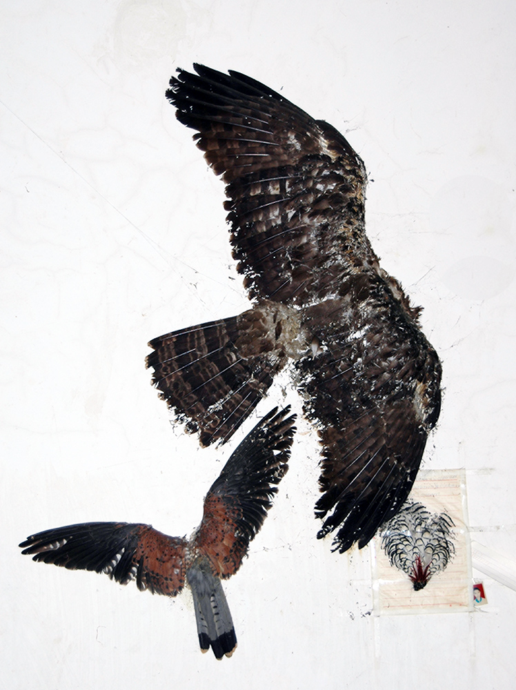
       Inside I spotted a crossbow in the corner and two trophies, an eagle and a pheasant, mounted on the wall.  Both were headless, probably because their heads were inserted into bottles of home-made liquor, like I’d seen among the Yi of Ninglang.  They also had a loom that was used for making straw floor mats, with stones tied to weight the heddle threads.  Hadn’t seen that before.

       The rain stopped before I got too drunk.  I thanked the family for their hospitality and thanked the rain for delaying my departure and enabling me to learn about one more aspect of Nujiang culture.  If I ever make it back, I’m sure there is more to discover.  All I need to do is make new friends—easy among the Lisu of Nujiang.

                                                            ***