Monday, December 26, 2016

Teak and Temples in Old Lampang


                                                              by Jim Goodman
      
the Wang River running through Lampang
       When the British annexed Lower Burma in the early 19th century they began organizing the teakwood business.  An excellent, durable hardwood, with natural oils that make it impervious to water and termites, teak was an ideal building material.  Vast forests dominated by teak trees existed in both Burma and northern Thailand.  As the British took over the rest of the country they further developed the trade and extended business operations into northern Thailand.
       British companies leased forests from local autonomous rulers in the north and set up bases mainly in Chiang Mai and Lampang, 100 km south.  
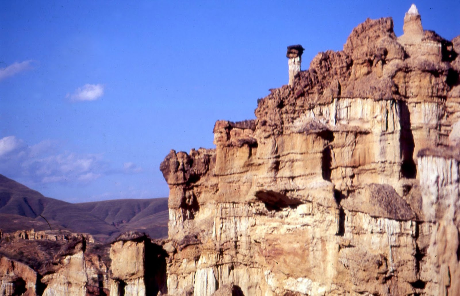
Lying along the Wang River in a broad plain, Lampang is surrounded by mountains, then full of forests that were a prime source of teak.  But while local authorities were quite willing to grant foreigners forest concessions, local people did not want to work in them.  So the British brought in workers from Burma, especially Shan, which not only affected the makeup of the population, but also introduced new cultural influences.  The city today features several Burmese-style temples, around half of those in northern Thailand.
the walled compound of Wat Lampang Luang
       Lampang is actually the second oldest city, after Lamphun, in northern Thailand.  The younger son of Queen Chamadevi of the recently established Mon state of Haripunchai, as Lamphun was then called, founded the city in the 9th century.  Because of the intervening Khuntan Mountains between the two cities. Lampang enjoyed a great measure of autonomy and indeed, there is scarce mention of the city in Haripunchai chronicles. 
       To protect itself from invasions, Lampang established bastions on all the routes leading into it.  When Mengrai of the Kingdom of Lanna conquered Haripunchai, including distant Lampang, these bastions were abandoned.  But one of them, about 18 km northeast, became the site of Wat Lampang Luang, one of the most venerated temples in northern Thailand.  Sitting on an artificial mound and surrounded by walls, it looks like a fortified temple compound.
18th century mural, Viharn Luang
19th century mural, Viharn Luang
       The Buddha himself is said to have visited the site and left a hair as remembrance, which was then housed in a shrine that eventually became a chedi, twice enlarged in the 15th century, that now stands 45 meters tall.  The Viharn Luang in front of it has a classic Lanna triple roof and an ornate, gilded housing for the main Buddha image. 
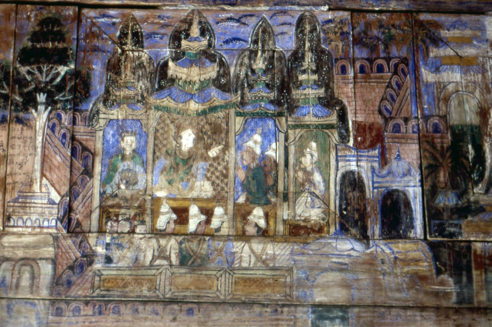
19th century scene, Lampang Luang mural
       The wooden interior walls feature painted frescoes of the Jataka Tales, a collection of stories of previous incarnations of the Buddha. Some of them date from the 18th century, the oldest in northern Thailand.  These are rather crude portraits, with fewer details and colors than the larger array of early 19th century murals.  Besides veneration of the Buddha, scenes depict kings at their courts, soldiers assembling for war, royalty at leisure and rivers full of fish and mythical creatures. 
       The original mid-15th century viharn (main prayer hall) has been replaced since then, though probably in the original style, as have most of the buildings.  But one of them, Viharn Nam Tam, built in the beginning of the 16th century, open-sided with a triple roof, has never been rebuilt and is the oldest extant original temple in the north.  
Viharn Nam Tam
       Within Lampang city itself, the most important temple in the Kingdom of Lanna times was Wat Phra Kaew Don Tao.  Built over a previous Mon temple in the 14th-15th centuries, it was the original home of the Emerald Buddha, considered Thailand’s most powerful guardian image. In 1434 lightning struck a chedi in Chiang Rai province and revealed a damaged Buddha image.  The abbot found that underneath the exterior stucco was an image of green jade.  The King of Lanna wanted it moved to Chiang Mai, but the elephant carrying it three times detoured to Lampang.  So it stayed in Wat Phra Kaew Don Tao until 1468, when King Tilokaraj removed it to Chiang Mai.   A century later it was taken to Laos and eventually Siamese troops captured it in Vientiane and took it to Bangkok, where it remains.
Po Thip Chang at Wat Phra Kaew Don Tao
       As the southernmost part of Lanna, Lampang occasionally suffered when wars between Ayutthaya and Lanna took place mainly in Lampang province.  Lanna itself began disintegrating in the mid-16th century and Burmese armies captured Chiang Mai in 1558 with scarcely any resistance.  Lampang fell under Burmese rule, too, but as in the days when it was part of Lanna, Lampang’s administration still enjoyed a fair measure of autonomy.  There were occasional revolts against bad Burmese governors, but these didn’t last long.  The various principalities in the north never coordinated their actions.
       In the 18th century, Burmese control began to weaken, even as it revved up for a showdown with Ayutthaya.  In 1732 a Lampang hunter named Po Thip Chang led an attack on the garrison that had been set up at Wat Lampang Luang and killed the commander.  Such was the politics of the day, though, instead of organizing a reprisal, the Burmese king confirmed Po Thip Chang as autonomous ruler of Lampang.  In return, until his death in 1757, the Lampang ruler could be relied upon to aid the Burmese forces suppressing revolts in other places.
Baan Sao Nak teak house
       Burma conquered and destroyed Ayutthaya in 1767.  But in the north, sporadic revolts had already been intensifying and now they picked up, with a little more coordination than previously.  The nominal King of Chiang Mai and King Kawila of Lampang, the second successor to Po Thip Chang, faced with a Lanna devastated by revolts and reprisals, sandwiched between two more powerful states, decided the best way to get rid of the Burmese was to agree to ally with and be vassals of Siam. 
       In 1774 a combined Siamese-Lanna force expelled the Burmese from Chiang Mai.   But after barely surviving a Burmese counter-attack the following year, Kawila abandoned the city and removed what remained of the population to Lampang.  When Rama I, who had commanded the Siamese troops in the taking of Chiang Mai, ascended to Siam’s throne in 1782, he appointed Kawila as King of a restored Lanna.  
Baan Sao Nak interior
       But Chiang Mai was still deserted and the Burmese still in the north.  Kawila spent the next couple decades on expeditions to capture people from northeast Burma to resettle them in Lanna.  He officially re-established Chiang Mai as Lanna’s capital in 1796 and finally expelled the last Burmese from Chiang Saen in 1802.
       Kawila was one of Lampang’s ‘Seven Brothers,’ or Chao Chet Ton, the dynasty that ruled Lanna until its final absorption into Thailand.  Another of the original Seven Brothers became prince of Lampang.  As it was still several days’ journey from Chiang Mai to Lampang, he also was a practically autonomous ruler.
the viharn at War Pong Sanuk
       Lampang was the second most important city in revived Lanna.  Chiang Mai’s population only began exceeding Lampang’s in the mid-19th century.  By then the teak business had made it one of the two northern cities with a significant foreign population.  The smaller portion of this was Western, primarily British, some of whom ran the city offices and some of whom spent many days in the forests supervising the logging.  Every December the British community celebrated Christmas together, alternating between Chiang Mai one year and Lampang the next.  (This became easier after 1919, when the railway line, which only reached Lampang three years earlier, was extended to Chiang Mai.)
       The other foreign communities were those who came in with the teak trade—Burmese, Shans and even Indians.  They worked both in the cities and the forests and some Burmese entrepreneurs became quite wealthy from the business.  One of Lampang’s most popular attractions today is Baan Sao Nak, the House of Many Pillars, built in 1895 by a Burmese Mon trader. 
Wat Sei Long Muang
       Altogether 116 pillars support the house’s four connected, Lanna-style buildings, with a Burmese-style verandah in front.  All the original furniture remains on display—beds, tables, chairs, cabinets full of lacquer ware, brass and silver bowls, utensils and porcelain, partition screens, a steam presser for creasing pants and a couple of early 20th century gramophones.
       Other Burmese merchants around this time sponsored construction of temples for their community.  The Burmese have been Theravada Buddhist at least as long as the Thai, but these temples introduced new architectural elements distinct from existing Lanna-style structures.  The most obvious is the tall, thin, multi-tiered, ornate tower over the entrances or on the roofs.  The shape of the viharn—assembly hall—could also vary, making a tour of Lampang’s temples interesting for the diversity of shapes and styles.
Wat Chedi Sao
       Built in 1886, Wat Pong Sanuk rests, like Wat Lampang Luang, on a manmade mound rising above the immediate neighborhood.  Besides a gilded chedi, the compound features a three-story viharn in an unusual cruciform shape.  The viharn at War Sri Long Muang, completed in 1912, lies on a horizontal axis, with a very wide roof over a triple entrance and three-tiered towers on either side of the central one.  The building is unlike any other temple in northern Thailand.  And the central Buddha image, of course, is very much in the Burmese style.
old house on Kad Kokng Ta
       A third Burmese temple from this period is Wat Sri Chum, in the southern part of the city.  U Myaung Gyi, also known as Big Boss, of mixed Burmese and Shan descent, sponsored its construction and helped pay to bring in skilled carpenters and craftsmen from Mandalay to build it, which was completed in 1901.  Both the viharn and the smaller ordination hall feature typical Burmese/Shan roofs, different from the angled, layered roofs of Thai temples, plus ornamented towers of receding tiers.  The viharn has two side entrances, with elaborately carved filigreed screens just above the entry staircases.
       In 1992 fire consumed the viharn.  Basing their work on photographs of the original, Burmese and Thai artisans tried to build an exact replacement.  They got close, but the tower over the rear entrance is somewhat higher than the original and the exterior walls that were once an attractive pale yellow are now bright white.  A large donation box, a postal receptacle and a few other small structures now stand between the entry staircases.  And the filigreed screens above them have been gilded.  Nevertheless, it’s still the finest Burmese temple in Lampang.
horse-carts station in Lampang
       Burmese architectural elements also crept into the original Lanna-style temples in Lampang.  An example is Wat Phra Kaew Don Tao, where a Burmese tiered tower stands at the entrance, just in front of the old Mon-style chedi.  After this temple, the best known is Wat Chedi Sao, on the north side of the Wang River.  Sao in northern Thai dialect means ‘twenty’ and that many white chedis with gilded tops stand in the courtyard.  It also has, unusually for a Theravada temple, a statue of a multi-armed Guan Yin, the Mahayana Buddhist Goddess of Compassion.  Wat Koh, on the south bank of the Wang River, contains buildings in the northern Thai style, but also a very Burmese-style small shrine in the rear of the compound, full of interior wall murals.
Kad Kong Ta Street
       The other influence on Lampang that came out of colonial Burma was that of the British teak wallahs themselves.  Lampang’s central clock tower went up at this time, replicating a feature the British introduced into cities in Burma.  The teak wallahs spent a lot of time in the forests supervising the work.  Their crews first girdled the trees so that they would die slowly while still standing and cut them down one to two years later.  Trained elephants hauled the logs out of the forest and shaped them into rafts on the riversides.  The logs floated downriver to Bangkok, staying in the water up to three months. 
       Coming home out of that environment, they wanted homes that were spacious and comfortable.  Kad Kong Ta, in the northern part of old Lampang, was a favorite neighborhood and today the old teak wallah homes, largely converted to other uses like restaurants and lodges, are another of the city’s highlight attractions. They are a mix of northern Thai and European styles, but in general so evocative of the teak trade’s heyday that the city chose the neighborhood as its ‘Walking Street’ on Saturday nights, wherein the street fills with stalls selling handicrafts and other merchandise, northern foods are on offer and musicians play Lanna tunes.
horse-cart in the streets of Lampang
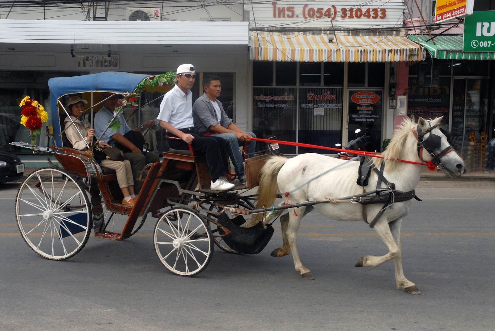
       The other enduring legacy of the British presence is the horse-cart, also previously introduced in Burma and still in use in Maymyo, or Pwin U Lwin, a hill station near Mandalay.  Lampang is the only city in Thailand one can still take a horse-cart to get around.  They ‘re actually cheaper than taxis and a much more interesting ride. 
       It’s amazing that they have survived this long, for the teak wallahs left a few generations ago and tourism didn’t take off until recent decades.  But now that Lampang is drawing more attention as an excursion for travelers in northern Thailand, the future of the horse-cart looks rosy.  They are a throwback to an archaic age, the city’s halcyon days of yore.  They are an appropriate vehicle for a relaxed exploration and enjoyment of the Mon, Lanna, Burmese and British legacies of Lampang’s fascinating heritage.
the original Wat Sri Chum, 1989
                                                                         * * *                         


Friday, December 16, 2016

Houses in the Jungles


                                               by Jim Goodman

Akha village above the Mae Suai plain
       The monsoon has finished and the weather is cool and dry in the hills of Northern Thailand.  This is the building season for anyone who needs a new house, before the work activity shifts in late winter to preparing the fields for planting.  In recent times many of the mountain people have improved their lot enough to afford lumber or cement brought in from the plains.  Traditionally, though, they obtained all they needed for a house from the jungles that surrounded them.
       Except for the Karen, who began settling in Northern Thailand from the 18th century, coming out of Myanmar, ethnic minorities only began migrating into the area in the 20th century, particularly the last decades.  As the plains were already occupied, and as they had lived in the hills in their original homelands, bands of migrants picked a location deep within the forest with a reliable water source and cleared an area to establish a village.
Lahu village, Mae Kachan district
       The slash-and-burn type of agriculture the people pursued involved clearing a patch of forest to make fields.  But because the soil in the hills is not very rich, after two years they had to abandon the fields and clear another patch.  The monsoon regenerates the abandoned fields, though, and after several years farmers return to clear and utilize the same fields again. 
       These fields lie a little distant from the village, past the thick swathe of forest on all sides of the settlement.  Besides keeping them fairly isolated from the affairs of the cities, plains and governments, the forest location has other advantages conducive to a goal of relative self-sufficiency.  In addition to being a source of building materials, the jungle provides them with food like birds and wild game, plus edible plants and fungi, as well as medicinal herbs.
Akha house leaning against a slope
       Now men go into the forest and, wielding simple machetes, cut and shape hardwoods for use as house posts, chop study bamboo poles for the framework and split others for floors and wall planks.  After laying out the wood and bamboo to dry, they prepare cords of bark strips or rattan to lash the poles, beams and planks.  Meanwhile the women gather thick imperata grass near their fields and bind stalks of it together on bamboo sticks to make roofing sections.  
       The type of house built varies by ethnic group.  While they might live high up in the hills, the Hmong, Yao and Lisu tend to put their houses on relatively level areas in the section of the forest they have cleared.  These sit directly on the ground, though some may be raised on stilts, especially if they live nearer to the plains and Thai influence.
Karen village,Mae Sariang province
       Traditional houses among the Akha, Lahu, Karen and Palong are usually stilted.   Some lie angled on slopes, so that the stilts only hold up the lower end.  They also attach an open-air balcony on one side, used for drying laundry, dyed cloth, herbs and vegetables, or for just sitting in the sun, as opposed to the somewhat dark interiors. 
       All of them use the same building materials, but the architecture may differ a little.  Lahu and Palong houses tend to be longer than those of the Karen and Akha.  Usually staircases of wooden planks are at the entrances, but to get into a Lahu house one uses a notched log leaning against the balcony next to the front door.  Akha houses also have a pair of ‘horns’ over the apex of each end of the roof, rather like the traditional northern Thai houses in the plains.
Palong village, Doi Ang Khang
       Usually a few related families get together for the construction.  When all the materials are dried and ready the men, advised by the village’s most experienced architect, erect the framework, lay down the floor beams and end beams, then put up  the central support post..
       Before going any further, the house owner makes a ceremonial offering to the underground spirits, lest the disturbance of having a house built over them anger them to the troublemaking point.  Among the Akha, this is a small dish containing an egg, some rice grains and silver shavings.  The owner pours these into a crevice at the foot of the central support post.  Following this rite, construction resumes.
construction materials laid out to dry
       Men climb up the framework and fasten the roof poles together with rattan strips.  Then they lay out the sections of roof thatch the women have made, overlapping them so that they won’t leak in the rain.  On Akha houses the two poles at each end of the roof cross to form a V above the top of the roof.  Usually these are plain extensions of the poles.  But sometimes they are wooden additions, with curved ends like cattle, and with three to five serrated wooden swords suspended vertically below the apex.
       Making the frame is but a day’s task, but the rest of the work, inside and outside, requires more time.  They have to put up the already prepared walls, made of latticed split bamboo, lay out and bind together the floor strips, install shelves, make a couple windows and shutters and make one or two hearths.  Outside they have the balcony and its railing to construct, the granary to erect, the staircases to make for the entrances and the fences for the gardens and animal pens.
putting up the frame
Lahu man splitting bamboo
     One feature of Akha house interiors that distinguishes them from those of other hill people is the partition wall, running through about three-fourths of the center, that divides it into two sections.  One side is the women and children’s sleeping quarters and the other side is for men and guests.  Both side have a hearth, for traditionally men cooked the meat and tea and women cooked the rice and vegetables, as well as the animal feed, usually at a separate hearth by the door to the women’s entrance.  If the house is small it may have only one hearth, but with two cooking stands.
Palong girl making roofing
       According to Akha mythology, when only men lived on earth an Akha man was lonely and so the Creator God Apoemiyeh instructed him how to find a spirit wife.  When the man reached the appointed place and called out three times, a creature part tiger and part spirit appeared.  She was furry and naked, had long, sharp fangs, sickle-shaped fingernails and hoe-shaped toenails.  The man cut the bottom of a rice sack for her to wear (the prototype Akha miniskirt), slipped his shoulder bag over her head and took her home.  But that night the wife killed and devoured him.
       Then she desired a new husband and proposed to the first Akha man she met.  He deemed her too frightening to wed.  So she bade him to strike off her fangs and nails and build a wall inside the house, promising to stay on her side of the partition at night.  Reassured enough, he agreed, she kept her promise and eventually turned into an ordinary human Akha woman.  And the partition has persisted in Akha houses until today, even when they build a Thai-style house or become Christian.
Akha women making thatch roof sections
       The wall also plays a social role.  Women and children tend to retire early and wake up early, as do the animals.  The wall separates them at night from the men socializing on the other side, for they tend to stay up later.  The men’s side may also be ornamented with the jawbone of a boar or deer as a symbol of men’s hunting prowess.
       On the women’s side, as though recognizing that women bear the children who continue the ancestral line, are all the paraphernalia associated with ancestral rites.  The sacred bamboo section is fastened to the pole next to the central support post.  At harvest time the household will insert the first five panicles of cropped rice as an offering to the ancestors.  The ancestral basket stands beneath it, beside a small altar tray where the family leaves offerings during festival rites.
       The hearth, with Akha as well as other mountain people, is square, with logs or sticks for fuel laid at angles pointing to a common center.  The fire is left to smolder when not aflame.  A three-legged, circular, iron cooking stand straddles the fire.  Suspended over the hearth, a large square plank of plaited split bamboo holds several cups, bowls, plates, chopsticks, etc, made of bamboo and several large gourds, which will later be used as water containers.  The smoke wafting up from the fire gives these items a dark patina over time, hardens the surfaces and keeps insects from boring into them.
decorated Akha balcony and house 'horns'
Lahu house, Doi Ang Khang
       Usually household members sleep on raised beds along the back walls or else thick mattresses on bamboo mats.  They sit on round stools, about 12 cm high, with buffalo hide seats.  They dine at round or square tables of woven split bamboo and when not using them suspend then upside down above the hearth to get the same smoke treatment as the utensils and gourds.  Often the stools are stacked in a corner until mealtime and people simply squat or sit on the floor.
       Large woven bamboo hampers by the beds contain most of the clothing.  Bigger items might be hung from hooks on the back walls.   The shelves along the wall behind the hearth are filled with more gourds, water jugs, pots and pans, ladles, chopstick containers, flasks, traps, scales, farm tools, fishing gear, tobacco boxes, bamboo chili mortars, small baskets and assorted odds and ends.  Hunting equipment, like long-barreled rifles and crossbows, they place on the highest shelves to keep them out of the reach of children.
Akha woman pounding rice beneath the house
       Because of the overhanging roofs and few, if any, windows, which are more useful for letting out the smoke than letting in the light, the house interiors are dark.  Most hill tribe villages only received electricity in the 1990s.  Until then the only illumination they had inside, besides the fire, came from tiny oil lamps.  (But people could still run a television off a car battery.)
       As a result, work that requires good lighting, like embroidery, as well as much of the socializing, takes place around the porch by the door or on the adjoining balcony.  Its floor, like the one inside the house, is made of split bamboo, lashed across bamboo poles, rendering it a little springy and making it creak whenever anyone walks across it.  Bamboo railing lines the sides, the poles used for hanging laundry or dyed cloth.  A portion of the floor may be used for drying grains.  Children play here and sometimes the family chooses a warm and balmy evening to dine out on the balcony.
       Standing in the yard a little way from the house is the granary.  Except for what it will need for the day, the family keeps its rice and other crops in this elevated shed as a precaution.  If a fire should burn down the house, at least their food supply will survive.  A modest fence surrounds the yard, which may also have chicken coops and pigpens on the grounds and a small vegetable garden occupying one part.
Akha man plaiting split bamboo
       Often the pigs, like the dogs, roam freely all day, but always return to be fed.  They sleep under the house and the noises they make at night are part of everyday sounds for the residents and unlikely to wake them up as a consequence.  They also keep the mortar and pestle for pounding rice, operated by foot, underneath the house, since it is too big to put inside.
       Hill tribe houses are quite sturdy and can last generations.  They do require some periodic renovation, though.  After three years the thatched roof starts leaking and must be replaced.  Making new roof sections is thus a common early winter village activity, even when no new houses are being built.  Individual strips on the floors might also need replacement. 
       As for the attached balcony, that also needs periodic renovation and the Akha have a festival activity to determine whether it is necessary.  In the late summer, during Ka-ye-ye, en event staged to chase out lingering evil spirits in the village, children wield painted wooden swords and race through the village slashing away at invisible spirits.  They run up the women’s entrance into the house, then out the other side to jump up and down on the balcony.  If it starts to break, that signals the owners it’s time to change it.  So sometimes people try to stop; the kids from jumping on the balcony because they don’t want to have to change it just now.
       When construction is completed, or at least that much of it that requires outside assistance, the house owner holds a feast for all involved.  The host will slaughter a pig or a couple chickens, urge everyone to eat as much as they can hold and ply them with rice liquor to enhance the conviviality.  And they’ll be ready to join the work crew whenever any of their guests are ready to build their own new house.

Akha village houses and granaries, Chiang Rai province
                                                                         * * *                 


Monday, December 5, 2016

The Beauty of Erosion


                                               by Jim Goodman

garden and pillars near the hotel in the Little Stone Forest
       Known for its ethnic diversity, with 24 minority nationalities spread across its territories, many of them with numerous distinct sub-groups, Yunnan also has the greatest geographical variety of any province in China.  It doesn’t have a seacoast, though a beach at the northern end of Fuxian Lake can provide a similar summer experience.  Nor does it have a proper desert, just extremely dry areas here and there where scarcely any vegetation grows.  But it has everything else, from low-lying tropical plains in the south to snow mountains in the northwest cresting over 6000 meters and every possible rugged landscape in between.
       Much of the present topography of Yunnan is due to its geological history, especially the disruptions of the Permian Age, some 270 million years ago.  Violent activity beneath the earth’s crust thrust mountains up to spear the skies, raised lake beds above their water level and drained the inland seas.  Eons later, the seismic activity has still not stopped.  Almost annually, major earthquakes wreck havoc in various parts of Yunnan, rearranging the landscape just like civilized man and his development projects.
limestone projections in the Stone FOrest
       Some of the Permian permutations occurred in places where the original inland seabed was limestone.  This is a sedimentary rock composed of marine elements like mollusk, coral and other creatures.  When exposed to rain, the water slowly but surely dissolves parts of the surface, creates fissures to seep through, sometimes all the way through the rock.  The process carves the rocks into new, irregular and unique shapes of hills, boulders, caves and pillars, creating a phenomenon known as karst landscape.
pillars in the Stone Forest
       The word comes from the Karst Plateau on the Istrian Peninsula, mostly in Slovenia, where the first scientific studies were carried out.  It means “place where rocks are exposed to the air.”  Karst landscapes, including subterranean examples, exist in many places throughout the world.  In this region the best known are in Guangxi Province, along the Li River from Guilin to Yangshuo, and H Long Bay in Vietnam, where the hills appear as islands speckling the sea.
       Yunnan’s karst rival to these sites is the Stone Forest, just two hours east of the capital Kunming.  It is not Yunnan’s only karst landscape, for others exist at Puzhehei, Babao and Duoyihe.  But in those locations the hills may have a bald cliff on one side, but are generally green with some kind of shrubs or plants at the least.  The formations in the Stone Forest are mostly pure, barren rock, usually silver gray.
       When I first visited Yunnan in the early 90s, the Stone Forest was the most heavily advertised tourist attraction.  Every hotel pushed tours there.  As it was also the homeland of the Sani people, a branch of the Yi nationality, I considered it an appropriate introduction to Yunnan’s two prime attractions—ethnic and natural.  But in those days tourists did it in a day-trip, arriving about 10 to 11 in the morning and leaving by 2:30 so they could have an early dinner back in Kunming. 
Dashilin--the Big Stone Forest
       This left the park virtually empty of visitors early morning and late afternoon, the best times for photography anyway.  So I opted to stay overnight inside the park, get out early and explore before the first tour buses arrived.  Just for the adventure, I took the train to Yiliang, which sometimes rose high above the highway for better countryside views.  But buses from Yiliang were not frequent then and, after a lunch in a restaurant, my traveling companions, a European teacher couple on holiday from Beijing, decided to hire a cab to take us there.
       We arrived just before dark, sped through the entrance gate where the ticket booth was already closed and managed to have our dinner just as the Sani dance show was about to begin.  People tend to disparage minority dance shows in Yunnan as exploitation for the tourist business.  I was seated from where I could see the performers off-stage, awaiting their turn and practicing their steps one last time before they went on.  They obviously took it seriously themselves.  In fact, ethnic minority dances have been part of Yunnan’s tradition of welcoming guests since the Nanzhao Dynasty over a thousand years ago.  A Yunnan minority troupe even resided in the Tang Dynasty capital of Chengdu at that time.
dog-like stone in Shilin
       We set out early, though the skies were nearly covered with clouds the whole morning.  Xiaoshilin, the Little Stone Forest, lay near the hotel and features a small lake and some of the tallest, most evocative pillars, including the one named after the Sani heroine Ashima.  Dashilin, the Big Stone Forest, a little further on, sprawls over a much larger area, with pathways that wind through, around and sometimes under the boulders. 
       Time and erosion have sculpted some of these stones into arresting and suggestive shapes, like a dog howling at the moon, or the one called Camel Riding an Elephant.  The path sometimes veers out of one conglomeration of boulders to a field flanked by yet another ‘grove’ of bare rocks jutting out three to six meters above the ground.  The sides of many have parallel vertical ridges like the exterior of a loofah gourd, the surface smooth in between the ridges.  Groups of boulders or pillars may also have horizontal crack lines across their sides, as if they came from a celestial giant’s building block set, or were being prepared as water channels for the invisible demons that prowl the ‘forest’ at night.
flat-topped pillars in the Sand Forest
       It was still overcast when we departed, Just as the park was fast filling with tourists.  I returned the following year in good weather to photograph everything again, this time staying in a lodge just outside the entrance, this time paying the 20 yuan entry fee, and again starting my exploration just as the crowds were leaving.  Since the mid-90s the ticket price has jumped nearly ten times that and so has the number of visitors.  It must be the most financially lucrative tourist spot in Yunnan.
       Smaller concentrations of karst topography lie all over Shilin County’s rolling hills.  The most notable are on the outskirts of Suogeyi village and in Naigu Shilin, the Black Stone Forest, where the rocks are mostly charcoal black instead of steel-gray.  For a very different kind of eroded attraction one goes to Luliang County, east of Shilin, and the Colored Sand Forest (Caise Shalin), 18 km south of Luliang city, at the foot of Wufeng Mountain.. 
wall sculpture in a Shalin cave
the 'scholar' rock
       Here it’s not limestone, but sand mixed with stone, with a high quartz content.  Rather than a near-uniform gray, rock formations come in a variety of colors: rust-red, light orange, white, yellow, light gray and pink, sometimes several in one group, which is why it got its name.  Tall, thin pillars like those in Shilin stand here, too, but most of the formations are thicker pillars with very even flat tops that almost look like they were sawed off.  They may stand in groups among the trees at the lower end of a steep cliff.  Or they could be lined up in descending heights.  Occasionally they can be egg-shaped or triangular, with an anthropomorphic cliff face, like the one resembling a scholar with a pointed cap.  Or they might have accessible caves, where ancient monks lived in retreat and in one case carved a deity’s face on the wall.
cliffs in the Colored Sand Forest
     
When I visited Shalin two decades ago it was a pleasant contrast to the commercial hubbub around the Stone Forest.  Though it was a nice day I was practically alone in the park, often wondering why it wasn’t crowded.  From March 2001 that changed dramatically with the inauguration of the annual International Sand Sculpture Festival, in which artists from across the globe come to create sculptures out of the grounds of the park.
       That gave the Colored Sand Forest nationwide publicity and the 21st century wave of domestic tourists began including Shalin on their Yunnan itineraries.  Conscious of its reputation for uniquely colored sands, local vendors began bottling them to sell to tourists.  Then tourists started bringing their own bottles and went out on the trails to chip away at boulders and cliff sides to collect free souvenirs. 
like a row of buildings in the Earth Forest
       A number of violent storms and a more acidic precipitation in recent years have also contributed to the accelerated rate of erosion.  The formations in the Sand Forest are intrinsically not as strong as limestone.  Combined with the tourist poaching, half of the park’s formations have disappeared or severely deteriorated.  In some cases souvenir excavations along the base of a cliff have helped make it slide onto the ground.
       Some of the intact scenic areas have been declared off limits as a result, while workers have installed black retaining walls in the park’s main 6km2 walking area to bolster the weakened cliffs.  Park workers also make daily tours looking for fresh holes to plug.  While the area still has its breathtaking attractions, the Colored Sand Forest is becoming a sad example of how tourism can instigate erosion far faster than natural forces like wind and rain.
the Earth Forest in Yuanmou County
       A third phenomenon of natural erosion in Yunnan suffers neither from pilfering nor vast crowds.  Called Tulin, the Earth Forest, it covers 50 km2 of an area 36 km northwest of Yuanmou, which is itself 200 km west of Kunming.  Thus it is too far for a day-trip and only likely to be part of a schedule for Yunnan visitors in the province who are here for an extended time.  I myself wound up seeing it in the mid-90s as an excursion out of Yongren, prior to an all-night bus ride back to Kunming. 
       After turning off the main road north of Yuanmou, we passed through a rural area full of trees and streams before reaching Banguo, the village beside the park.  Entering the area just beyond the village the landscape suddenly changed.  The groves were gone.  The stream beds were dry and the view in front of me more approximated that of a desert.   High, dry, vertical cliffs lined the stream bed in subdued colors of pale yellow to light red-brown.  Some vegetation sprouted on small ledges along the cliff faces, but scarcely any trees were visible except on the hills in the distance, glimpsed in between sections of the cliffs.
cliffs and pillars in the Earth Forest
       There was no ticket booth back then and the only manmade addition to the park, besides a smattering of signposts along the bridle trail, was a flower tree garden just inside the entrance.  Villagers offered me a pony ride, which would have been a good idea to reach the furthest parts of the park, but I really only had time for the nearest section and, felling fairly vigorous after the ride from Yongren, decided to walk.  As the afternoon wore on and the light was less intense, the colors on the cliffs and pillars became ever richer and more enchanting.  
chedi-like spires in the Earth Forest
                Compared to the Stone Forest and Colored Sand Forest, the Earth Forest is relatively young.   Geologists reckon its age as 1.5 to 2 million years.  The soil here is sand rock mixed with clay.  Movements of the earth’s crust caused crannies in the soil that deepened and widened over the eons.   Besides the cliffs that rise so sharply from the plain, the Earth Forest features pillars that rise like columns up to forty meters high. 
       A walk through the Earth Forest easily stimulates one’s imagination.  Protrusions on the sides of the cliffs can resemble high-relief carvings of animals like rabbits, gophers and crouching lions.  Some of the pillars are topped with narrowing spires that look like Southeast Asian Buddhist temple chedis.  Other pillars have lateral extensions at the top like horse heads on their upturned necks.
       Other cliffs suggest urban architecture.  Cliffs in a row, a little apart from each other, stand like high-rise city buildings.  Some spots on the high cliff walls, sculpted by time and weather, appear to be rocked-carved cathedrals, with doors, windows and triangular roofs.  Others are like palaces with columned front facades.
       The Earth Forest does not have an annual sculpture festival.  There’s a ticket booth now, 100 yuan admission, and tours are a bit more organized, with vehicles instead of ponies.  But it draws nowhere near the crowds of the Stone Forest and encompasses a larger area.  There are still plenty of places in the Earth Forest where one can be alone in contemplation of an inspiring landscape, and define its details in similes and metaphors, just like the classic Chinese poets.

'buildings' carved by time in the Earth Forest
                                                                    * * *