Showing posts with label karst. Show all posts

Sunday, October 7, 2018

Making the Đồng Vân Circuit—the Northern Tip of Vietnam


                                                                           by Jim Goodman

Đồng Văn and its majestic setting
       The northeast border province of Hà Giang has always been one of the most remote parts of Vietnam.  Mountains cover most of its nearly 8000 km2 area and only in the last decade have good, all-weather roads been constructed linking its capital Hà Giang City with Hanoi, 320 km south, and other towns in the province.  Agriculture and forestry account for most of the economic activity.  While the province is rich in mineral resources—antimony, iron ore, zinc, manganese, copper tin, gold, bauxite and gemstones—these remain underexploited. 
the old market in Đồng Văn
       It is still a poor province, in terms of services, hospitals and the general standard of living in the rural areas.  Yet its population of around 730,000 is by no means destitute.  Those residing in the towns, mostly Vietnamese and some Ty, live moderately well and those in the highlands—Hmông, Dao and other minorities—enjoy basic self-sufficiency.  Travelers are unlikely to encounter malnutrition or dire poverty.
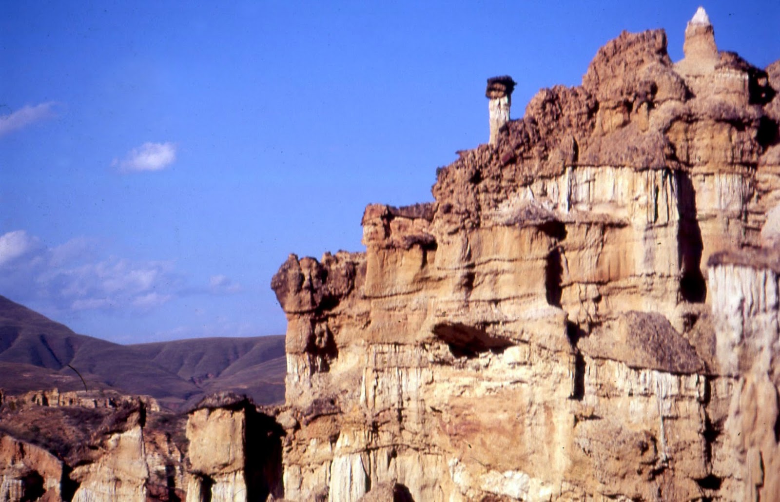
       Hà Giang is also one of the country’s most beautiful provinces.  Its four northernmost districts—Qun B, Yên Minh, Mèo Vc and Đng Văn—make up the UNESCO-recognized Đng Văn Karst Plateau Geopark.  Of its 2300 km2, limestone accounts for 80% of the surface, usually in the form of mountains up to 2400 meters, with some of it consisting of boulders that jut up from farmlands in the valleys.
Đồng Văn farms
       Rocks in this landscape contain fossils dating back 400-600 million years.  Excavators have also found stone tools made by early human settlers 10,000-30,000 years ago.  At the Sì Phài Pass above Đng Văn a stone inscription marks the spot as the site of one of the five biggest sudden mass extinctions in the history of the bio-world.  Due to climate changes, a fall in the sea level and changes in the composition of sea water, 33^ of marine fauna families disappeared.
Hmông village at Mã Pí Lèng
       In the recent past it could take at least three days to go from Hanoi all the way to Đng Văn.  Nowadays, leaving Hanoi in the morning, travelers can reach Đng Văn, 146 km further north of Hà Giang City, in the early evening.  The town’s stunning location is in a narrow oval plain at 1100 meters altitude, backed by high hills that flank the rice fields adjacent to the urban area.  Some farms lie on the slopes with more moderate gradients, but many of the hills are too steep for cultivation.
       In the town center is the old market square, marked by a large sculpture of a reed-pipe, a cultural symbol of the Hmông minority, the dominant ethnic group in the hills..  The new market is down a lane across the street and is especially active on Sunday, Đng Văn’s market day, when ethnic minorities from the hills stream into the town.  Many hotels and restaurants are in this area, while on the main street local folks set up convivial evening stalls offering cups of corn liquor and various grilled snacks.
Nho Quê River at Mã Pí Lèng
karst landscape near Mã Pí Lèng
       In colonial times Đng Văn was too remote to attract French settlers.  It did have a military base, though.  Behind the southwest suburbs stands a tall, steep hill where the French built a lookout post and fort called Đn Cao.  Only the ruins of its walls survive, but visitors can take the path up to it for a splendid view of the valley.
Mèo Vạc
       The French first arrived in the area in 1886, following victory in the Sino-French War, fought over the issue of which nation would control northern Vietnam.  As they tried to extend control they faced a revolt by the Dao minority in 1901.  They quickly quelled the uprising, then made an alliance with the district’s de facto ruler Vương Chính Đức, a Hmông lord whose family had been commissioned by the Nguyễn Dynasty to administer the district.  Now he would rule on behalf of the French and helped them put down another revolt, by the Dao and their allies, that lasted from 1913-1915.
White Hmông girls in traditional clothes
       In the vicinity of Đn Cao a road turns right and immediately ascends into the mountains and heads south 21 km to Mèo Vc, with fabulous scenery all the way.  This is the beginning of the Đng Văn circuit and after about ten kilometers the road reaches the Hmông settlement at Mã Pí Lèng Pass, just above the canyon of the Nho Quê River.  The view here is the best on the route, looking across to myriad shapes of jagged peaks and steep, nearly vertical slopes.
       The village sprawls below a high hill, the land much studded with rocks.  Small patches for grain and vegetables lie between.  It’s too high and the soil too stony for rice cultivation, so the main crop is corn, which grows wellhere.  People use it to feed themselves and their animals, turn a portion of it into liquor and use the husks and stalks as fuel.
elderly Dao Tá Pàn woman
Hmông woman in the Lũng Phìn market
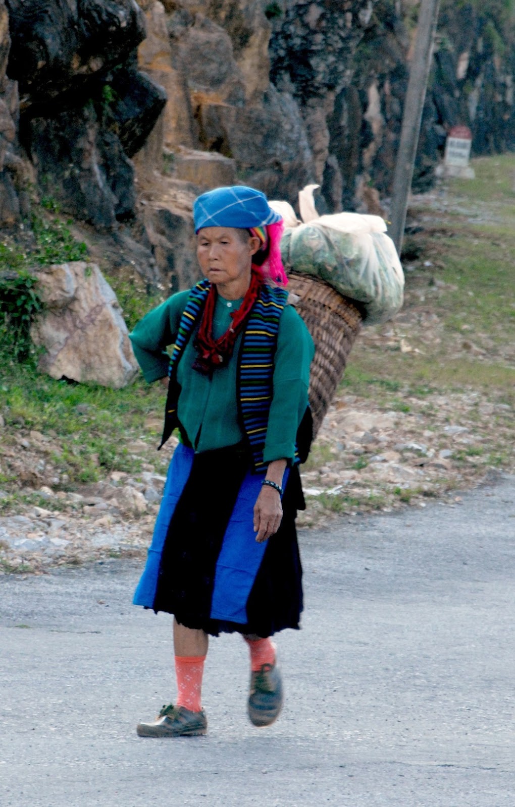
       The villagers belong to the White Hmông branch and are not as colorful as the various Flowery Hmông groups to their west.  Men dress in modern style and women wear knee-length, pleated skirts of a great variety of colors and patterns which mostly come from Chinese textile factories.  They may wear traditional leg wrappers and side-fastened jackets, but exhibit no sense of uniformity in the complete outfit.  Nevertheless, they are still recognizably Hmông, for no other ethnic group dresses like this.
Lũng Phìn market day
       The Hmông, lik their linguistic cousins the Dao, migrated to this area two to three centuries ago.  The plains and valleys were already occupied, so they had to settle in the mountains, with its rocky slopes, stony ground and less productive soil.  But that’s been a theme of Hmông history, always pushed out of good land by stronger neighbors and forced to make a living on the lands nobody else wanted.  Yet they succeeded, extracting the maximum from what was available for them.
       From Mã Pí Lèng the road continues high above the Nho Quê River and begins descending about five kilometers before Mèo Vc.  This town is about the same size as Đng Văn, though its enclosing hills are a little further away.  Ordinarily it’s a quiet place, except for Sunday, also Mèo Vc’s market day, with lots of hill people in and around the central covered market.
Dao woman in Lũng Phìn
Hmông girl in Lũng Phìn
       At the junction just outside of Mèo Vc, one road turns southeast towards Bo Lc, in Cao Bng province, and the other heads west to Yên Minh, 50 km distant.  The landscape is not as dramatic as that above the Nho Quê River, but it’s a pleasant ride through rolling, forested hills.  The biggest villages along the way are Sung Tra, about six km from Mèo Vc, and Lũng Phìn, another twenty km or so further.  Sung Tra holds its market day on Saturday, while Lũng Phìn hosts it on the tiger and monkey days of the 12-day animal cycle.
the road to Yên Minh
       Market days are the other prime attraction, besides the scenery, of the Karst Geopark districts.  Moreover, they are enjoyable on cloudy, misty days, when the scenery is barely visible.  Most foreigners confine their market day experience to Sundays, at Đng Văn and Mèo Vc.  The former starts very early, while the latter isn’t active until very late morning.  The other venues see few foreigners and are without any souvenir stalls catering to tourists. 
       Lũng Phìn’s market is especially attractive.  The village lies on the south side of the road and where its main street meets the highway the commercial activity is at its most congested.  All along the main street, which rises slightly uphill, Hmông and Dao women set up their stalls, on up to the covered market building at the top.  The Hmông here outnumber the Dao, and dress similarly to those around Mã Pí Lèng. Some of the younger ones don white skirts or very spangled blouses and lots of ornaments.
rich farm manor near Lũng Cú
      The Dao belong to the Tá Pàn sub-group and their women wear long coats, split at the sides, with embroidered strips running vertically down the front, fastened by rectangular silver buckles.  They also wear trousers that look plain black when they stand still.  But when they walk, or a breeze comes along while they are standing, the heavily embroidered patterns on the sides become visible.  Older women wear large black turbans, middle-aged ones wear round caps and the unmarried go hatless.
Lũng Cụ flag tower
       Past Lũng Phìn, the road continues across rolling hills, occasionally swerving around huge black granite boulders jutting up from the fields.  At Yên Minh it turns north and begins climbing into the mountains again.  After 20 km it comes to a junction.  The way left goes five km to a closed valley and the border post village of Phó Bng.  A right turn goes west back to Đng Văn.  Several km past the junction stands another big sculptured Hmông reed-pipe.  The road turning north here runs along high hills and then reaches Lũng Cú, a small town with its rice fields lying at the bases of a cluster of hills.
       Lũng Cú’s claim to fame is its position at the northernmost point of Vietnam, just below the Tropic of Cancer line.  On a hill on the northern side of town stands a flag tower, and from here one can have a view into southeastern Yunnan, China.  There’s not much to see in that direction but wild mountains, but the view down to the village and town layout and its farms is worth the excursion.
       Returning to the road junction with the reed-pipe, just a little further west is the next major stop.  This is the Hmông village of Sà Phìn.  It holds market day on snake and pig days, drawing mainly local and neighboring White Hmông.  It’s also the location of the Vương Palace, which sits in a wooded area outside the village. 
part of the Vương family palace
       After sealing their alliance with Vương Chính Đức, the French hired Chinese architects to build him a palace in 1902-03.  Comprising four two-story wooden buildings, separated by courtyards and surrounded by a white-plastered brick wall, the palace, now a museum, is the primary historical attraction in the area.  Side rooms in each quadrangular compound serve as exhibits of household items when the palace was in use.  These include the elegant furniture of the study, the family altar, the kitchen with its twin brick fireplace, the family altar, a wooden mortar for pounding corn, a vertical loom, thread-winder and spinning wheel, and an armory with a rack of  old rifles.
       For assistance in suppressing the 1913 revolt, for sending soldiers to the French garrison in Hà Giang City, and for keeping order in his domain, the French promoted Vương Chính Đức to General in 1927.  In the following decade, however, he became sympathetic to the anti-colonial resistance and after the Japanese occupied northern Vietnam in 1940, he began supplying covert assistance to the Việt Minh.  
the Vương family dining room
       He died in 1944, but his son and successor Vương Chính Sính pledged support to Hồ Chí Minh and helped enable the Việt Minh capture of Hà Giang City in March 1945.  After 1954 he donated his land to the provincial government and served it as the representative of Đồng Văn, Mèo Vạc and Yên Minh districts.  He died in 1966 and the palace became a school.  In recent decades a new school was erected below the palace, which then became a museum.
       The road back to Đồng Văn remains high in the hills most of the way, allowing many scenic views, especially on the slow descent to the city. The best time of year to visit is the autumn, when the fields are yellow with the ripening rice crop.  But winter is never very cold, as it rarely snows, even in the mountains, while during the summer it doesn’t rain continuously and the fields are bright green.  Planting takes place in mid-spring, but this is also the time of the area’s most interesting annual event—the Khâu Vai Love Market.
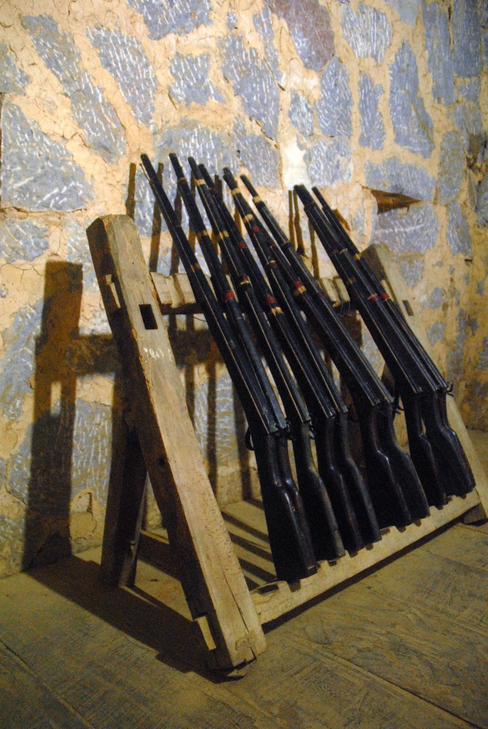
old rifles in the Vương palace
Hmông woman on the road above Đông Văn
       Khâu Vai holds a regular market day every five days beginning with the 2nd day of the lunar month.  But on the 26th-27th days of the 3rd lunar month it hosts the Love Market.  Unmarried young people may attend any ordinary market day with their eyes open for a potential partner, but this Love Market actually marks the opportunity for ex-lovers to meet again.  It originated long ago in an affair between a Giáy girl and a Nùng boy.  Opposition from Giáy elders led to a war between the two ethnic communities and the couple decided to terminate the relationship in the interests of peace.  But they arranged to meet once a year at Khâu Vai and since then the custom spread amongst other ex-lovers and became the Love Market Festival. 
       Besides former lovers, the popular event attracts a broad range of ethnic minorities in the area, dressed in their best, enjoying a variety of activities and entertainment.  And like the fabulous karst landscape, it is unique to the northern tip of Vietnam.

farms behind Đồng Văn 
                                                                             * * * 
Delta Tours Vietnam can make arrangements to visit Đồng Văn and other destinations in Hà Giang province.  See https://www.deltatoursvietnam.com/other-tour-options


Monday, December 5, 2016

The Beauty of Erosion


                                               by Jim Goodman

garden and pillars near the hotel in the Little Stone Forest
       Known for its ethnic diversity, with 24 minority nationalities spread across its territories, many of them with numerous distinct sub-groups, Yunnan also has the greatest geographical variety of any province in China.  It doesn’t have a seacoast, though a beach at the northern end of Fuxian Lake can provide a similar summer experience.  Nor does it have a proper desert, just extremely dry areas here and there where scarcely any vegetation grows.  But it has everything else, from low-lying tropical plains in the south to snow mountains in the northwest cresting over 6000 meters and every possible rugged landscape in between.
       Much of the present topography of Yunnan is due to its geological history, especially the disruptions of the Permian Age, some 270 million years ago.  Violent activity beneath the earth’s crust thrust mountains up to spear the skies, raised lake beds above their water level and drained the inland seas.  Eons later, the seismic activity has still not stopped.  Almost annually, major earthquakes wreck havoc in various parts of Yunnan, rearranging the landscape just like civilized man and his development projects.
limestone projections in the Stone FOrest
       Some of the Permian permutations occurred in places where the original inland seabed was limestone.  This is a sedimentary rock composed of marine elements like mollusk, coral and other creatures.  When exposed to rain, the water slowly but surely dissolves parts of the surface, creates fissures to seep through, sometimes all the way through the rock.  The process carves the rocks into new, irregular and unique shapes of hills, boulders, caves and pillars, creating a phenomenon known as karst landscape.
pillars in the Stone Forest
       The word comes from the Karst Plateau on the Istrian Peninsula, mostly in Slovenia, where the first scientific studies were carried out.  It means “place where rocks are exposed to the air.”  Karst landscapes, including subterranean examples, exist in many places throughout the world.  In this region the best known are in Guangxi Province, along the Li River from Guilin to Yangshuo, and H Long Bay in Vietnam, where the hills appear as islands speckling the sea.
       Yunnan’s karst rival to these sites is the Stone Forest, just two hours east of the capital Kunming.  It is not Yunnan’s only karst landscape, for others exist at Puzhehei, Babao and Duoyihe.  But in those locations the hills may have a bald cliff on one side, but are generally green with some kind of shrubs or plants at the least.  The formations in the Stone Forest are mostly pure, barren rock, usually silver gray.
       When I first visited Yunnan in the early 90s, the Stone Forest was the most heavily advertised tourist attraction.  Every hotel pushed tours there.  As it was also the homeland of the Sani people, a branch of the Yi nationality, I considered it an appropriate introduction to Yunnan’s two prime attractions—ethnic and natural.  But in those days tourists did it in a day-trip, arriving about 10 to 11 in the morning and leaving by 2:30 so they could have an early dinner back in Kunming. 
Dashilin--the Big Stone Forest
       This left the park virtually empty of visitors early morning and late afternoon, the best times for photography anyway.  So I opted to stay overnight inside the park, get out early and explore before the first tour buses arrived.  Just for the adventure, I took the train to Yiliang, which sometimes rose high above the highway for better countryside views.  But buses from Yiliang were not frequent then and, after a lunch in a restaurant, my traveling companions, a European teacher couple on holiday from Beijing, decided to hire a cab to take us there.
       We arrived just before dark, sped through the entrance gate where the ticket booth was already closed and managed to have our dinner just as the Sani dance show was about to begin.  People tend to disparage minority dance shows in Yunnan as exploitation for the tourist business.  I was seated from where I could see the performers off-stage, awaiting their turn and practicing their steps one last time before they went on.  They obviously took it seriously themselves.  In fact, ethnic minority dances have been part of Yunnan’s tradition of welcoming guests since the Nanzhao Dynasty over a thousand years ago.  A Yunnan minority troupe even resided in the Tang Dynasty capital of Chengdu at that time.
dog-like stone in Shilin
       We set out early, though the skies were nearly covered with clouds the whole morning.  Xiaoshilin, the Little Stone Forest, lay near the hotel and features a small lake and some of the tallest, most evocative pillars, including the one named after the Sani heroine Ashima.  Dashilin, the Big Stone Forest, a little further on, sprawls over a much larger area, with pathways that wind through, around and sometimes under the boulders. 
       Time and erosion have sculpted some of these stones into arresting and suggestive shapes, like a dog howling at the moon, or the one called Camel Riding an Elephant.  The path sometimes veers out of one conglomeration of boulders to a field flanked by yet another ‘grove’ of bare rocks jutting out three to six meters above the ground.  The sides of many have parallel vertical ridges like the exterior of a loofah gourd, the surface smooth in between the ridges.  Groups of boulders or pillars may also have horizontal crack lines across their sides, as if they came from a celestial giant’s building block set, or were being prepared as water channels for the invisible demons that prowl the ‘forest’ at night.
flat-topped pillars in the Sand Forest
       It was still overcast when we departed, Just as the park was fast filling with tourists.  I returned the following year in good weather to photograph everything again, this time staying in a lodge just outside the entrance, this time paying the 20 yuan entry fee, and again starting my exploration just as the crowds were leaving.  Since the mid-90s the ticket price has jumped nearly ten times that and so has the number of visitors.  It must be the most financially lucrative tourist spot in Yunnan.
       Smaller concentrations of karst topography lie all over Shilin County’s rolling hills.  The most notable are on the outskirts of Suogeyi village and in Naigu Shilin, the Black Stone Forest, where the rocks are mostly charcoal black instead of steel-gray.  For a very different kind of eroded attraction one goes to Luliang County, east of Shilin, and the Colored Sand Forest (Caise Shalin), 18 km south of Luliang city, at the foot of Wufeng Mountain.. 
wall sculpture in a Shalin cave
the 'scholar' rock
       Here it’s not limestone, but sand mixed with stone, with a high quartz content.  Rather than a near-uniform gray, rock formations come in a variety of colors: rust-red, light orange, white, yellow, light gray and pink, sometimes several in one group, which is why it got its name.  Tall, thin pillars like those in Shilin stand here, too, but most of the formations are thicker pillars with very even flat tops that almost look like they were sawed off.  They may stand in groups among the trees at the lower end of a steep cliff.  Or they could be lined up in descending heights.  Occasionally they can be egg-shaped or triangular, with an anthropomorphic cliff face, like the one resembling a scholar with a pointed cap.  Or they might have accessible caves, where ancient monks lived in retreat and in one case carved a deity’s face on the wall.
cliffs in the Colored Sand Forest
     
When I visited Shalin two decades ago it was a pleasant contrast to the commercial hubbub around the Stone Forest.  Though it was a nice day I was practically alone in the park, often wondering why it wasn’t crowded.  From March 2001 that changed dramatically with the inauguration of the annual International Sand Sculpture Festival, in which artists from across the globe come to create sculptures out of the grounds of the park.
       That gave the Colored Sand Forest nationwide publicity and the 21st century wave of domestic tourists began including Shalin on their Yunnan itineraries.  Conscious of its reputation for uniquely colored sands, local vendors began bottling them to sell to tourists.  Then tourists started bringing their own bottles and went out on the trails to chip away at boulders and cliff sides to collect free souvenirs. 
like a row of buildings in the Earth Forest
       A number of violent storms and a more acidic precipitation in recent years have also contributed to the accelerated rate of erosion.  The formations in the Sand Forest are intrinsically not as strong as limestone.  Combined with the tourist poaching, half of the park’s formations have disappeared or severely deteriorated.  In some cases souvenir excavations along the base of a cliff have helped make it slide onto the ground.
       Some of the intact scenic areas have been declared off limits as a result, while workers have installed black retaining walls in the park’s main 6km2 walking area to bolster the weakened cliffs.  Park workers also make daily tours looking for fresh holes to plug.  While the area still has its breathtaking attractions, the Colored Sand Forest is becoming a sad example of how tourism can instigate erosion far faster than natural forces like wind and rain.
the Earth Forest in Yuanmou County
       A third phenomenon of natural erosion in Yunnan suffers neither from pilfering nor vast crowds.  Called Tulin, the Earth Forest, it covers 50 km2 of an area 36 km northwest of Yuanmou, which is itself 200 km west of Kunming.  Thus it is too far for a day-trip and only likely to be part of a schedule for Yunnan visitors in the province who are here for an extended time.  I myself wound up seeing it in the mid-90s as an excursion out of Yongren, prior to an all-night bus ride back to Kunming. 
       After turning off the main road north of Yuanmou, we passed through a rural area full of trees and streams before reaching Banguo, the village beside the park.  Entering the area just beyond the village the landscape suddenly changed.  The groves were gone.  The stream beds were dry and the view in front of me more approximated that of a desert.   High, dry, vertical cliffs lined the stream bed in subdued colors of pale yellow to light red-brown.  Some vegetation sprouted on small ledges along the cliff faces, but scarcely any trees were visible except on the hills in the distance, glimpsed in between sections of the cliffs.
cliffs and pillars in the Earth Forest
       There was no ticket booth back then and the only manmade addition to the park, besides a smattering of signposts along the bridle trail, was a flower tree garden just inside the entrance.  Villagers offered me a pony ride, which would have been a good idea to reach the furthest parts of the park, but I really only had time for the nearest section and, felling fairly vigorous after the ride from Yongren, decided to walk.  As the afternoon wore on and the light was less intense, the colors on the cliffs and pillars became ever richer and more enchanting.  
chedi-like spires in the Earth Forest
                Compared to the Stone Forest and Colored Sand Forest, the Earth Forest is relatively young.   Geologists reckon its age as 1.5 to 2 million years.  The soil here is sand rock mixed with clay.  Movements of the earth’s crust caused crannies in the soil that deepened and widened over the eons.   Besides the cliffs that rise so sharply from the plain, the Earth Forest features pillars that rise like columns up to forty meters high. 
       A walk through the Earth Forest easily stimulates one’s imagination.  Protrusions on the sides of the cliffs can resemble high-relief carvings of animals like rabbits, gophers and crouching lions.  Some of the pillars are topped with narrowing spires that look like Southeast Asian Buddhist temple chedis.  Other pillars have lateral extensions at the top like horse heads on their upturned necks.
       Other cliffs suggest urban architecture.  Cliffs in a row, a little apart from each other, stand like high-rise city buildings.  Some spots on the high cliff walls, sculpted by time and weather, appear to be rocked-carved cathedrals, with doors, windows and triangular roofs.  Others are like palaces with columned front facades.
       The Earth Forest does not have an annual sculpture festival.  There’s a ticket booth now, 100 yuan admission, and tours are a bit more organized, with vehicles instead of ponies.  But it draws nowhere near the crowds of the Stone Forest and encompasses a larger area.  There are still plenty of places in the Earth Forest where one can be alone in contemplation of an inspiring landscape, and define its details in similes and metaphors, just like the classic Chinese poets.

'buildings' carved by time in the Earth Forest
                                                                    * * *             


Wednesday, February 12, 2014

People of the Stone Forest


                                                        by Jim Goodman

    From the opening of Yunnan to foreign tourists, an essential part of everyone’s itinerary was a trip to the Stone Forest.  Lying just over 100 kilometers east of Kunming, a visitor could do it as a day trip.  The excursion was a convenient combination of the province’s natural and cultural attractions—a unique landscape of eroded limestone pillars and a colorful ethnic minority, the Sani, a branch of the Yi nationality, who inhabit the vicinity.
eroded pillars in the Stone Fores
     For the origin of the Stone Forest phenomenon, the geologists have an explanation.  Once upon a time in the Permian Age, some 270 million years ago, a lake occupied the county’s territory.  Fossilized ammonite shells are still found in the area and were one of the tourist souvenirs on sale at the park.  Sudden shifts in the earth’s crust thrust the limestone lakebed upward to form a tableland.  Rain, wind and seeping water daily nibbled away at the limestone over the eons, causing fissures on the pillars, sculpting them into grotesquely suggestive shapes.  Chinese tourists, who have been coming here since the Ming Dynasty, dubbed some of them with fanciful names like Phoenix Preening its Wings, Rhinoceros Looking at the Moon, Camel Riding an Elephant, Wife Waiting for her Husband.
"The Brothers" (left) at Naigu Shilin
    The local Sani have their own version.  Accordingly, an ancient hero named Jinfang Roga, sort of a Sani Prometheus, sought to improve the lot of his people by building a great dam to hold the waters as a defense against drought.  To do this he sneaked into Heaven and stole a magic whip, capable of driving mountains like sheep.  All night he drove the peaks together from eastern Lunan County west towards Yiliang.  But he failed to finish before dawn, when the whip’s magic powers ceased.  The herd of peaks stood fast to
"stone grove" near Suogeyi
become the Stone Forest (Shilin in Chinese), while the vengeful gods captured the hero and put him to death.
    Actually, the Stone Forest is merely an 80-hectare concentration of a phenomenon that characterizes much of the county’s landscape.  Another conglomeration of much darker rocks lies several kilometers north, called Naigu Shilin, after the Sani word for black.  Clusters of similar stones jut up all over the pastures and rolling highland plains, while many Sani villages lie adjacent to “stone groves” of weird pillars equally as eye-catching as those of Shilin.  A particularly interesting set stands next to Suogeyi, 15 km south of Lunan town, where I found myself ready to emulate the ancient Chinese poets and bestow names of my own on certain limestone formations:  Buffalo Rampant, Drunken Sentry, Crooked Phallus, Tower of Pebbles, Easter Island Immigrant, etc.
    These karst formations, as they are called, disappear when crossing the county’s boundary lines.  They have become such a tourist attraction that in 1998 the government changed the county’s official name from Lunan to Shilin, though residents still refer to the county capital as Lunan.  The name in Chinese means “south of the road,” but in the Sani pronunciation means “dark stone.”  The tourist business at the Stone Forest Park, with its ever-increasing ticket prices, souvenir stalls, guides in ethnic clothing and variety of Sani entertainment shows, is the most important economic generator in Shilin County.  But with the crowds, the Chinese characters painted on the pillars, the obvious commercialization and plethora of souvenir stalls, it can be somewhat overbearing.
tobacco plants offshore at Yuehu (Moon Lake)
    Compared to Shilin Park and Naigu Shilin, the rest of the county’s scenery remains relatively unmolested.  Just past Suogeyi, off the road to Guishan, lies Changhu, Long Lake, a picturesque, oblong shaped body of water that can be circumambulated in an hour.  The only manmade structure here is a small stone lion on the southern shore.  Fishermen stand on the banks to cast their lines and Sani villagers occasionally come here for picnics.  About 12 km east of Shilin Park, in a much wilder setting, is Yuehu, Moon Lake, with a shape resembling a thick crescent moon.  West of Shilin Park are a few karst caves, their walls and stalactites illuminated with lights of
Daduishui waterfall
different colors.  And in the southwest, an hour’s ride from Lunan town, the Bajiang River drops 96 meters over a cliff into a pool.  Called Daduishui, splayed 30 meters in width, this is Yunnan’s most spectacular waterfall.
    In between these gems the land undulates gently, bounded by a horizon of distant hills and mottled by villages, patches of forest, flocks of sheep and goats and tilled fields of red earth, with crops of rice, maize or tobacco.  Sani villages usually lie around one or two large ponds that serve as principal water source.  Houses are of typical Yunnanese rural construction:  rammed earth walls, timber posts, tiled roofs, the ground floor for living, the upstairs for storage.  Back walls sometimes have built-in beehives for honey production.  The wheels of carts and barrows, as well as the old-fashioned threshers, are often made of wood and stacked against the rear wall.
typical Sani village
    In the past the Sani lived mainly in the hilly eastern part of the county, forced there by aggressive Han immigrants.  Hereditary chieftains ran autonomous villages, dominated by aristocratic landlords.   But in the late Qing Dynasty, opium-addicted Chinese landowners began selling off lands around Lunan to pay off debts and since then the Sani have occupied places all over the county.  Most Sani villages are animist, honoring deities assumed to be in control of the natural elements affecting their environment.  They venerate the tiger as their totem animal and keep a tiger image in their homes as a protective spirit.
    A small number of villages, though, are Catholic, due to the efforts of a remarkable French priest named Paul Vial in the late 19th century.  French missionaries had already had some success in the Nujiang and Lancangjiang canyons, but virtually no converts in cities like Lijiang and Dali.  The Sociéié des Missions Étrangères, in charge of French Catholic work in the province, decided in 1888 to transfer Père Paul Vial from Dali, where he had had no success, to Lunan County.
    Vial took an instant liking to the place and its people.  He learned the language and delved deeply into the traditional culture.  Distrusting individual conversions, for they might be subject to social pressure from traditional believers and lead to recantation, Vial preferred the conversion of whole extended families and villages at once.  He did not demand a wholesale rejection of Sani customs in embracing Christianity, but sought to incorporate some of their traditions into the faith he was offering.  For example, Sani children traditionally wore baby caps festooned with badges of protective spirit images.  Upon conversion, mothers did not remove the caps, just replaced the “pagan” badges with little medals of Catholic saints.
    In addition to his missionary work, Vial launched a side career as ethnologist and linguist.  He composed reports on his mission work to the Société’s newsletter, while also writing scholarly volumes on the history, culture and customs of the Sani.  He even compiled a Sani-French dictionary.  He was an indefatigable defender of Sani interests, Christian or traditional, in any disputes with outsiders or the government, a reputation that endeared him to all Sani.
    He only managed to convert a small number of villages during his time in Sani country.  But these villages have remained Catholic to this day, with churches renovated and active.  Once denounced as a Western imperialist agent, as all missionaries were, Vial nowadays is in official favor for his non-mission work.  Sani intellectuals value him for his meticulous recording of Sani history and traditions, not to mention his linguistic achievements.  Since the beginning of the Reform Era in the 1980s the Sani have been much more immersed in traditional culture.  And with preferential treatment accorded to minority nationalities, even mixed families in Shilin County, Han husbands with Yi wives for example, have been registering in each census as Yi.
young Sani women in Lunan town, Shilin County
    The most visible manifestation of this ethnic consciousness is the tendency for most Sani women to wear their traditional clothing.  In the past every house had a bamboo-frame, two-treadle loom.  The women stood at the rear of it and wove narrow bands of cloth, to be stitched later into clothing components, shoulder bags or blankets.  Rather than cotton, they used hemp thread, going through 76 steps to turn the hemp from seed to plant to thread to cloth.  Much of the laborious work involved treatments and rinsing in various solutions to soften the stalks.  Nearly all Sani garments were made from hemp cloth, supplemented with thicker cloth made from the thread of another plant, called fireweed, usually employed for warm outer jackets or vests.
    With access nowadays to modern markets selling finished bolts of cotton cloth, the use of hemp cloth has been reduced to shoulder bags, men’s vests and women’s capes, while items made from fireweed cloth have practically disappeared.  The rest of the clothing uses mill-made cloth with parts, like shoulder bags and baby-carriers, hand-embroidered.   Women wear a long-sleeved tunic, trousers, an apron with embroidered strap ends, and a round turban with an opening at the back, through which they hang their ponytails.  Married women favor dark blue and black.  Younger women prefer lighter and brighter hues, while their headgear, with stripes of contrasting colors around it, sports a pair of triangular tabs over the ears, to indicate their status as single women.
unmarried Sani women
    Men’s clothing is much simpler, basically a blue-bordered white vest and wide black trousers.  Both sexes might wear straw hats and capes of palm fiber.  In cooler weather, they might also don a fireweed cloth jacket, while older women prefer capes of sheepskin, fastened, like all types of cape, by tabs appliquéd with ornate cut-out designs.   Women devote much of their free time to embroidery, even producing items like strips of tiny flowers, sold to Kunming shops for use as garment trimmings.
    Men are responsible for construction, quarrying, fishing and plowing.  Women do most of the farming and domestic chores.  They also gather herbs and edible roots and fungi from the forest to sell in the streets of old Lunan on the Wednesday and Saturday market days.  Villagers journey to the city packed in tractor-trailers and trucks.  The markets fill with rural merchandise, from animals, vegetables and goat cheese, a Sani specialty, to utilitarian items like carrying poles,
sundry types of rope, stools of coiled straw, baskets,
whisks and brooms.
  
the old Lunan market, 1995
    In former times the Sani youth would return from market day and stage a round of singing and dancing in the village center.  The effects of television have undermined this tradition, but the spectacular development of the tourist industry has spawned the revival and preservation of Sani music.  Instruments include flutes and long-necked, three-string lutes, “elephant-leg” drums and even a certain type of broadleaf.  The grandest display of traditional music takes place during the Torch Festival, held the 24th day of the 6th lunar month, staged in the stunning arena of Shilin Park.  Besides songs and dances, the program includes wrestling matches and bull fights as well.
older woman in the Lunan market
    The songs, however, may be heard at any time.  They are in the Sani dialect of the Yi language, a Tibeto-Burman tongue characterized by short vowels, a tonal system more musical than Chinese, and many guttural and sibilant consonants.  Singers may accompany their tunes with a thin, bamboo mouth-harp, called mosheen.  The most popular are those dealing with the tragedy of Ashima, the Sani national heroine.  An alabaster statue of her stands at the center of Lunan town, with many shops and streets named after her.   Old folks sit on stools at weddings and sing her ancient ballad, while those whose marriages turned out unhappy find solace in singing of her fate and identifying with her.
    The bittersweet ballad
Sani guides at Shilin Park
depicts Ashima as the ideal Sani maiden.  She is beautiful, honest, a talented singer and mosheen player, a happy herder and farmer, whose love of nature in her native land is reciprocated by all the birds, beasts and people around.  Far away lives the evil magician Rebubala, who also plants flowers around his domain, “but to his flowers no bees would come to sip the nectar.”  Yet Rebubala has staked his prestige on securing this renowned beauty as a wife for his repulsive son.  He dispatches a greedy go-between, but Ashima refuses to leave her home for the wealth of her suitor, for “clear water will not mix with foul.”  The envoy kidnaps her and takes her to Rebubala’s home where, for her obstinacy, she’s whipped and cast into a dungeon.
    Her brother Ahei hears of her distress, mounts his steed and gallops after her.  The ogre and his son challenge Ahei to a singing-riddle contest, which Ahei wins to gain entry into the castle.  Thereafter he must pass several more tests, with his sister playing warnings on the mosheen, until he triumphantly escorts Ashima out of the castle.  But the double-crossing Rebubala conjures up a flood to thwart the pair just as they reach the Stone Forest.  A wave sweeps away Ashima, leaving behind only her echo.  Her spirit remains to inhabit a pillar in the park’s Little Stone Forest.  Nowadays
tourists like to pose their lovely Sani guides beside it.  They are especially pleased when the girl gazes poignantly at the pillar, since it makes a good photograph.  Virtually none of them have any inkling of how evocative a moment that might be, in the mind and heart of their guide, as she looks upon Ashima Rock.
Ashima Rock, Little Shilin
                                                                        * * *