Sunday, February 2, 2020

Between the Mountains and Plains: the Karen of Northern Thailand


                                                                 by Jim Goodman

weaving on the back-strap loom and dressed in traditional style
       The highlands of Northern Thailand are home to several ethnic minorities, collectively known as the ’hill tribes’—the Hmong, Lahu, Akha, Yao, Lisu and Karen.  The Thai never settled there, preferring the plains and valleys.  In fact, until the early 19th century, when the Karen began settling in the lowlands along the western border with Burma, the northern highlands were virtually uninhabited.  A century ago only a handful of villages of the other hill tribes existed in the far north.
       The major impetus for migration came in the 1960s, when various ethnic minorities in Myanmar began armed struggles against the government.  The resulting chaos of armies contesting control of villages led many hill residents to flee the country and settle in the remote mountains of northern Thailand to live a peaceful existence far from the insurgencies. 
old-fashioned houses in a Karen village
       As the wars in Myanmar gradually wound down (though still not entirely) migration into northern Thailand eased.  The hill tribe population today is nearly a million, half of them Karen, and the mountains are the site of so many settlements that the traditional slash-and-burn agricultural system is no longer viable.  Most farmers now rely on cash crops like cabbages, tea and coffee that don’t require new fields every two years.
       As recently as the early 1980s many mountain villages also cultivated opium.  Tourist literature promoted visits to the hills to meet minorities and see the opium fields.  By the late 80s, thanks to new roads cut into the hills and aerial surveys, the government had eradicated all but the smallest private fields. 
Karen village in Mae Satiang province
       The Karen in Thailand were not involved in commercial opium cultivation.   For one thing, they occupied the foothills, rarely as high as 1000 meters altitude, and opium only grows successfully here above 1000 meters.  Opium was not part of traditional culture.  Families living higher up above 1000 meters might grow a little for medicinal use, but rare was the Karen addict.
       Like the other hill tribes, the Karen originated from remote mountainous regions north of Thailand and Myanmar.  They migrated into Myanmar at least 800 years ago, settling along the Salween River and the border areas next to Thailand.  The dialects of their language are part of the Karenni group, but linguists debate whether Karen dialects should be included in the Tibeto-Burman group of Sino-Tibetan languages or classified as a separate group of their own.
elderly Pwo Karen woman
Karen man and his pipe 
       Karen dialects are not mutually intelligible, a factor in their development as relatively autonomous villages that were not linked in anything resembling a unified state.  Just as the Karen never had hereditary kings, it had no nobility or privileged class.  It was an egalitarian society.  Even the family inheritance was divided equally among the surviving children.
at ease at home in Mae Khanat, Lamphun province
       A headman assisted by a Council of Elders managed village affairs.  The council was all male, but women had a high status.  When they married, instead of all their children becoming part of the husband’s line,  only the males did.  The daughters became part of the matrilineal line.  Important annual rituals were jointly conducted by the headman and the senior woman of the oldest matrilineal line.
       Their religion was animist, accented by strong notions of omens, propitiatory rites and the dangers of unknown spirits.  Very early in their history they adopted the use of bronze drums.  These were very large, over a meter diameter, with the top inscribed with concentric designs and often decorated with animal figures, especially frogs, on the rim.
       During the height of the dry season people beat the drums to summon the monsoon rains.  The sound resembled thunder and aroused the frogs, also associated with rain, and thus encouraged the rain to come.  They also beat them at important ceremonies to frighten off nefarious spirits.
Karen girl, Mae Sariang province
Pwo Karen girls dressed in their best 
       When they migrated into eastern Burma the choicest plains locations were already occupied by Burmese or Mon.  So they settled away from these areas to the far edges of the plains and into the lower slopes of the hills.  Those on the plains grew wet rice, tobacco, betel, and various fruits.  Those higher up grew dry rice, yams, tea, chili, vegetables and cotton.
mahout directing an elephant's work on the Salween River, 1977
       In the surrounding forests men hunted boar, deer, squirrel and lizard.  Women and children gathered frogs, mushrooms, insects and larvae, honey, field crabs and medicinal herbs.  The village goal was self-sufficiency.  That was nearly impossible to fully achieve, but they relied on the market for very little of their everyday needs.
       They stayed as isolated as possible from Burmese administration, carried on feuds with each other, making raids and counter-raids, and periodic conflicts with their neighbors the Lawa.  Changes came with the British colonial period in the early 19th century.   In terms of taxation and corvée labor, the Karen found the British much less demanding than the Burmese and did not resist the new system.  The British sent missionaries into the Karen villages and because the Biblical stories and Christian precepts often coincided with some of their own ancient legends and traditional values, many Karen villages quickly converted.
Ruammit, the Karen village for riding elephants
       Some missionaries, upon discovering these similarities, began persuading the Karen that they were one of the lost tribes of ancient Israel.  They may even have believed it themselves and outlined a migration route from Israel after the Roman conquest, up through the Caucasus, across central Asia, the Gobi Desert, then down through the snow-capped mountains of southwest China and Tibet and finally into Lower Burma.       
       The Christian British also treated their Karen subjects the same way they did their Burmese subjects, an equality imposed by colonialism.  This also influenced the decision to convert.  Later on the British introduced schools, educating both men and women.  This had an unintended effect of stimulating pan-Karen nationalist sentiment.  When the British prepared to withdraw, Karen nationalists were ready to campaign for a high degree of autonomy within the coming independent state of Burma, if not their own separate state entirely.
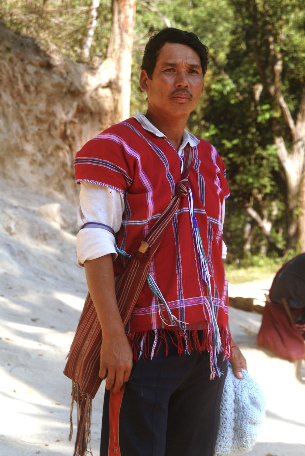
Karen mahout near Samoeng
feeding the elephants near Samoeng
       Supposedly the Burmese leader Aung San was sympathetic to their demands.  But after his assassination the new government refused to consider Karen autonomy.  War broke out between the two sides.  Many of the Karen fighters had served in the British army during the war with Japan, so their officers were just as experienced as those on the Burmese side.  In the beginning the Karen occupied the Ayeyarwaddy Delta and nearly captured Yangon.  But the Burmese regrouped, drove the Karen out of the Delta and carried the war to Karen territory.
weaving in Mae Khanat, Lamphun province
       They never fully subjugated all of the Karen lands, though gradually pacified most of them.  The intensity of the conflict subsided over the decades, yet the insurgency has still not ended.  The war drove many Karen refugees across the border, living in camps until they could find a place to settle.  The fact that they had fled into what was already territory occupied by Karen migrants for several generations certainly eased their assimilation.
       Most of the Karen in Thailand belong to two groups—the Sgaw and the Pwo.  They live the same way, but speak mutually unintelligible, separate dialects. Both Sgaw and Pwo Karen women provide their families’ garments by weaving bolts of cotton cloth on a back-strap loom.  They used to grow and spin their own cotton, but in recent decades they have opted for buying machine-made thread in the markets. 
       Nevertheless, the rest of the process still follows the traditional procedures.  They wind the thread into balls and then prepare the warp threads by winding them out around pairs of bamboo sticks, changing colors where necessary.  When that’s done they mount the warp threads on the loom by tying them around end sticks, separating every other thread with a continuous, single-thread heddle, and attaching the near end stick to a strap that wraps around the waist while they are seated.  The far end stick they fasten to a house post, back of a trailer or anything strong and immovable.
marketing Karen textiles, Li district, Lamphun
       The weaver leans forward to loosen the tension on the warp threads, lifts the heddle stick to separate the warp set and create a ‘shed.’  Through this opening she tosses the shuttle with the weft thread.  She then leans back to tighten the tension and knocks the weft thread into place with a wooden beating sword.  She then repeats the process, but tosses the weft shuttle in the opposite direction. As the web of cloth gets bigger she may add patterns onto the surface by inserting what’s called ‘supplementary weft.’  These are often done using woolen thread to make them stand out more.
       The result is a tightly bound, strong and durable strip of cloth 50 cm wide and up to four or five meters long.  They stitch sections together for various articles of clothing.  The most common is the shirt, worn by both sexes, though with different patterns for each.  The head fits through an opening at the top and the sides and hem may be fringed.  The long dress that young women favor is a longer version of the shirt, reaching to the shins.  Usually it’s basically white.  Sgaw girls add some fringe on the sides and over the front.  Pwo girls fringe the top and decorate the section below the knees with bright red pile embroidery patterns.
       Most of the rest of the cloth goes to make sarongs, the everyday garment for women.   Another portion is for shoulder bags and the rest for blankets and cloth for swaddling babies.  With the onset of tourism and Karen involvement in the trade, the women now have incentives to produce traditional textiles for new, non-Karen customers.
young Karen man, Li district
elderly weaver near Mae Sariang
       With new roads connecting Karen villages with the outside world, the youth have been migrating out for education, jobs and new trades.  Modernization also means that seasonal labor or temporary work on construction projects is also possible.  Some Karen became successful tour guides, for the average trek of three to five days included at least one night in a Karen village and the customers usually preferred ethnic minority guides for visiting hill tribe villages.
still using mortar and pestle to pound rice
       In the 20th century many Karen men worked in the logging industry, particularly in Mae Hong Son and Mae Sariang provinces.  They were the mahouts, the elephant handlers who trained the animals to haul logs out of the forest and assemble them into rafts to float downriver.  Towards the end of the century the government, in response to rapidly shrinking forests, banned logging.
       Throughout the 90s tourism began growing fast and the industry found a new use for the Karen mahouts and their animals.  Riding elephants became one of the things most tourists had to experience while in the north.  They had the option of the elephant show at Mae Rim, less than an hour north of Chiang Mai, where short rides were possible. 
Karen woman from Mae Sariang province
Karen woman, Mae Khanat, Lamphun
       If they had the time, though, they preferred going further away, somewhere looking less touristy and more authentic, even though it was set up for tourists.   One early popular excursion was the Karen elephant village Ruammit, on the banks of the Kok River west of Chiang Rai.  Not only did the ride take place in a genuine rural environment, customers also enjoyed the one-hour boat journey from Chiang Rai through the rural scenery, passing villages, temples, farms and other boats.
       Other riding centers sprang up in the forests near Mae Taeng, the remote streams of Mae Wang district and the hills above Samoeng.  Some camps also educate their customers on caring for elephants and learning about their nature.  The Karen have been involved with elephants for many centuries and certainly know them intimately.
Karen women at Chiang Mai's Tribal Life Festival
       Despite the changes of the last few decades, the Karen still live mostly according to traditions.  Historically a shy people, they have managed to stay aloof and largely unaffected the modernizing world.  Though about 15% are Christian, and a smaller percentage still animist, the majority are Buddhist, influenced by their long proximity to the Burmese Buddhists.  And like their Burmese (and Thai) neighbors, they never really abandoned animist beliefs, like the dangerous presence of bad spirits that must be placated.
       Their material life blends their tradition with the influence of neighbors.   When they build something to replace their bamboo and thatch house, it’s a stilted wooden house, like those of their northern Thai neighbors.   They use electricity instead of oil lamps now, but still pound rice the old way.  They might buy modern jackets in the city markets to don in cold weather, but still prefer, the women especially, their traditional, hand-woven clothing, as well as ornaments like the many brass and silver bangles around their arms. .
       They are also very community-conscious.  Family and kin are especially important.  While they devoutly observe religious holidays, special family occasions, especially weddings, are events demanding gusto and exuberance.  At such times drinks flow, frivolity follows, jokes and laughter fill the room and the normally hidden gregariousness of the Karen people puts on a full display.

conviviality at a Karen party

                                                                        * * *    

Sunday, December 29, 2019

Bagan’s Sea of Pagodas


                                      by Jim Goodman

Shwesandaw and Dhammayan Gyi
       For a country long used to negative reports in the international media, this year Myanmar drew the world’s attention for a very felicitous reason.  On 6 July 2019 UNESCO recognized the ancient capital of Bagan as a World Heritage Site.  It was a long time coming.  Myanmar’s government had first nominated Bagan for the award in 1995.  But Myanmar was a pariah country then, under the military-led State Law and Order Restoration Council (the notorious SLORC).  Western governments discouraged their citizens from making it a tourist destination.  And members of the UNESCO committee objected to some of the restoration work.
the gilded stupa of Shwezigon
       Time passed.  Eventually a civilian government came to power.  Tourist arrivals have been burgeoning for at least fifteen years, with Bagan one of the most popular excursions.  Despite the original qualms, UNESCO could no longer deny the site its due recognition. 
       It certainly deserved it.  The Bagan Archaeological Zone, with over 3000 pagodas and temples, comprises 104 square kilometers, making it the world’s largest.  Founded in the mid- to late 9th century, capital of the country’s first Burmese Empire from 1044-1287, the plain around it once held over 10,000 religious monuments.  Bagan’s religious tradition followed that of their Pyu predecessors, a Tibeto-Burman people occupying several city-states in the Ayerewady Valley, heavily influenced by their trade links with India.  It encompassed both Theravada and Mahayana Buddhism, plus Tantra, Hindu cults of Shiva and Vishnu, as well as the indigenous spirit (nat) beliefs.
stupas on the way to New Bagan
      Wars with its neighbor Nanzhao, in contemporary Yunnan, China, from 750-830, destroyed Pyu political power.  In this power vacuum rose the Kingdom of Bagan, founded by Burmese people (Bahmar), who would by two centuries later extend their control over the whole Irrawaddy Valley and its periphery.  Under King Anawrahta, who ascended in 1044, the state became an empire.  He extended the rice cultivation area, especially to the east, with weirs and canals, which encouraged the immigration of ever more farmers.  He made Theravada Buddhism the state religion, though tolerated other beliefs, and sponsored the formation of a script for the Burmese language.
Thatbinniyu (right), the tallest pagoda on the plain
      His able successors Kyinsuttha (1081-1112), who patronized Mon scholars and artisans, and Alaungsithi ·1112-1167), who constructed more irrigation systems and standardized weights and measures, presided over a long period of peace and prosperity.  The empire had no real rivals and grew quite wealthy.  And with both kings and commoners religiously pious, much of that wealth became devoted to building temples and pagodas.  Their palaces, houses and walls have disappeared, but their spectacular array of religious monuments remains as a legacy that draws visitors from all over the world.
pagodas on the Bagan plain
       People can fly to Bagan’s airport, but a more interesting way there is to go by boat from Mandalay, to the north.  The fastest boat takes about eight hours, though one could take cheaper, slower ones that arrive well after dark, or even the next morning.  The journey by road also takes the entire day and is basically a boring succession of farms and villages.  The river route can also be tedious for long stretches, but at least one can walk around on deck and enjoy food and drinks.
sunrise view from Shwesandaw
       After departing Mandalay in early morning, the boat soon passes slowly by the former medieval capital Sagaing.  The town lies on the west bank and morning light from the east on the two long, temple-studded hills that make up the town keeps the passengers’ cameras clicking.  After Sagaing the scenery is monotonous until the junction with the Chindwin River, and then relatively boring again until just before the landing at Bagan, where the northernmost stupas are first visible.
       I made the trip on a sunny day in December 2006.  The monsoon had ended less than two months previously but already the river was rather shallow.  The boat zigzagged its way downriver to avoid getting stuck on a sandbar.  It made brief stops at a village south of Sagaing, where children waded out from shore to sell bananas and other snacks, and at the confluence with the Chindwin, where a few passengers disembarked.  Until approaching Bagan scarcely any other vessels were in the river, with a surprising dearth of fishing activity.
Sulamani Temple

      The boat pulled into the pier at Old Bagan next to Bupaya Temple, reputedly the oldest monument in the city.  Unfortunately, a devastating earthquake of 6.3 magnitude in1975 completely leveled the building and what stands there now is a reconstruction.  Most of the main temples remained standing, though some lost a few spires.  Bagan suffered periodic earthquakes throughout its history and it’s a tribute to the skills of the planners and architects that so many major temples and pagodas survived them relatively intact.
       Reconstruction commenced soon afterwards and by 2006 even the smaller temples and stupas had all been restored.  Some had plaques placed in front listing the names of those who sponsored the restoration and others had newly installed Buddha images.  Because they used new bricks it was easy to tell which spires or other parts had been damaged and some were completely rebuilt from the base up.
typical bell-shaped stupa
       We arrived late in the afternoon when the waning light enriched the colors of the monuments, enhancing the 40-minute hike to New Bagan, where I stayed in a moderately priced hotel for four nights.  Clusters of pagodas along the way gave me a foretaste of what to expect come morning.  Rich visitors stayed in luxury hotels in Old Bagan and backpackers headed for cheap guesthouses in Nyaungthu village.  But wherever one lodged, wonderful temples and pagodas were just a short walk away.
gilded stupa atop Dhammayazika
      For the most majestic view of the archaeological zone one could take an expensive balloon ride over the plain.  The government had also erected a 60-meter-tall viewing tower on the northern side. Most people were content to explore the area on foot, by bicycle or by pony-cart.  I did all three.  About a dozen temples have interior staircases enabling visitors to reach the upper levels, provided you can find the groundskeeper to unlock the door. 
       A notable exception is Shwesandaw, southeast of Old Bagan, which has exterior stairways on three sides, with handrails.  It’s the most popular spot to watch the sun set behind the mountains west of the river.  Perhaps because guests did not want to miss the free morning breakfast in their hotels, hardly anyone showed up for the sunrise, which I found even more enchanting.
severed Buddha head on the ground
stone carving on a temple facade
       Climbing up to the fifth level of this whitewashed temple and looking west I could see groups of pagodas at intervals, with the distant mountains in the background.  The nearest cluster stood about a hundred meters away.  The first sun rays bathed the fronts of the buildings, while wispy, low, skinny clouds lay between the trees in nearby groves.  When the sun rose higher, the clouds dissipated and it was time to move on.
stone frieze on Abeyodana Temple
       Scholars divide the buildings into three periods.  The early period, 850-1100, reflects Mon and Pyu influence, with small perforated windows and dark interiors.  The middle period, 1100-1170, features bigger windows, taller stupas and a vertical emphasis.  Those of the late period, 1170-1300, are more elaborate, with more sculptural embellishments.
       The majority of the buildings are individual stupas, both simple small ones and big ornate ones.  The earliest were often cylindrical or like mounds, but from the 11th century the bell shape dominated.  A few are whitewashed, others gilded, but most are of brick.  Some have smaller stupas at the corners of each of the pagoda terraces and some are completely gilded.  All of them are supposed to contain relics, indicating, from the sheer number of such stupas, just how prevalent the collecting and preserving of relics was to the religious-minded people of the Bagan era.
temple and stupas
       Stupas also rise above the tops of the temples, which have extended hollow chambers at the base, generally one or four, used for meditation and rituals.  They may also have large Buddha images from the original construction or smaller, modern ones installed during restoration.  Several temples feature interior frescos.
       UNESCO sponsored restoration of the biggest group, at Abeyodana Temple, mainly Hindu and Mahayana Buddhist imagery, but including lots of secular everyday life activities.  Nandamannya Pahto’s set of Mahayana panels is in less good condition.  Its most famous scene, the Temptation of Mara, with its bare-breasted beauties, is covered with glass and difficult to see.  Those at Ananda Ok Kyaung and Updi Thein depict daily life activities from the 17th-18th centuries, when they were painted.  Frescos in the Kyanzitthi cave temple, 800 years old, are too worn to see well, though they include panels of Mongols.
interior Buddha images
       Compared to the sculptural paradise of Angkor, Bagan doesn’t have many extant carvings.  Here and there one comes across a toppled Buddha head on the ground.  A few stone panels of deities, mythical animals and dancing apsaras exist, like the set at Abeyodana Temple.  A couple others have standing Buddhas or well-worn elephants.  Dhammayazika, with a recently re-gilded spire, has panels of Jataka scenes, stone sculptures around the base and protruding, stone makara-headed drainage pipes on the terrace levels.
       Among the most picturesque temples are three from the early period:  Shwesandaw—the sunrise/sunset viewing favorite, Thatbinniyu—the tallest on the plain, and Ananda Pahto—the biggest and most complex.  All three are whitewashed.  For its 900th anniversary in 1992, Ananda Pahto had its spires gilded  
Manuha Temple, built by a captive Mon king, 11th c.
       Besides Abeyodana and Dhammayazika, other Bagan temples draw much visitor attention.  Sulamani has the most classic shape, with small stupas lining the sides of the multi-tiered base.  Mahabodhi is an exact replica of the ancient one in Bodh Gaya, India, where the Buddha achieved Enlightenment.  Dhammayangyi is the largest in volume, though its spire has toppled.  The Sein Sisters pair are in completely different styles from each other. Seinnyet Nyima resembles a smaller version of Sulamani, while Seinnyet Ama is a large, bell-shaped stupa.
       Bagan reached the zenith of its prestige and power in the late 12th and early 13th centuries, under Kings Narapatyi Sithu (1174-1211) and Htilominlo (1211-1235).  These rulers enlarged the borders, prevented Khmer expansion out of central western Thailand, codified the law, established a standing army and extended Burmese cultural influence beyond its boundaries.  The capital’s population then is estimated as anywhere from 50,000 to 200,000.  Yet this heyday was not to last much longer. 
everyday life in ancient Bagan
       Piety had become a problem.  Kings and nobles granted much of the agricultural land to temples and monasteries, which were exempt from taxation.  Falling revenues meant less money for state administration, especially in the furthest away border provinces, building canals to open new farmland, and equip the army.  The religious spirit, which had inspired so much architectural grandeur, was undermining the state. 
       Conflict began in the south and Bagan lost territory to Arakan and Martaban.  Later in the 13th century Bagan faced Mongol invaders.  While the Mongols apparently never occupied the city itself (they usually destroyed every city they captured), their campaigns successfully terminated Bagan’s power.  By 1287 Bagan’s empire was history and its population reduced to several thousand.  The Myinsaing Kingdom to the south became the pre-eminent state in the country, though neither it nor any of its successors for the next few centuries held sway over Myanmar as much as Bagan had.
UNESCO-restored frescos at Abeyodana
Mahabodhi Temple
       Though it was no longer important politically, Bagan continued to attract pilgrims from all over the country.  They concentrated on Ananda Pahto, Shwezigon, Sulamani, Htilominlo and Dhammayazika.  The other monuments fell into decline.  When the Konbaung Dynasty (1752-1885) took control of Burma, holding territory even greater than the Bagan Empire, its government sponsored many restorations in Bagan, though not necessarily following the originals.  Nevertheless, the ancient site’s prestige, with its importance to Burmese culture, endured. 
Winido Temple, near the viewing tower
       Pilgrims continued to journey to Bagan throughout the colonial period and in the first few decades after independence.  With a slightly improved political situation, tourism began taking off in the 21st century.  It did not draw anywhere near the numbers that visited Cambodia’s Angkor, but it was a less congested, more relaxing experience.  Like Angkor the main sites had their local hawkers, selling souvenirs, bric-a-brac and snacks, plus the ubiquitous painters.  But they were never very persistent.
       In 2006 the entry ticket was a mere US$10, valid for however long you stayed.  Unlike Angkor, where the nearest hotels were in urban Siem Reap, the lodgings were all inside the quiet archaeological zone.  Right after you left your hotel you were in the vicinity of ancient monuments.  You could even walk among them by moonlight.  Many travelers explored the zone on their own.  Groups in buses were not so numerous and didn’t stay long at any particular site, other then the sunset viewing pagodas.
       Visitor numbers have increased since my 2006 excursion, and are likely to grow more now that Bagan is a recognized World Heritage Site.  No doubt more people will be taking the balloon flights over the plain, but the area is too vast to get very congested.  And for an example of what religious fervor can do for architecture, Bagan remains one of the world’s most outstanding,

Seinnyet Nyima and Seinnyet Ama

                                                                        * * *   

Tuesday, November 19, 2019

Watgate: Chiang Mai’s International Suburb


                                                                          by Jim Goodman

site of the former Watgate river port
       When King Mengrai of the state of Lanna conquered the ancient Kingdom of Haripunchai in the late 13th century, he decided it was time to move his capital from Fang to somewhere closer to the center of his expanded realm.  Rather then move into Haripunchai (today’s Lamphun), he opted to make that old city Lanna’s spiritual center and instead build a new one at Wiang Kum Kam, about 25 km north.  Unfortunately, located beside the Ping River, the site was prone to regular flooding.
       Fed up with this situation, in 1296 he laid the foundations for Chiang Mai, literally “New City”, a few kilometers north and several hundred meters west of the Ping River, beyond the reach of any flood.  Besides the moats and walls around the city, eventually another wall went up between the eastern side of the city and the river, extending all the way around to the neighborhoods outside the moats to the southwest.  Most of the capital’s commoners lived inside this wall.
the vihatn of Wat Ketdaram
       Some lived along the river, though, for it was Lanna’s prime communication link.  The main port was on the east bank, opposite what is now Warorot market, in what became the district of Watgate.  Except for the small community involved with river trade, most of the area was agricultural and the farms didn’t extend very far from the river.  Nevertheless, in 1428 the royal government sponsored the construction of a temple close to the port, Wat Ketkaram, to service the spiritual needs of the inhabitants.  For over four centuries it was the only religious building east of the Ping River.
          In the late 18th century, after two centuries of rule over Lanna, Burmese authority began to collapse.  Sporadic revolts broke out at various places in the north.  Because they were uncoordinated, the Burmese suppressed them and in some cases retaliated by expelling people from the cities that revolted, such as the entire population of Chiang Mai.  King Kawila of Lampang, allied with the Kingdom of Siam, expelled the Burmese from their Chiang Mai garrison in 1774 and then went on to chase them out of the rest of Lanna over the next several years. 
rainbow strikes the chedi at Wat Ketkaram
Chedi Chula Manee at Loy Krathong
       Rama I of the new Rattanakosin Dynasty appointed Kawila King of Lanna in 1782, but the city was deserted and the campaign against the Burmese far from finished.  Only in 1796, five hundred years after Mengrai founded the city, Kawila finally settled in the capital.  He had spent the previous few years going around to persuade scattered ex-residents to move back, now that it was again safe.
Sala Bitr, the former Chinese school
       Slowly but surely Chiang Mai’s population grew and commerce and agriculture returned to normal.  Watgate port became active again, a business community settled in around it, augmented in the 19th century by Chinese immigrants, who sponsored a major renovation and expansion of Wat Ketkaram.  The renovated Chedi Chula Mani, said to house a hair of the Buddha, is the oldest original building in the compound, whole the rest are 19th and 20th century constructions.
       The viharn (assembly hall) is a beautiful example of the Rattanakosin style, with its multi-layered roof of orange tiles and golden trimmings.  The color red dominates the interior, with tall columns supporting the roofs, a gilded seated Buddha at the far end and a painting of a standing Buddha flanking one of the columns.
the 'dogs' of Wat Ketkaram
       Near the chedi stands a small, elegant open shrine to a standing Buddha, while next to it is the larger ubosot (ordination hall), with the twelve animals of the Chinese zodiac sculpted around the exterior walls.  Flanking the doors are high-relief vertical descending tigers, a feature copied on the doors of the abbot’s residence on the other side of the chedi. 
       Behind the shrine stands Sala Bitr, built of dark teakwood and embellished with gold on the door panels and shutters.  The attractive two-story building was originally a school for Chinese but is now empty.  A much larger modern school in the eastern part of the compound has replaced it.
dog sculptures next to the chedi
viharn interior
       The very clean and tidy compound has one other unique feature—its dogs, not the real animals but statues of them.  The chedi was built in the Year of the Dog.  Thus dogs are honored here with statues of various breeds, including ones not native to Thailand.    
the Attaqwa Mosque
         With peace and prosperity continuing, Watgate continued to expand.  Besides the Chinese coming up from Bangkok, the district attracted Muslim Chinese (Hui) in the1870s after the suppression of the Muslim Revolt in Yunnan.  They also established themselves in Warorot, but a large community settled a few blocks east of the river.  They built the Attaqwa Mosque, which eventually included a school with teachers trained in Cairo and Saudi Arabia.  Today the school has 150 students and the language of instruction is Arabic.
       Around the same time Watgate witnessed the arrival of Western missionaries.  They built the first church in 1868 near the river at the southeast corner of the district.  The most prominent were Dr. Daniel and Sophie McGilvary, austere and dedicated, who believed Buddhism was superstitious idolatry and local people needed a true religion like Christianity to save them from the Devil. 
Muslim girls passing through Wat Ketkaram
       Local people felt Buddhism was quite good enough for them and so conversion was slow.  After several years McGilvary could count only eight converts and two of them were killed for it.  The missionary then had to turn his attention to efforts to get the Court in Siam to issue a decree that no one was to be harmed because of conversion.  That success protected his new Christians but did not speed up the conversion rate.
       The next step was to set up schools.  Chiang Mai didn’t have schools then.  All education was in the monasteries and only for boys.  In 1878 the McGilvary couple opened the Phra Racha Chaiya Girls School, named after the young daughter of Chiang Mai’s King Inthawichayanon.   This princess later grew up with the name Dara Rasami and today is revered and remembered as the most famous lady in late Lanna history.  The school eventually changed its name to Dara Academy and now has both girl and boy students.
the Christian School Chapel, Chiang Mai's oldest church
the church at Prince Royal's College
       Dara Rasami’s youth coincided with a time of great political anxiety in the country.  France had begun taking over Indochina and Great Britain had already subjugated much of Burma.  In 1883 a rumor spread that Queen Victoria wished to adopt Dara Radami.  Having just been through problems with British logging interests in the north, the rumor alarmed the Siamese Court.  They viewed it as a possible first step toward seizing Lanna. 
April flowers on Rattanakosin Road
       King Rama V dispatched a delegate to Chiang Mai to propose a royal marriage.  In 1886, the year Britain annexed northern Burma, Dara Rasami left her home to live in the royal palace in Bangkok as one of the king’s consorts.  She and her entourage continued to dress in Lanna style, with very long hair tied in a bun at the top of the head and sarongs with Lanna designs.  Other Court ladies looked down on them, considered them Lao foreigners.  These ladies wore their hair shorter and preferred different kind of sarongs, a style they believed was more ‘civilized’.
       In late1889 she bore the king a daughter, who unfortunately died in early 1892.  The distraught mother destroyed all photos and portraits of the girl.  Princess Dara bore no more children but remained in Bangkok until 1908, when she made a visit to Chiang Mai. Lampang and Lamphun to visit her relatives.  On her arrival in April she was greeted by royal and military officials, soldiers and commoners from all over Lanna.  Likewise, upon her return to Bangkok in November, the King and Court, government officials and Bangkok residents welcomed her back with a flotilla of a hundred royal boats.
Princess Dara Rasami in Chiang Mai
Siri Guru Singh Sabha, Sikh temple on Charoenrat Road
       In 1910 Rama V died.  Four years later Princess Dara asked his successor Rama Vi for permission to return permanently to Chiang Mai.  She remained active in her royal duties and patronage projects until she died in 1933.
       Much had changed since Princess Dara first moved to Bangkok.  In 1887 the missionaries opened another school in Watgate—the Chiang Mai Boys School.  This institution would educate Thai boys in subjects they did not study at the monasteries, like science, mathematics and, naturally, Protestant Christian theology.  It was successful and won royal favor such that in 1906, expanding into new buildings, Crown Prince Maha Vajiravudh, later Rama VI, came up from Bangkok to lay the cornerstone.  Thereafter its name was Prince Royal’s College.
=old buildings on Charoenrat Road
display in the Watgate Museum
       In 1888 missionaries opened McCormick Hospital on Kaew Nawarat Road, between Prince Royal’s and Dara Academy.  By establishing the first public health care center, with all the latest modern medicines and treatments, as well as the first formal schools, the missionaries certainly raised their prestige.  Though the great majority of Buddhists clung to their religion, conversions did grow.  Today Chiang Mai province has the largest number of ethnic Thai Christians in the country. 
       Meanwhile another foreign religious community immigrated to Chiang Mai and took up residence in Watgate—Sikhs from British India.  The first arrived in 1905, a cloth merchant who later persuaded many others to join him.  They also got involved in the cloth business, and still are, and in 1907 set up a gurudwara (Sikh temple) on Charoenrat Road along the Ping River—Siri Guru Singh Sabha, a large white block building with a golden dome on the roof.
the British Council, built in 1952
       The Watgate port was still active, but not for long.  When Princess Dara made her 1908 trip she went by train to Nakhon Sawan and by boat from there to Chiang Mai.  The journey took two months and nine days.  In the early 1920s workers completed a railroad and highway from Bangkok to Chiang Mai, reducing travel time either direction to just over a day.  River commerce was over.  But Watgate had already outgrown its port.
       The district included all the neighborhoods on either side of the three roads—Charoen Muang, Kaew Nawarat and Rattanakosin--that ran east of the three main bridges spanning the Ping River.  The new train station stood near the end of Charoen Muang and the northern bus terminal lies near the end of Kaew Nawarat.  The river port was dismantled and farms behind the eastern riverbank largely disappeared, replaced by residential neighborhoods. 
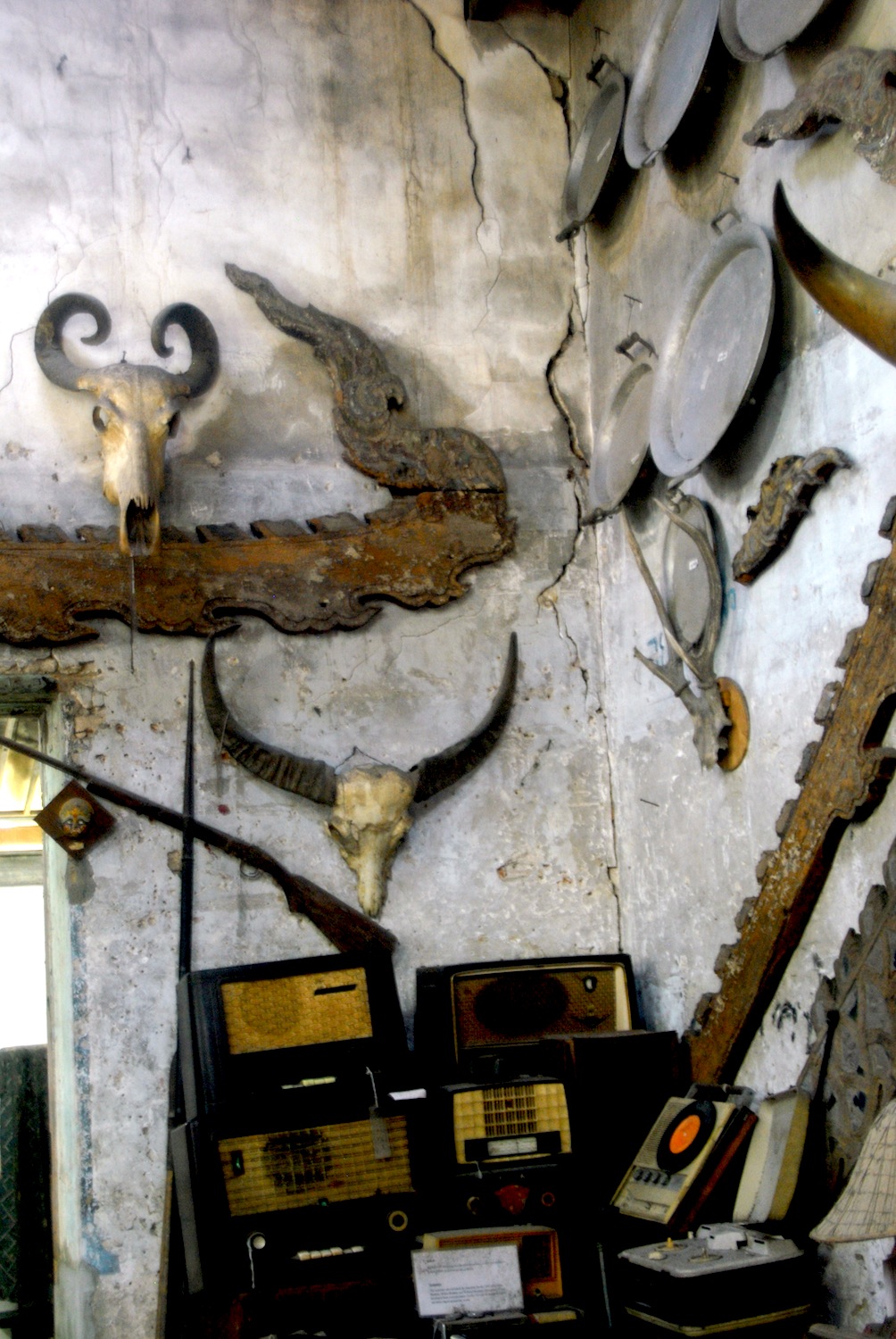
       For a look at the artifacts, crafts, photos and items of everyday use in this period one should visit Wat Ketkaram’s Museum, established around a century ago.  Many Lannna temples have museums, but this is the largest.  Furnishings, images, manuscripts and decorations from the original temple are on display, but the collection also includes a host of objects representing the secular life of the times.  These include baskets, musical instruments, leather cases, old typewriters, radios and phonographs, hunting and fishing gear, wooden animal head trophies, looms, thread winders, classic sarongs and festival rocket launchers.
a modern traditional style house in Watgate
       As the century progressed Watgate retained its importance to Chiang Mai’s educational program.  Dara Academy and Prince Royal’s College expanded into new buildings and today have a few thousand students.  Payap University, another Christian-sponsored institution, opened a campus opposite McCormick Hospital.  Facing Rattanakosin Road, in the rear of the campus, is the McGilvary Institute for religious studies.  Chiang Mai’s first church still stands, now called Chiang Mai Christian School Chapel, next to a Bible Study Institute.
       Besides the Christian schools, Watgate also has some language learning institutes.  The first was the British Council, on Bamrungrat Road, constructed in 1952, whose activities today are basically restricted to teaching English.  Besides English academies, there is also a center nearby for foreigners to learn Thai.
       From the late 90s tourism to Thailand accelerated and affected developments in Watgate.  New restaurants and nightclubs lined the riverbank between Charoen Muang and Kaew Nawarat.  Many of the fine old wooden houses were converted into hotels and art galleries.  The quiet end of Rattanakosin features several buffet grills, though customers are mostly Thai.
NcGilvary Academy, Payap University
       In fact, for all the foreigner presence in Watgate, the district’s residents are still predominantly Thai.  Several Buddhist temples have been built the last few decades, plus a crematorium at the end of Rattanakosin.  Typical of suburban Thai life is the warren of lanes behind this road.  Some of the houses are quite fancy, old or new, others very modest.  The residents include white-collar professionals and ordinary workers and traders, some of whom transport their goods in side carts attached to their motorbikes. Shops on the lanes cater to the neighborhood’s needs, including convenience stores, legal offices, realtors, beauty salons, food stores and small restaurants.
       Bars, karaoke clubs and snack and grill stands are just around the corner, opening in late afternoon.  People also gather at the tables in front of the small essentials shops to have a ‘sundowner’ beer or whisky.  It’s a quiet and convivial scene, far from city congestion and one of the delights of being a resident of Watgate.

Watgate riverside in May

                                                                          * * *